
Minnesota State Fair Weather
"It's time once again for the "Great Minnesota Get Together." Weather plays quite a role in the State Fair experience. Who doesn't remember braving the heat with the crowds on one of the busier intersections on a sweltering afternoon? A quick rain burst will send people scurrying for cover, and folks savor balmy days in the 70s with just a bit of a breeze. Below are some State Fair weather facts and notable weather events that have happened in past Minnesota State Fairs."
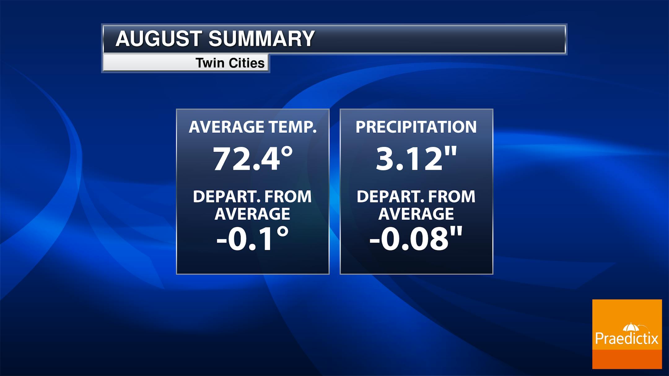
August Weather Summary For The Twin Cities
The first half of the month was hot and dry, but things have been a little cooler and wetter as of late. Through the first 22 days of August, temperatures have been running pretty close to average with near average precipitation.
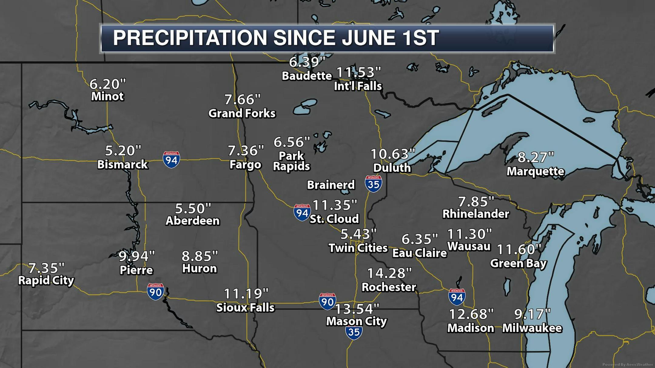
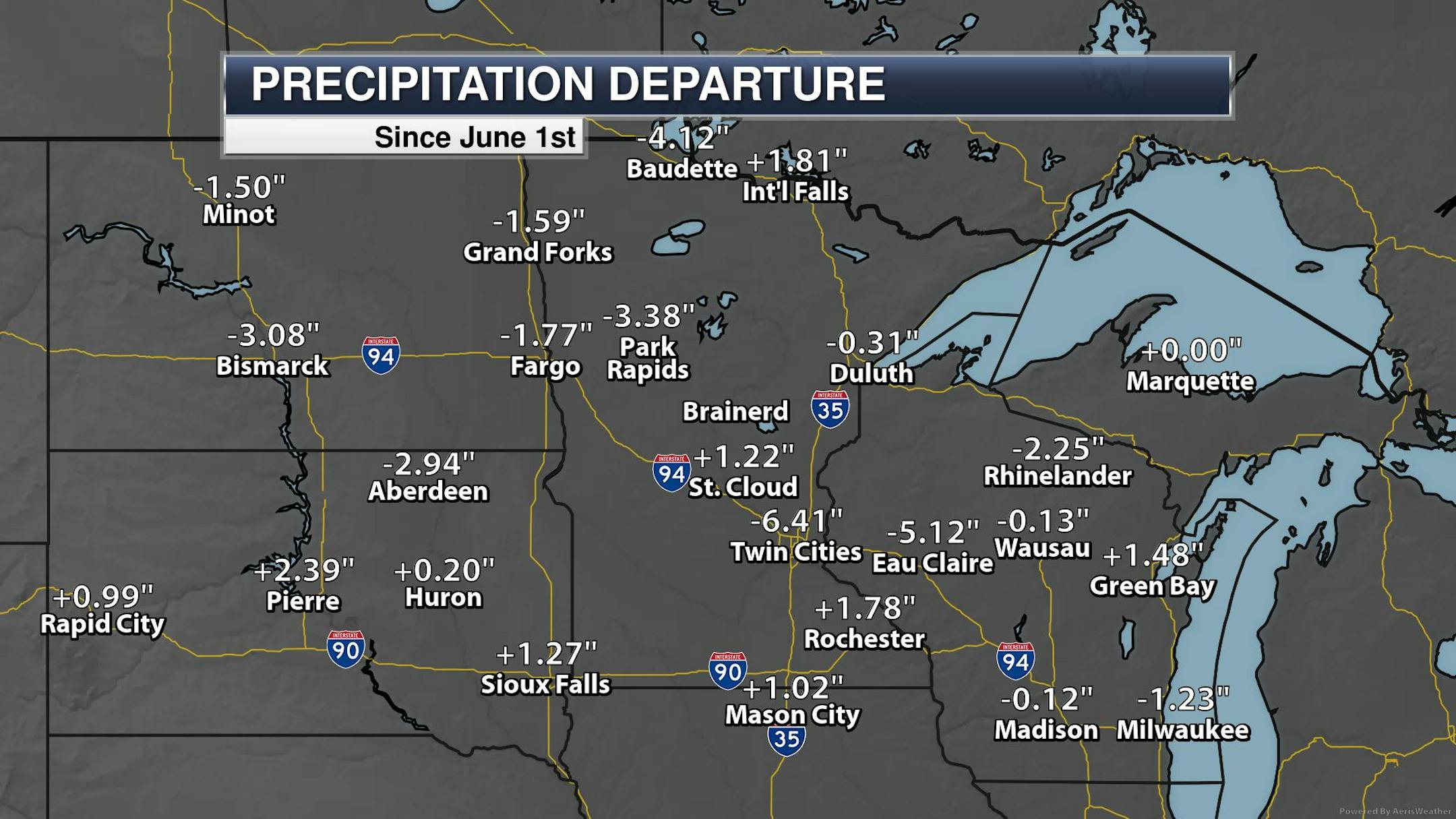
Summer Precipitation
Taking a look at precipitation so far this summer (since June 1st), it's a mixed story. A few locations are running above average, but other locations are running well below average, including the Twin Cities, which is still nearly -6.50" below average.
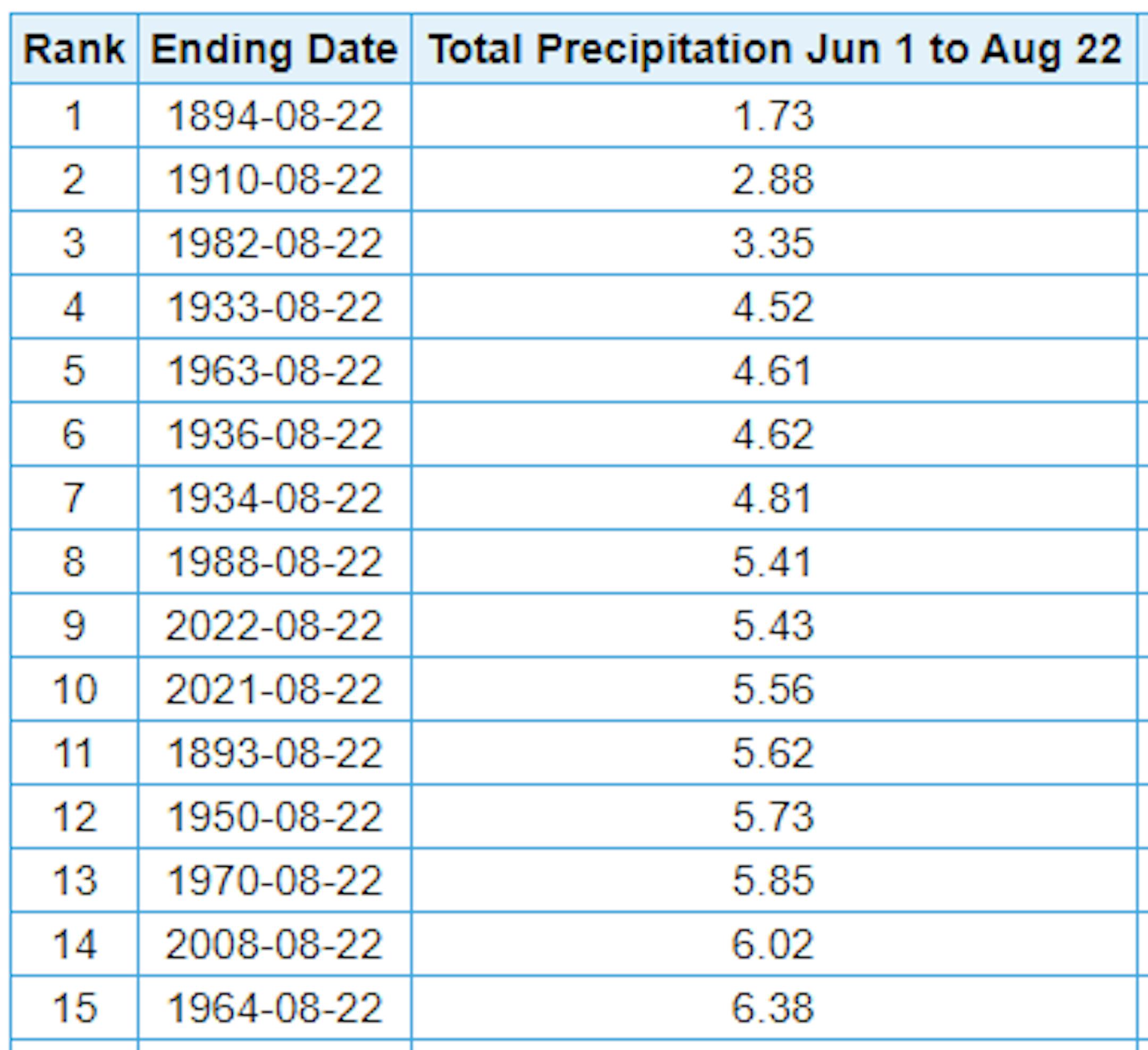
9th Driest Summer at MSP
Here are the 15 driest summer's on record at MSP. Note that this summer (since June 1st) has been the 9th driest, last year was the 11th driest. If MSP doesn't see any additional rainfall through the rest of August, this would be the 6th driest summer on record.
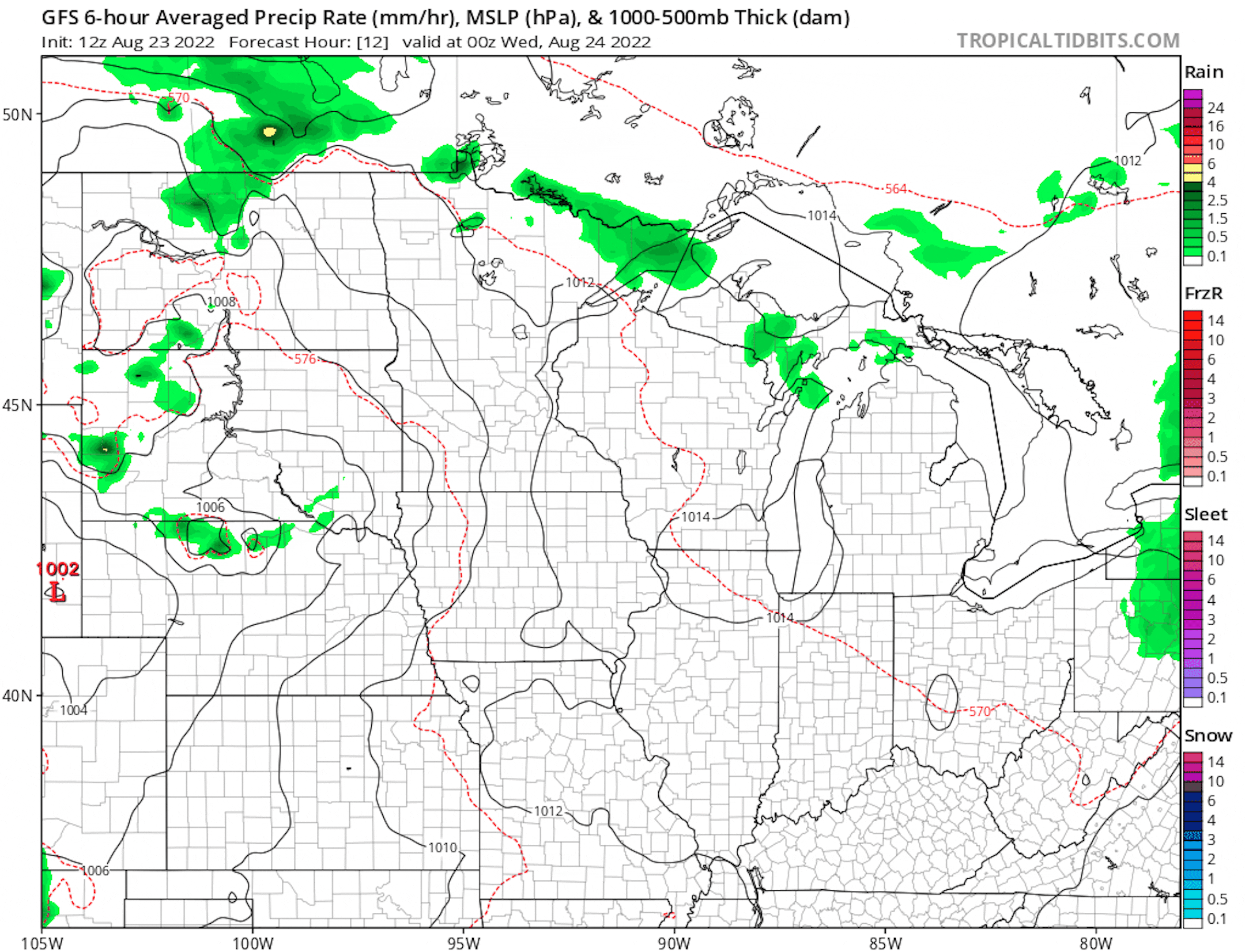
Spotty Storms Wednesday & This Weekend
Here's the weather outlook from AM Wednesday to AM Monday. Weather conditions will turn a little more unsettled midweek with spotty showers and storms possible Wednesday. Much of the day Thursday and Friday will be quiet, but another round storms will arrive as we approach the weekend.
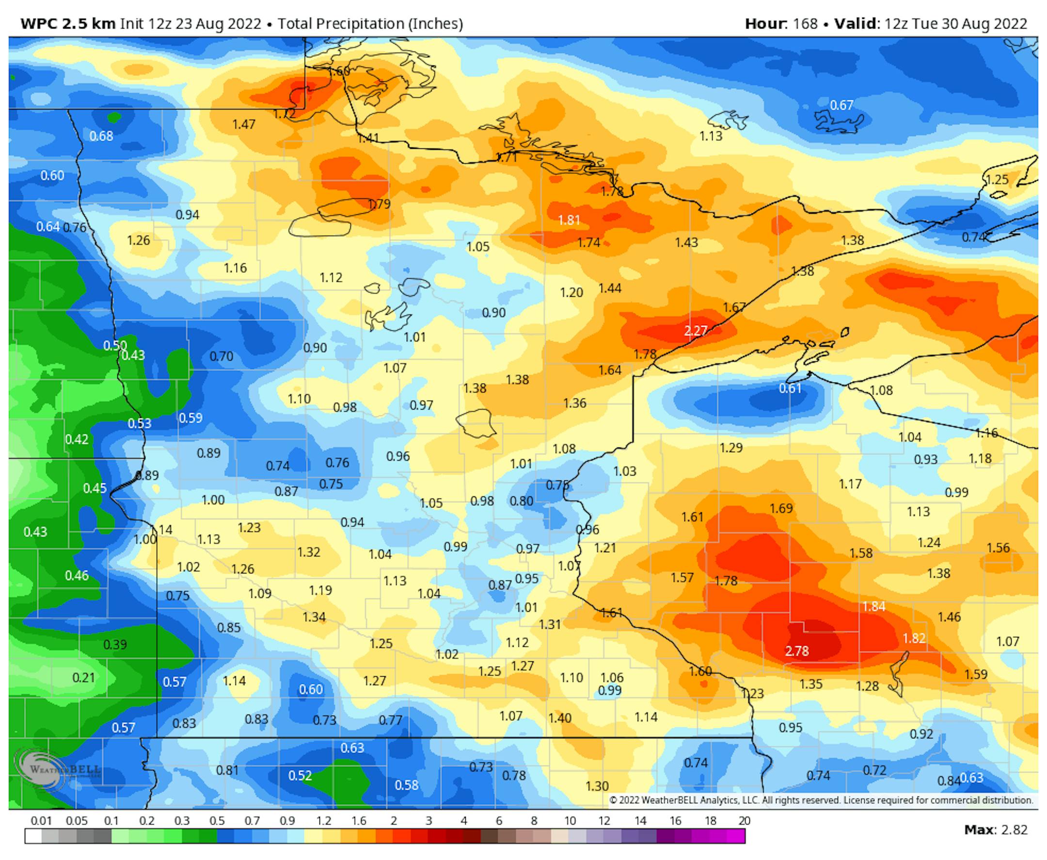
Precipitation Potential
The extended precipitation outlook through the week and weekend ahead shows pockets of locally heavy rainfall across parts of the state. Some locations could pick up more than 1", including near the Twin Cities. Stay tuned...
Minnesota Drought Update
Here's the latest drought update across Minnesota. Prior to last week's rain, severe drought was sitting at a little more than 2%, while Moderate drought was at nearly 12.5%. The good news is that we picked up some much needed rainfall and I would assume some improvement in the drought update on Thursday.


