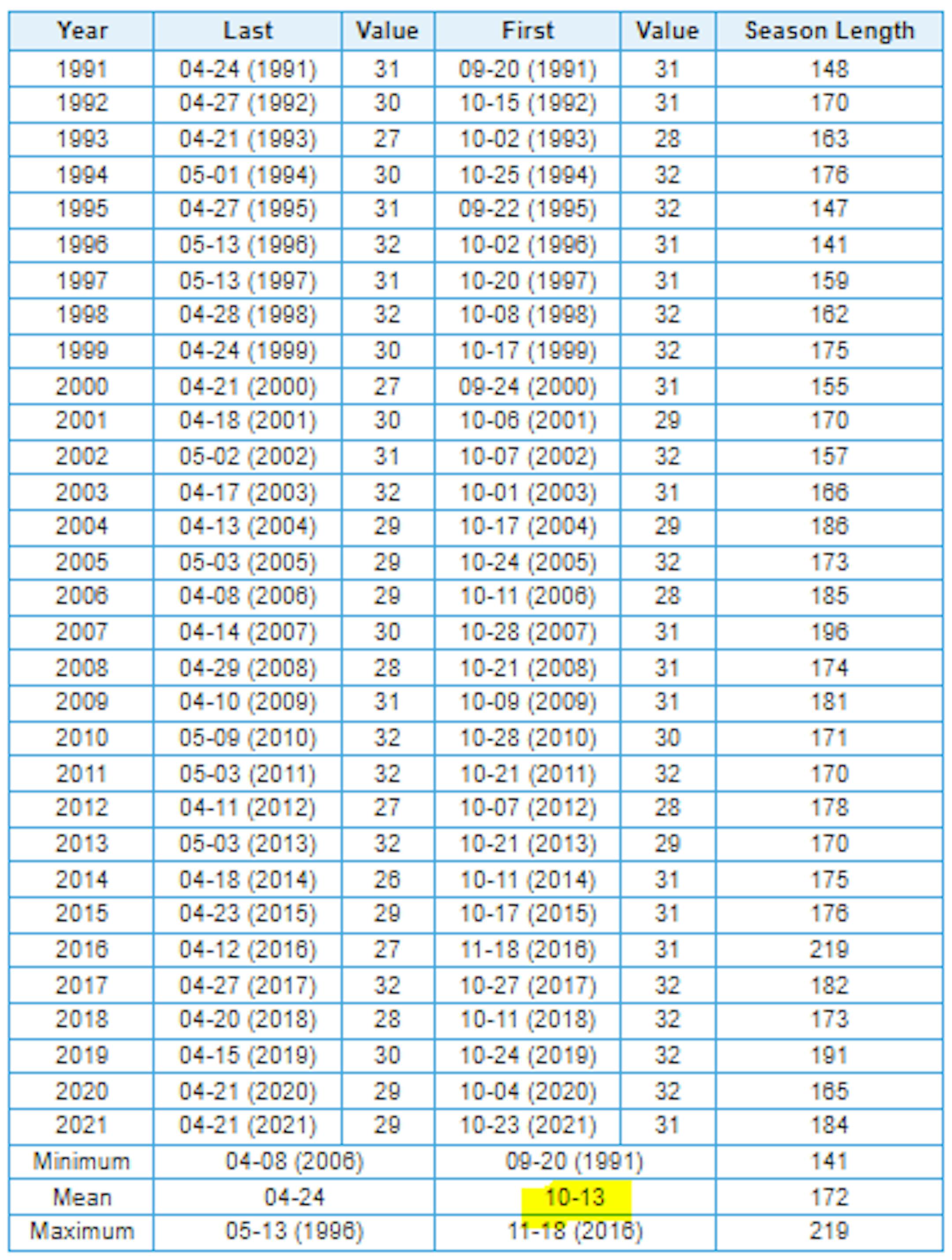
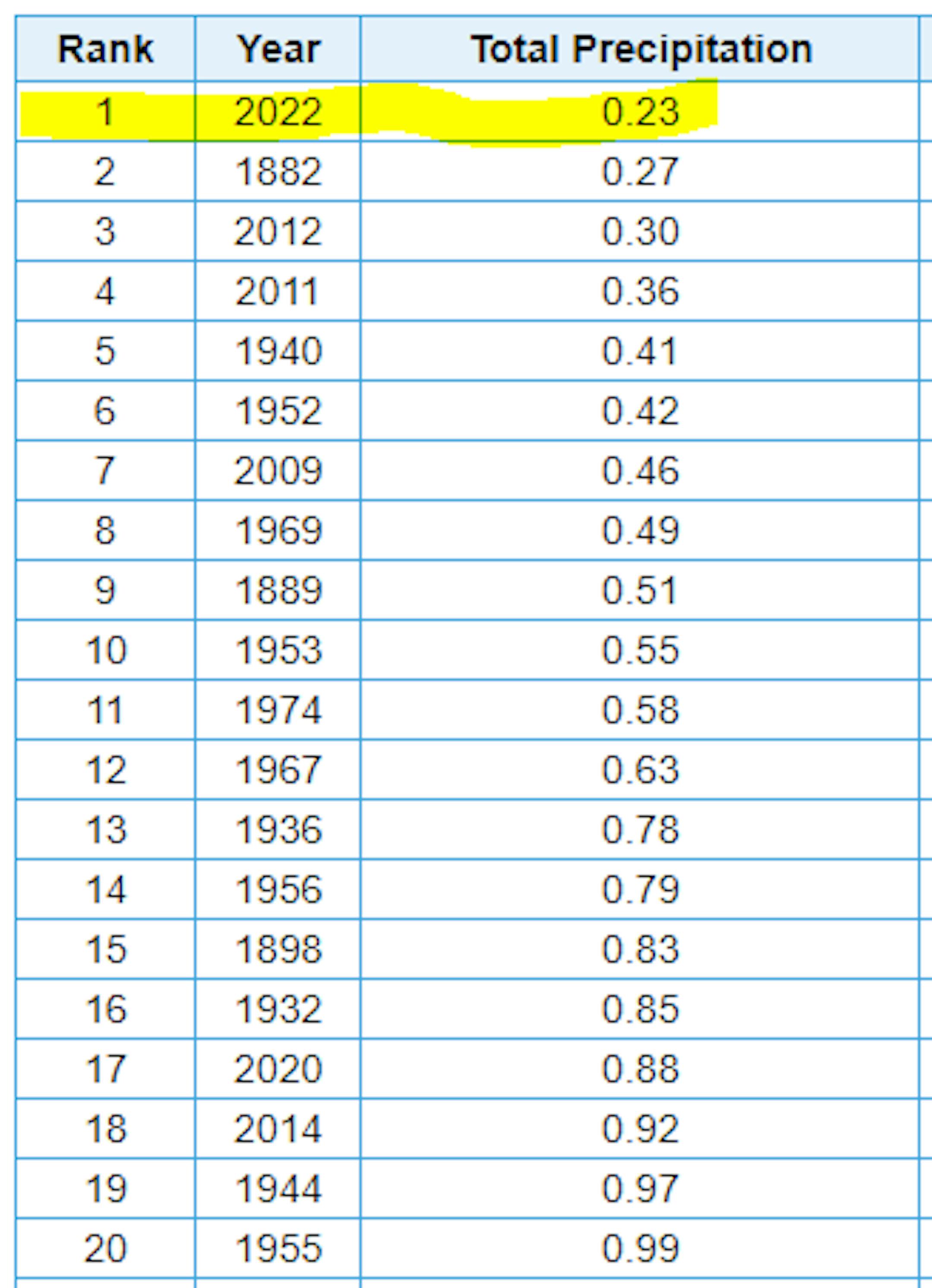
Driest September on Record at MSP?
Well this kind of snuck up on us, but did you realize that MSP has only seen 0.23" of rain so far this month? If MSP doesn't see any additional rainfall through next Friday, this will be the driest September on record at MSP.
September Precipitation
Here's how much rain has fallen across the region through the first 3 weeks of the month. Despite a few pockets of heavy rain here and there, September has been a fair dry month for many. The most widespread heavy rain has fallen across parts of Wisconsin, where Milwaukee has seen 6.23" of rain and is at their 9th wettest September on record.

September Precipitation Departure From Average
Looking at the precipitation departures from average for the month of September, many locations are running deficits, some bigger than others. Again, September has been a pretty dry month in the Midwest with the exception of southern Wisconsin.

Yearly Precipitation Departure From Average
If we take a look at the year as a whole, rainfall has been hit or miss around the region as well. Minneapolis is nearly -7" below average (24th driest start to any year on record), but 75 miles north of the MSP in St. Cloud, there is a +5" surplus, which is the 20th wettest start to any year on record. Meanwhile, International Falls is nearly +11.50" above average and is currently sitting at the wettest start to any year on record!

Mostly Dry Extended Forecast
Here's the precipitation outlook through the weekend, which shows very little rainfall across the region. In fact, it looks dry through the end of the month and into the first few days of October.

Dry Last Full Week of September
Here's the weather outlook from through the last full week of September and into the first weekend of October. A bubble of high pressure will slowly drift through the Upper Midwest with a few days of very cool and fall-like weather with a couple/few mornings of frost up north!

Fall-Like Dewpoints This Week
Looking at the dewpoint forecast through the week ahead, it certainly won't be humid! As a big bubble of high pressure settles in this week, dry and mostly sunny weather will persist. Dewpoints will actually fall into the 30s Tuesday, Wednesday & Thursday, which will be some of the driest dewpoints we've seen so far this season. A lower dewpoint will also mean cooler overnight low temps as well. Sweater weather has returned.

Frosty Mornings Up North This Week
Frost advisories will be likely across parts of the region over the next few night as temperatures dip into the 30s. The coldest morning will be Wednesday with widespread 30s and possibly even some 20s in northern Minnesota and NW Wisconsin.