
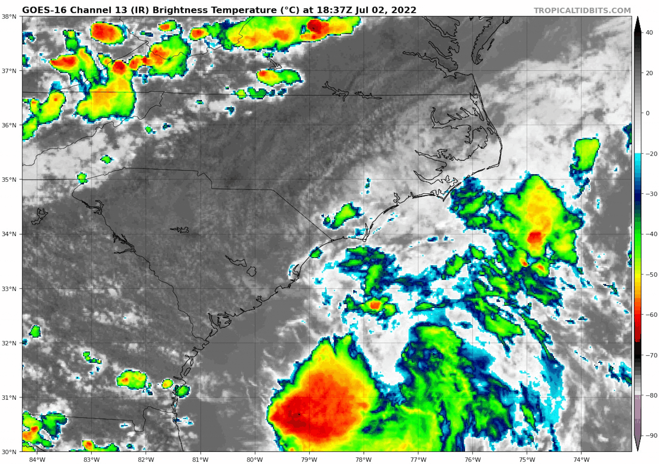
Tropical Storm Colin
Colin (unexpectedly) became the 3rd named storm of the 2022 Atlantic Hurricane season overnight Friday into early Saturday morning along the Carolina coast. It looked pretty disorganized, but gusty winds and areas of heavy rainfall will continue along the North Carolina Coast and Outer Banks into Sunday as Colin slowly pushes east.
Tracking the Tropics
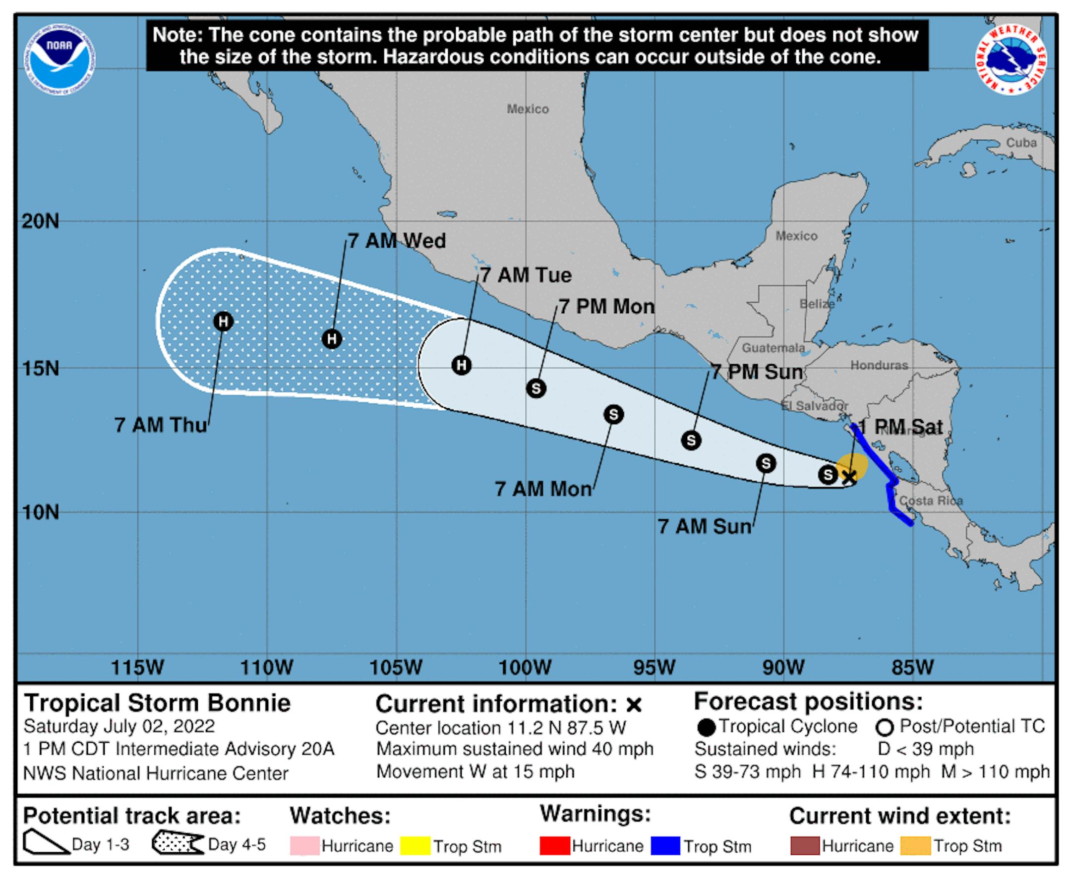
Meanwhile, Bonnie is now in the Eastern Pacific and could potentially become a hurricane early next week south of Mexico. Keep in mind that Bonnie developed in the Atlantic Basin last week, so it's fairly rare to see crossover storms from one basin to the other.
4th of July Outlook
If you have parade or outdoor BBQ plans on Monday, it looks like there could be a few isolated t-storms through the day. Again, it won't be a washout, so you should be able to enjoy some time outdoors. Isolated thunderstorms may lingering into the evening for a communities, but hopefully most fireworks displays will be dry.
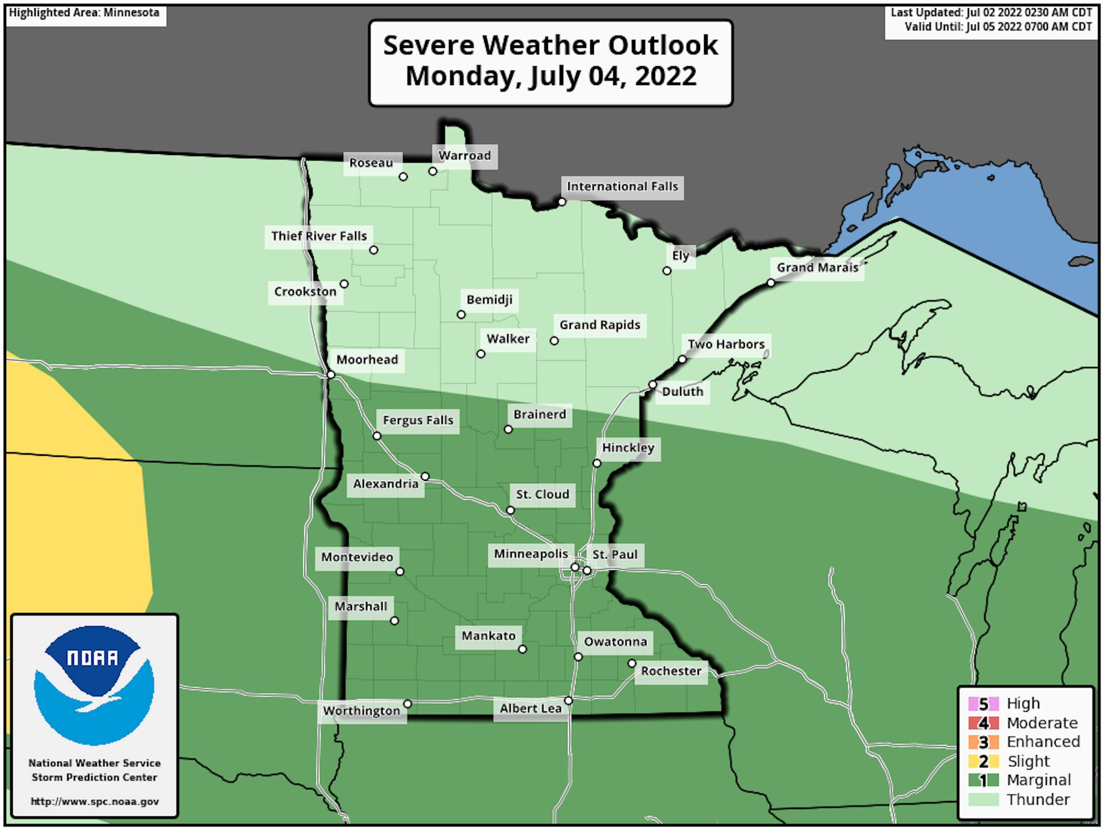
Severe Threat 4th of July Monday
According to NOAA's SPC, there is a Marginal Risk of severe thunderstorms across the southern half of the state on Monday. The best chance of stronger storms will be later in the day with gusty winds, hail and heavy rainfall as the primary threats.
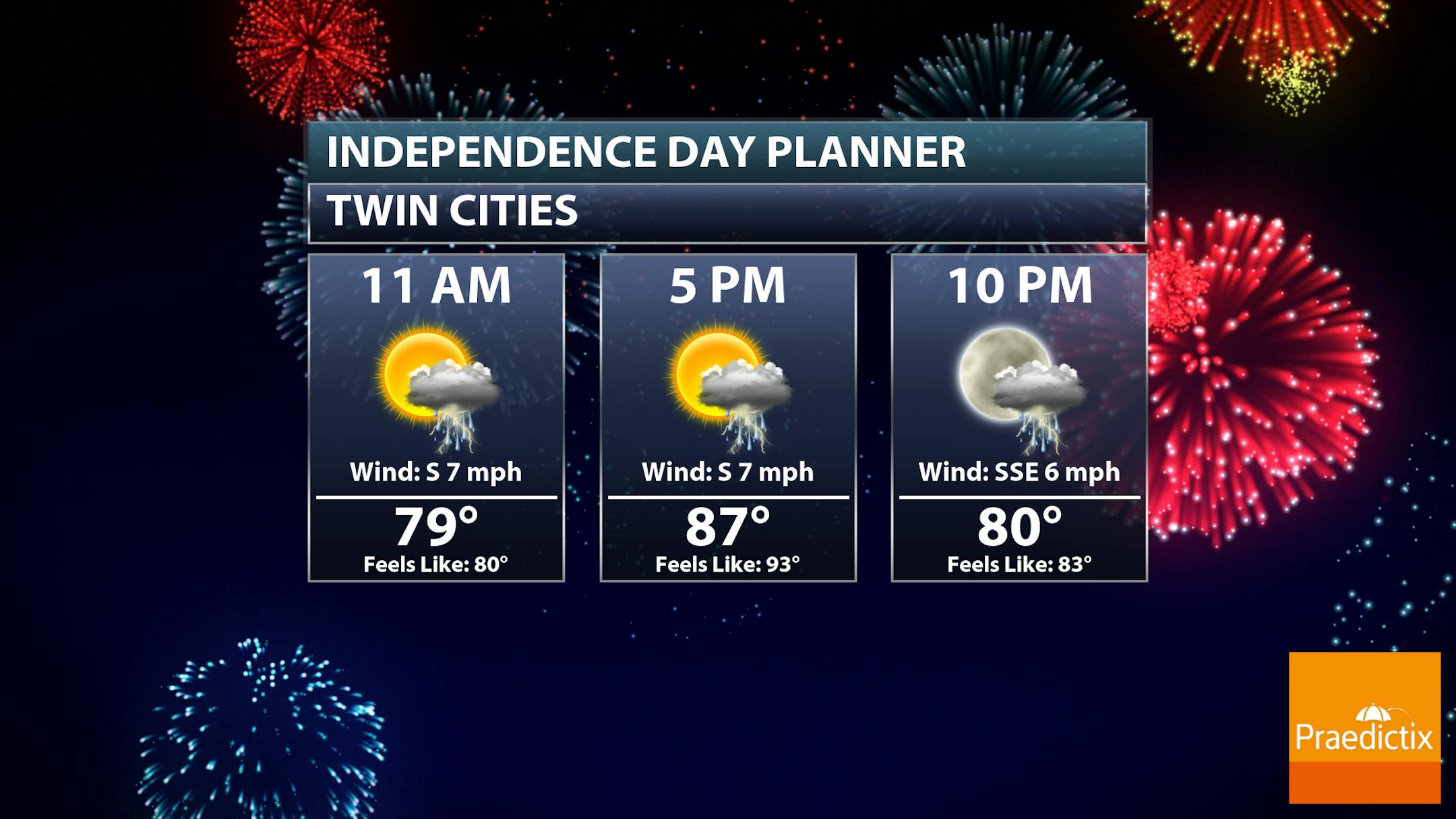
4th of July Outlook
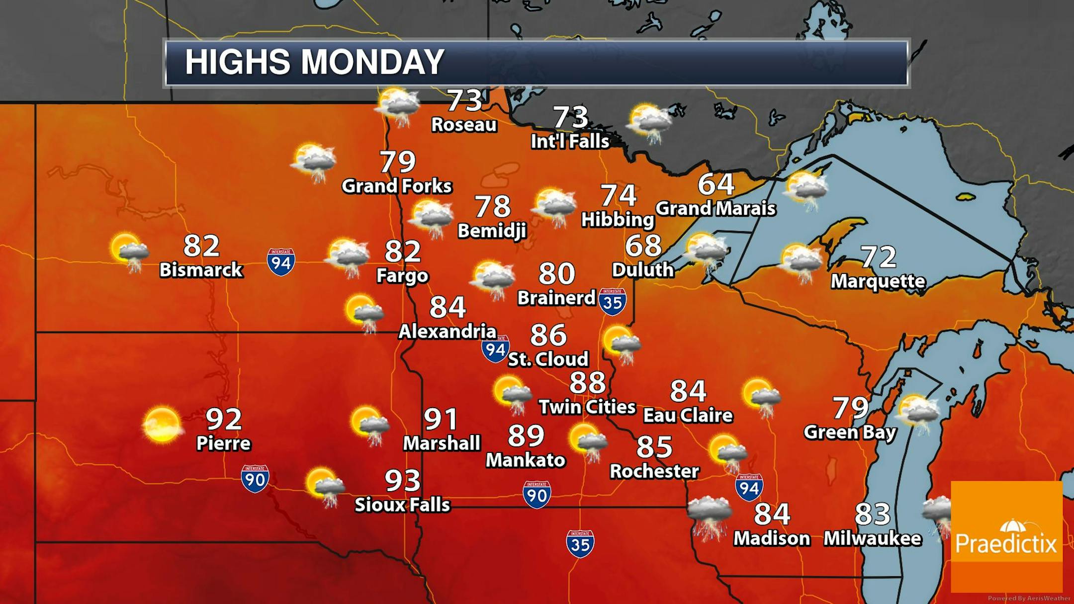
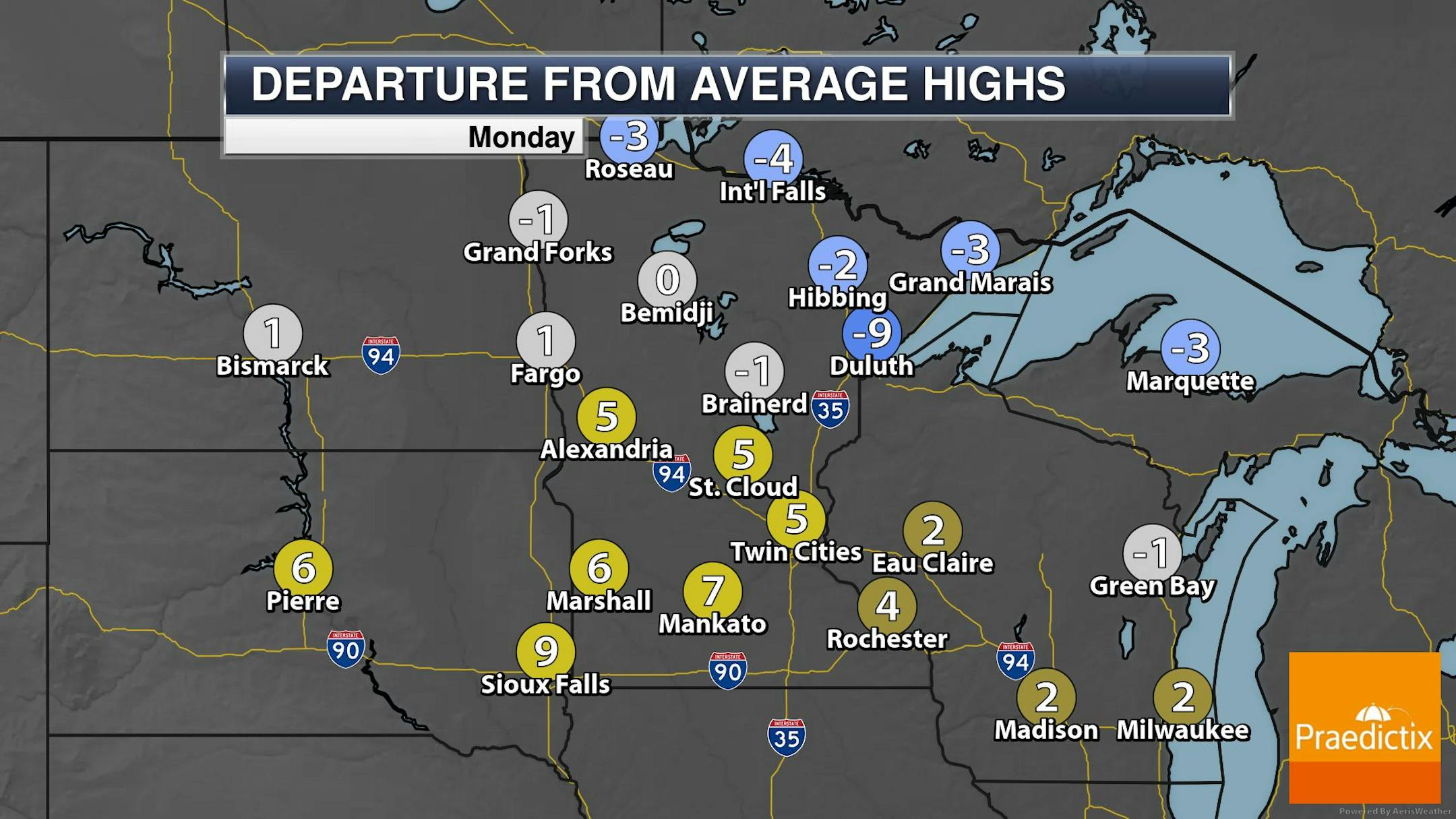
The weather outlook for the 4th of July Monday looks unsettled across the state. Scattered showers and storms will be possible, some of which could be strong to severe later in the day with locally heavy rainfall. Highs will warm into the 70s and 80s across much of the state with some 90s possible in the Southwest corner. The high temp in the Twin Cities will warm into the upper 80s, which will be nearly +5F above average.
Spotty Thunder Chances This Week
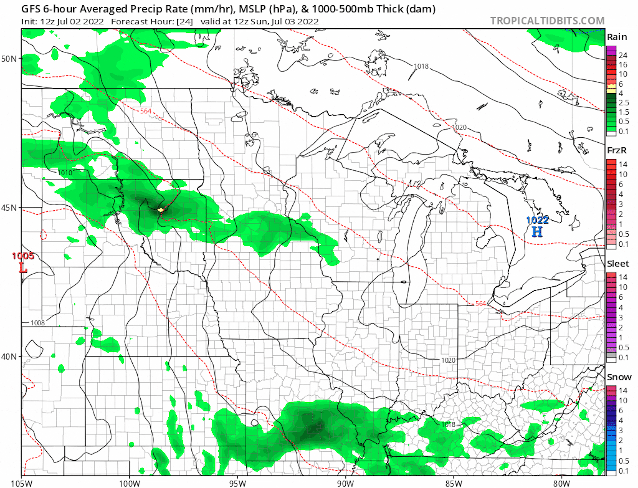
Here's the weather outlook from 7AM Sunday to 7AM Tuesday, which shows somewhat unsettled weather in place over the next few days. None of the days will be washouts, but there will be times of inclement weather. The best chance of showers and storms will be overnight into the early morning hours.
Precipitation Potential Through Tuesday
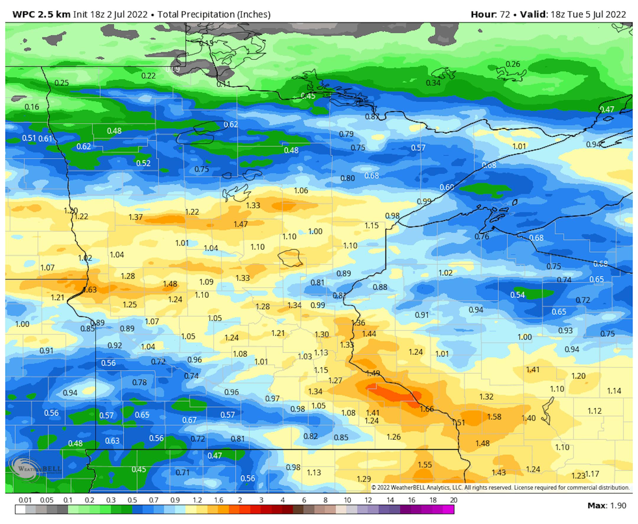
Here's the extended rainfall potential through Tuesday. Several round of thunderstorms may be possible with locally heavy pockets of rain here and there across the region. Some locations could see up to an inch of rain or more through the holiday weekend.
Precipitation Departure From Average Since Jan. 1st
Here's the precipitation departure from average so far this year. Note the Twin Cities is more than -2.00" below average so far this year, but just an hour north, St. Cloud is more than +6.00" above average, which is good enough for the 9th wettest start to any year on record there.


