
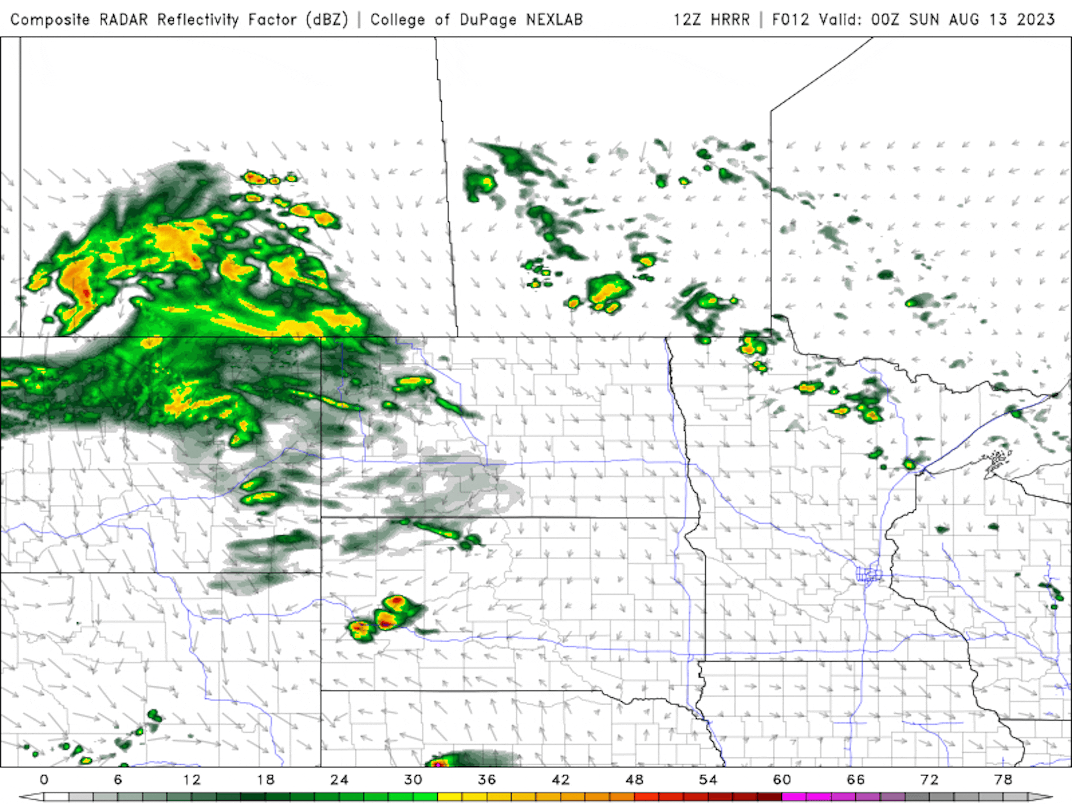
Soggy Sunday Ahead
Weather conditions Sunday into Monday look fairly soggy across parts of Minnesota and Wisconsin. Some of the heaviest/steadiest rains develop late Sunday and will linger through the morning hours of Monday. This looks like a steady rain with embedded rumbles of thunder that could produce more than 1" of rain for many across central Minnesota and into Wisconsin.
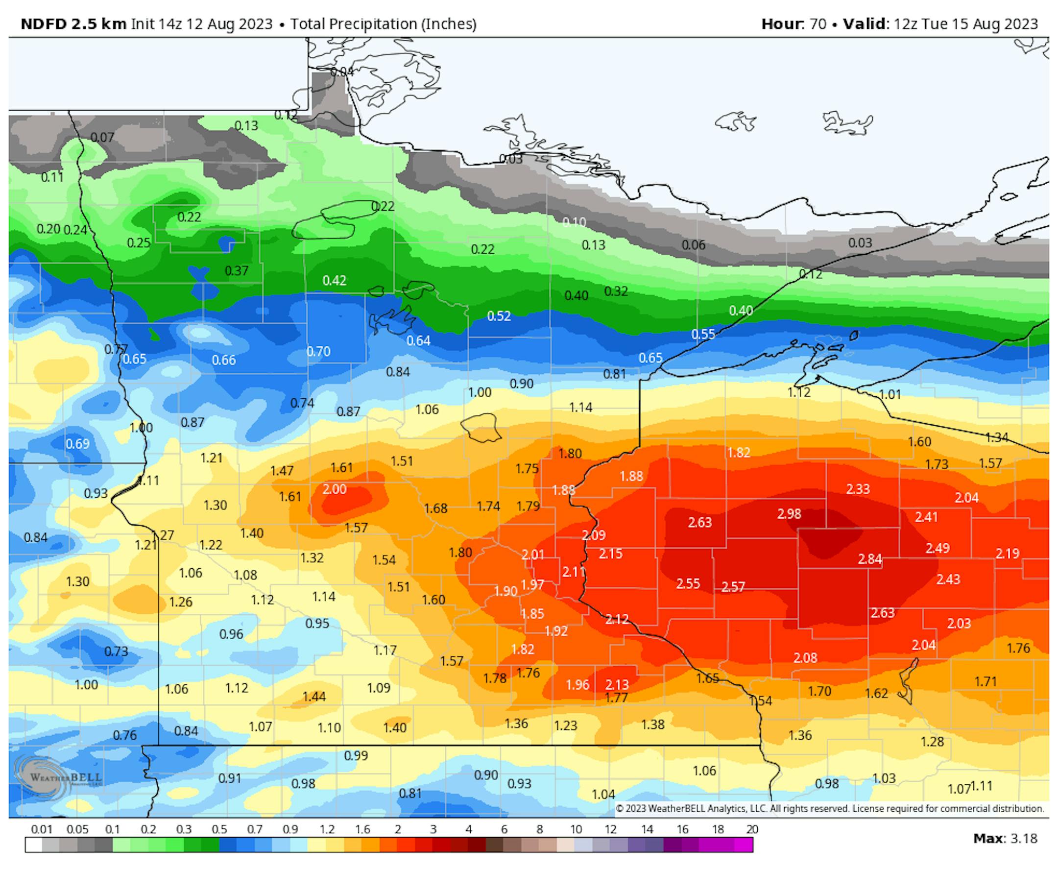
Rainfall Potential Through The Weekend
Sunday could be a potentially soggy day with a million-dollar soaking for some, especially north of the metro. Some locations across the northern half of the state could see in excess of 1" of rain. The Twin Cities could see a decent amount of rain, but the heaviest looks to stay north.
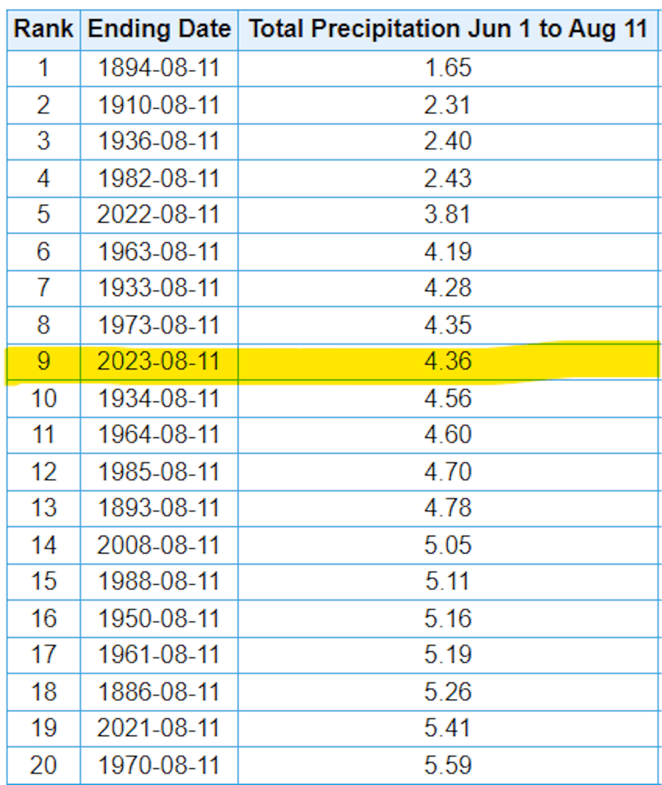
6th Driest Meteorological Summer on Record
It has been very dry across much of the region so far this summer with only 4.36" of rain falling at the MSP Airport since June 1st. That is nearly -5.90" below average and is the 9th driest Meteorological Summer on record with the driest being 1.65" set in 1894. Interestingly, the last summer (2022) was even drier.
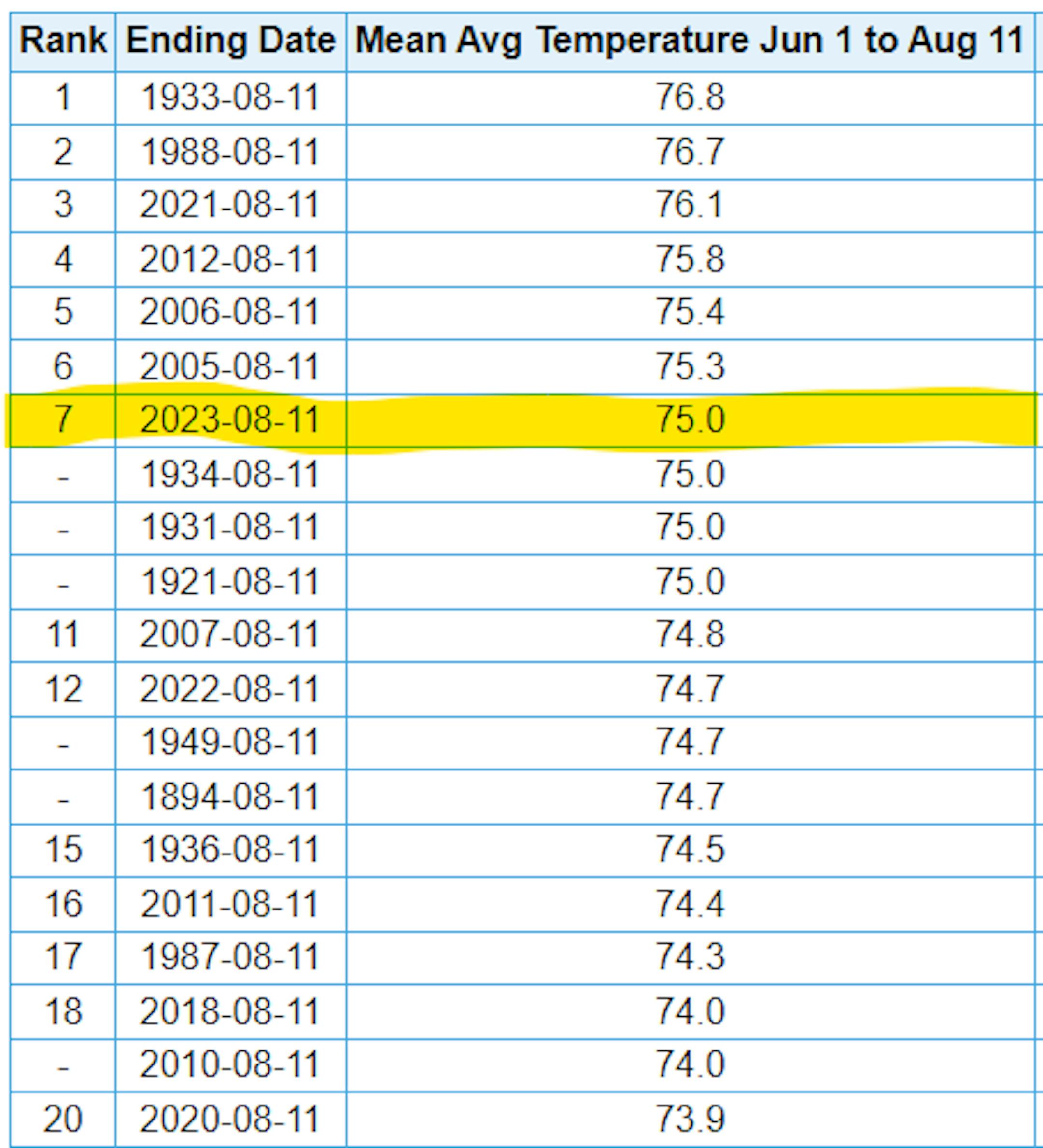
7th Hottest Meteorological Summer on Record
It has also been a hot summer with readings running well above average since June 1st and good enough for the 7th hottest Meteorological Summer on record so far. Note that 2021 was the 3rd hottest and 2022 was the 12th hottest From June 1st to August 11th.
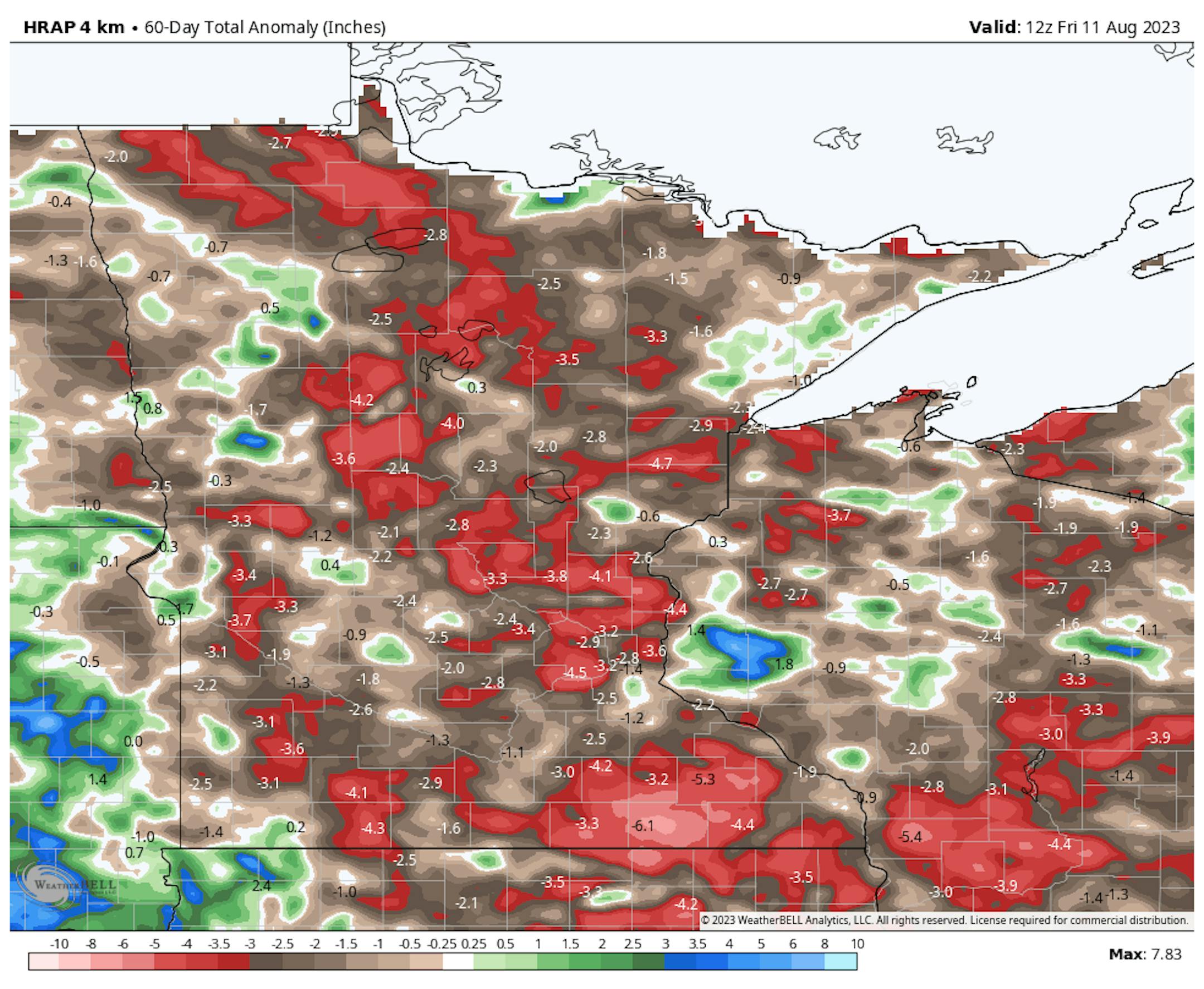
60 Day Precipitation Anomaly
The map below shows the 60 day precipitation anomaly, which indicates that some locations are nearly -3.00" to nearly -6.00" below average (in red/pink) since mid June. There are a few locations across the state that have surpluses, but most locations are well below average.
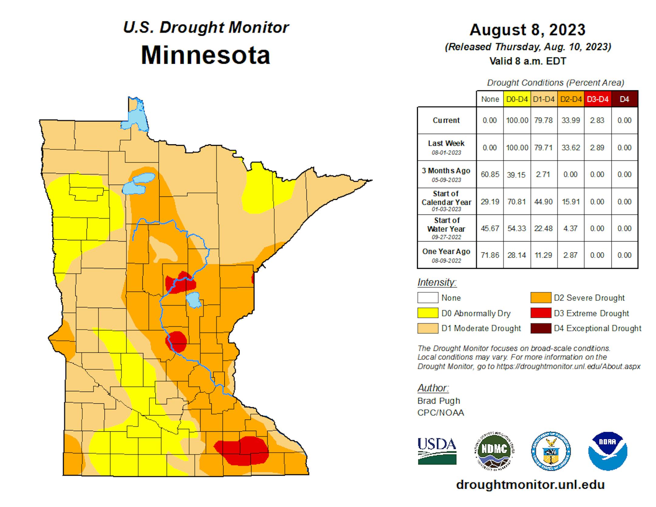
Drought Update
There wasn't much change in the drought from last week, but drought conditions have deepened since the beginning of summer. Some areas across the region are considered in an Extreme Drought showing up (in red). Interestingly, the last time that parts of Minnesota were in an Extreme Drought was back in mid December, nearly 7 months ago.
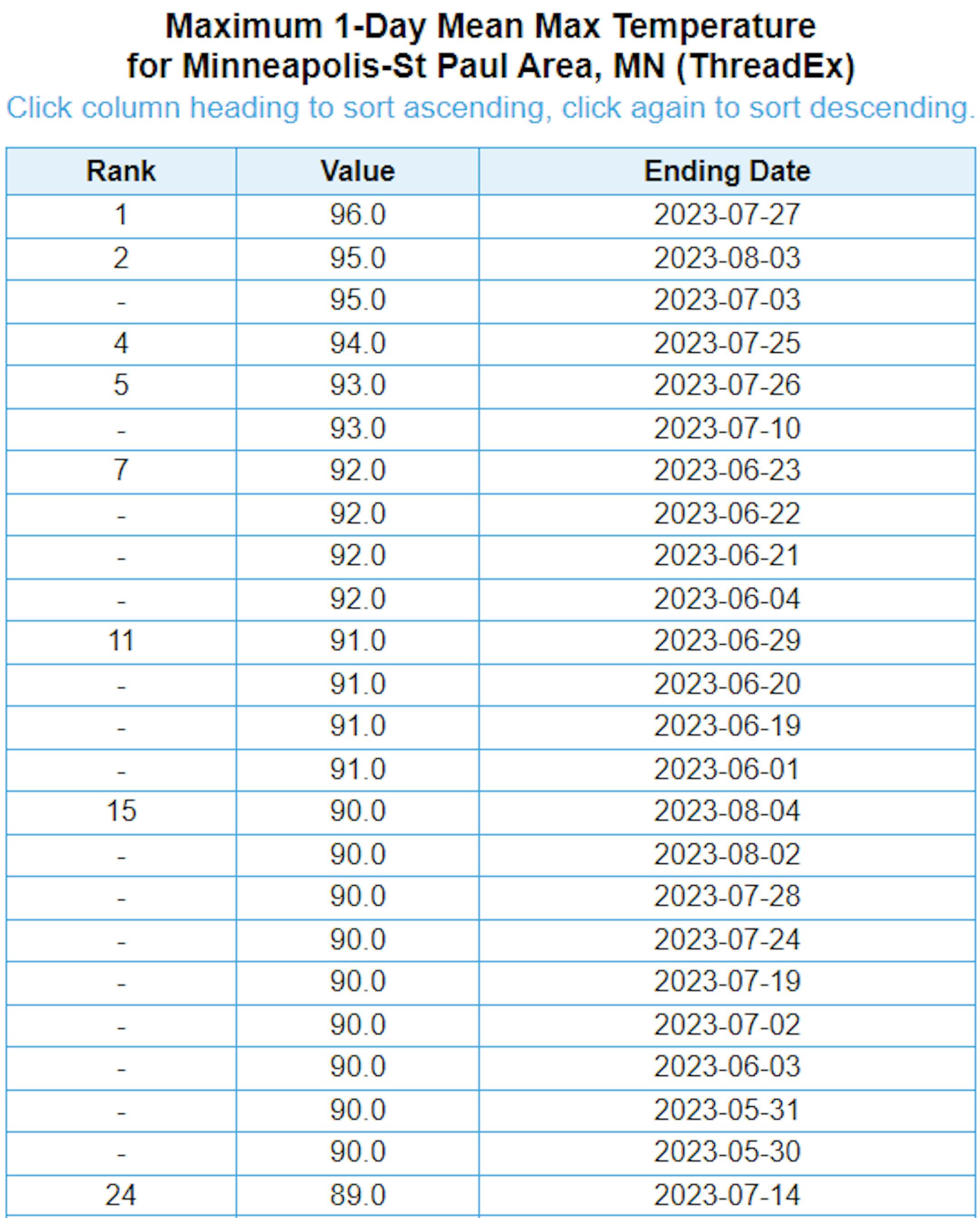
Hottest Days of 2023 So Far
The hottest day of 2023 (so far) was Thursday, July 27th with a high of 96F and heat index values peaking around 105F to 110F. Uffda! There have been (23) 90F days this year. Our average number of 90F days is 14.
Average Number of 90F Days At MSP
Looking at the last 30 years, the average number of 90F days at the MSP Airport is (14). July is the hottest month with an average of (6) 90F days. This year we've had (23) 90F days, last year we had (18) days in the 90s and in 2021 there were (27) days in the 90s. The most number of 90F days in any single year was (44) set in 1988.


