
A Developing System in the Gulf?
The National Hurricane Center is currently watching a developing area of low pressure in the Bay of Campeche that will bring disturbed weather to the Gulf Coast States this week with heavy rain and gusty winds.

Tracking A Developing System in the Gulf
Latest model runs continue to show a slow drift northward toward the Coastal Bend of Texas. Areas of heavy rainfall and flash flood concerns can't be ruled out as this system moves through.

Heavy Rainfall Potential in the Gulf
Latest model runs suggest several inches of rain from the Coastal Bend of Texas to Louisiana as we head through the week ahead. Flash flood concerns can't be ruled out in some of the heaviest rain bands.

Fall Color Tracker
According to the MN DNR, much of the state is already experiencing minor changes in the fall color. Keep in mind that much of the summer was hot and dry, so some of the trees are a bit stressed and could be prematurely changing. With that being said, we are getting closer to that time of the year. See the latest update from the MN DNR HERE:

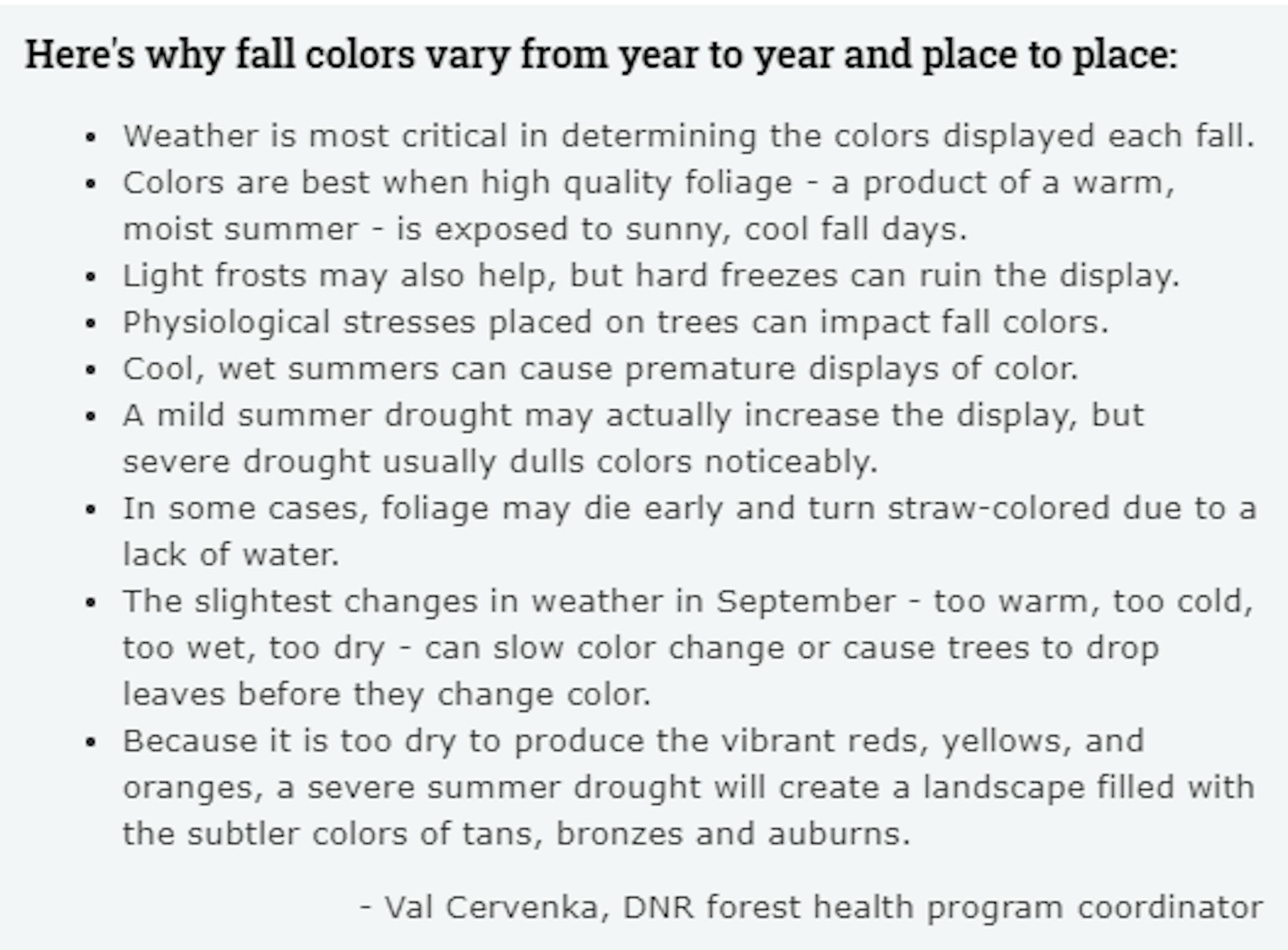
Fall Color Depends on Weather
Ever wonder why some years, fall color is so vibrant vs some years, fall color tends to be a bit more dull? Val Cervenka, Coordinator from the DNR Forest Health Program, shares how the weather can play a roll in those fall colors. Due to the hot and dry summer that most of experienced, it is likely that fall foliage could be less impressive this year with more tans, bronzes and auburns.
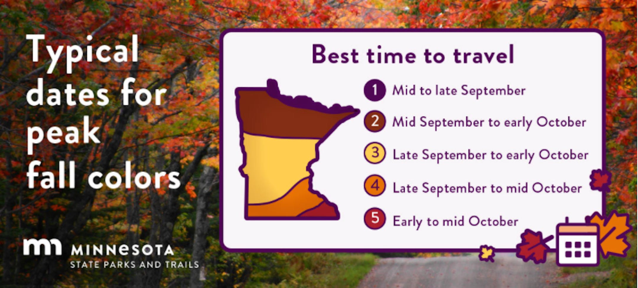
Typical Peak Dates For Fall Color
According to the MN DNR, fall colors typically start to peak across the northern part of the state in mid/late September. Peak color typically arrives in central and southern Minnesota late September and into early/mid October. Note that over the next several weeks, you'll notice some big changes in the landscape as we head deeper into fall.
Larry To Bring FEET of Snow to Greenland
Take a look at the GFS model forecast below. On the right part of the screen, you'll notice Larry, which will quickly lose tropical characteristics as it lifts north toward Greenland, but will still pack a major punch. The remnants of Larry are expected to bring FEET of snow to eastern parts of Greenland with blizzard-like conditions as winds gust to near hurricane force!


Another Tropical System in the Gulf?
Keep in mind that the peak of the Atlantic Hurricane season is on September 10th and things are still quite active in the Atlantic basin now. NOAA's NHC is tracking 4 other waves, 2 of which have a high probability of tropical formation over the next 5 days. The one migrating into the Gulf could bring very heavy rainfall to the Gulf Coast as we head into next week.


