

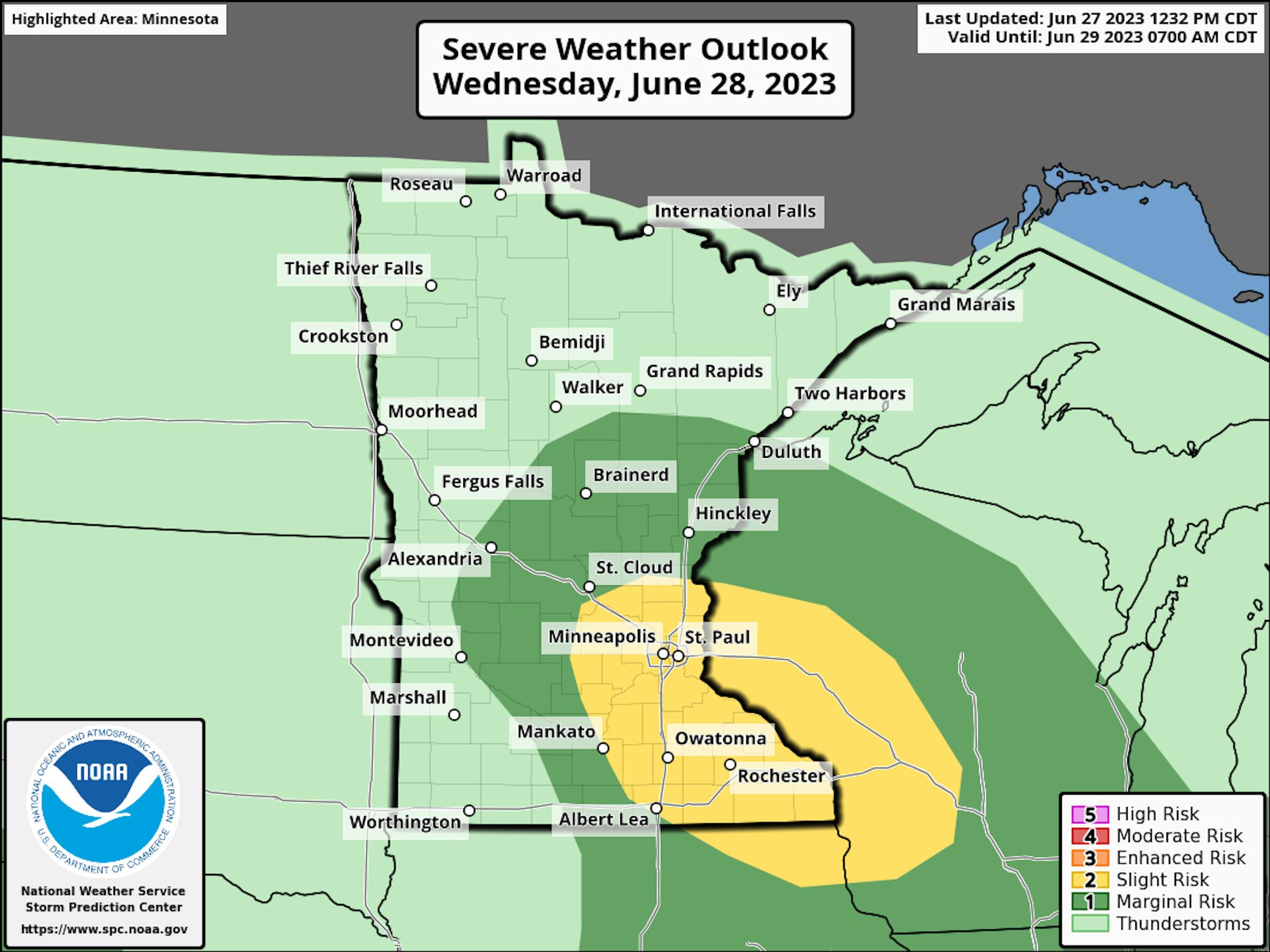
Severe Threat on Wednesday
According to NOAA's Storm Prediction Center, there is a risk of strong to severe thunderstorms on Wednesday. A Slight Risk (in yellow) indicates a level 2 out of 5 for the potential of isolated large hail and damaging wind events from near the Twin Cities into southeastern Minnesota and into Western Wisconsin.
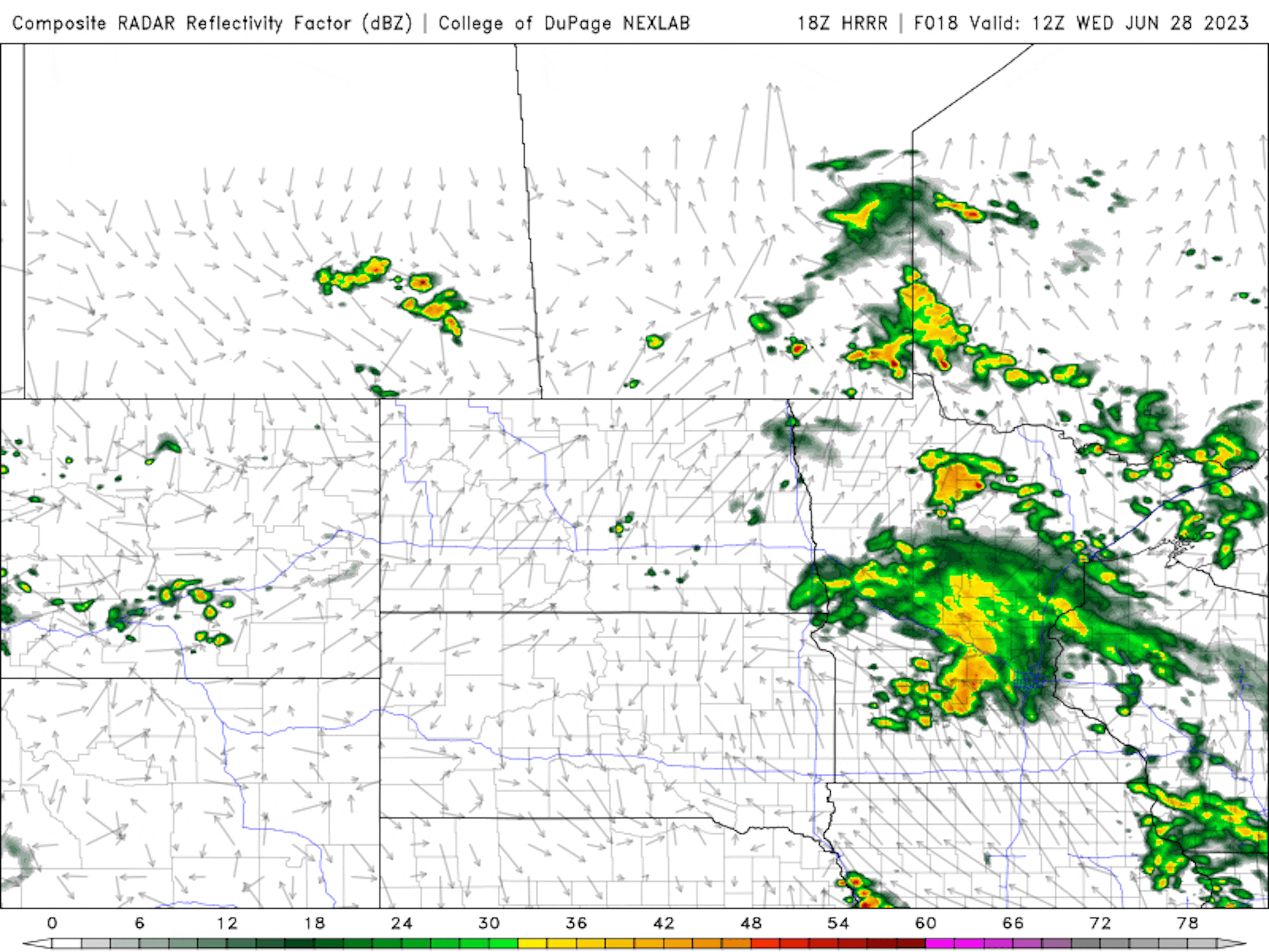
Simulated Radar
The simulated radar from AM Wednesday to Midday Thursday shows scattered showers and storms in place during the morning hours of Wednesday and thunderstorms redeveloping in the afternoon hours of Wednesday. Some of the storms PM Wednesday could be strong to severe with large hail and damaging winds.
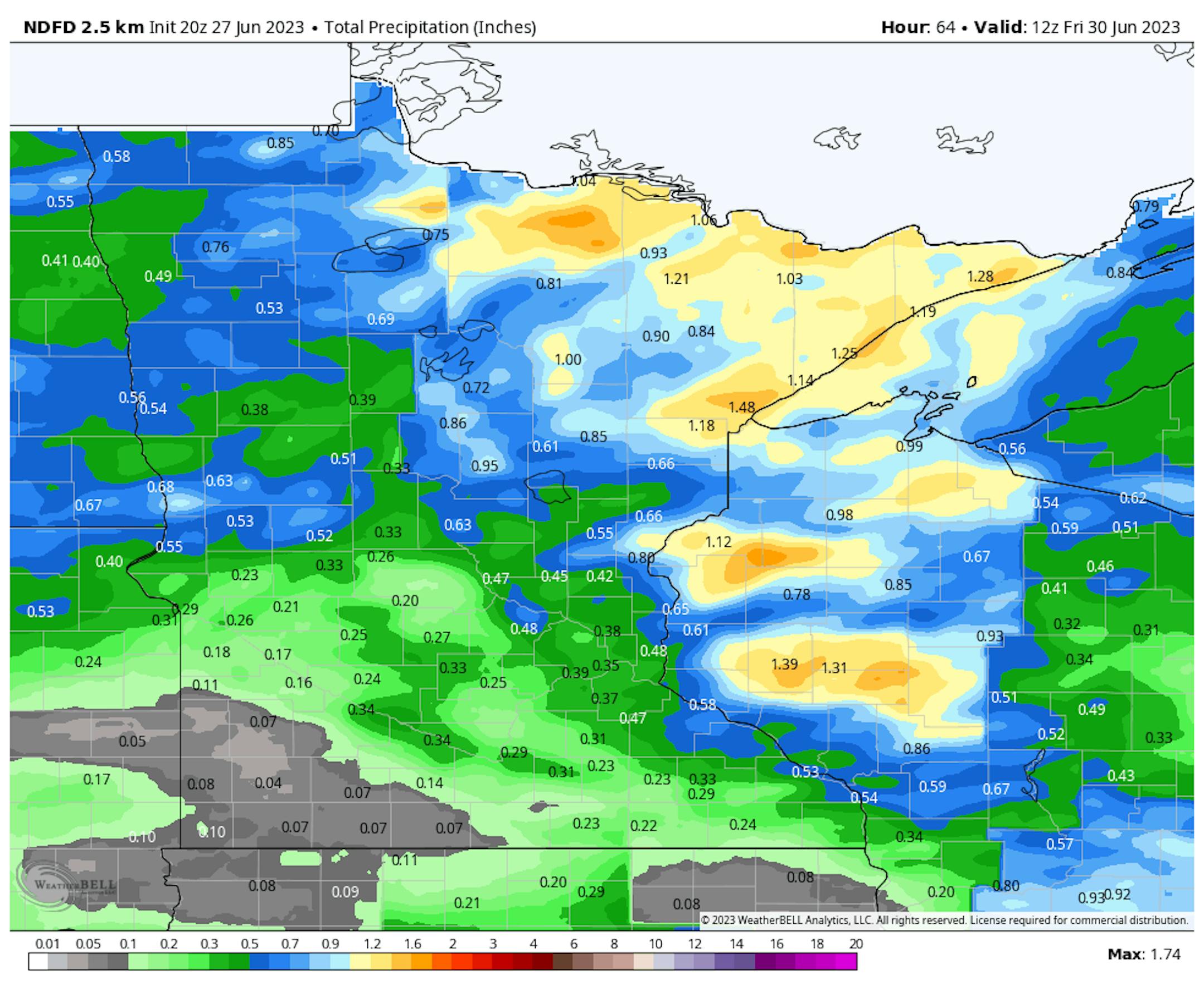
Precipitation Potential
Pockets of heavy rainfall can't be ruled out across parts of the state. Some locations could see up to 1" or more, mainly north and east of the Twin Cities.
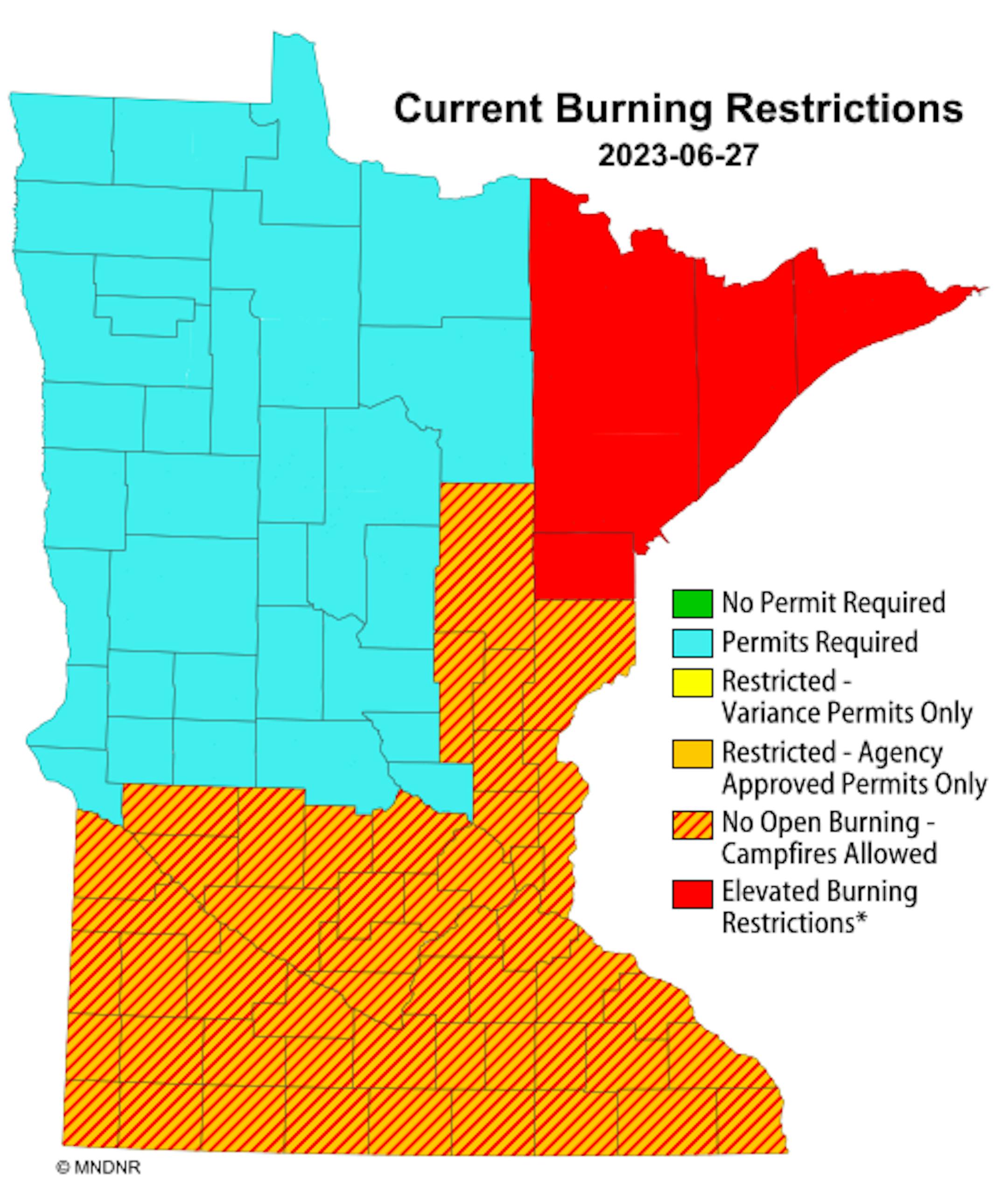
Current Burning Restrictions
Thanks to several days of hot and extremely dry weather, there remains a burning restriction across northeastern Minnesota. There are also some burning restrictions across the southern half of the state and into eastern Minnesota.
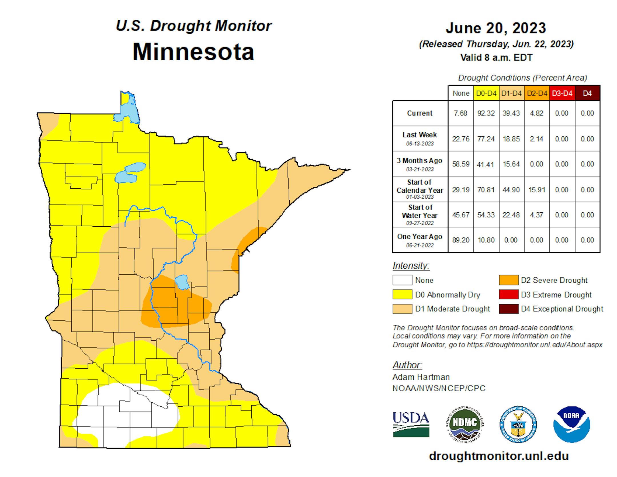
Drought Update
It has been an extremely dry stretch of weather across much of the station over the last several weeks. Only a few locations have seen decent pockets of rain, but the drought is expanding. Severe drought conditions have popped up across parts of central Minnesota with moderate drought now in place across parts of the Twin Cities.
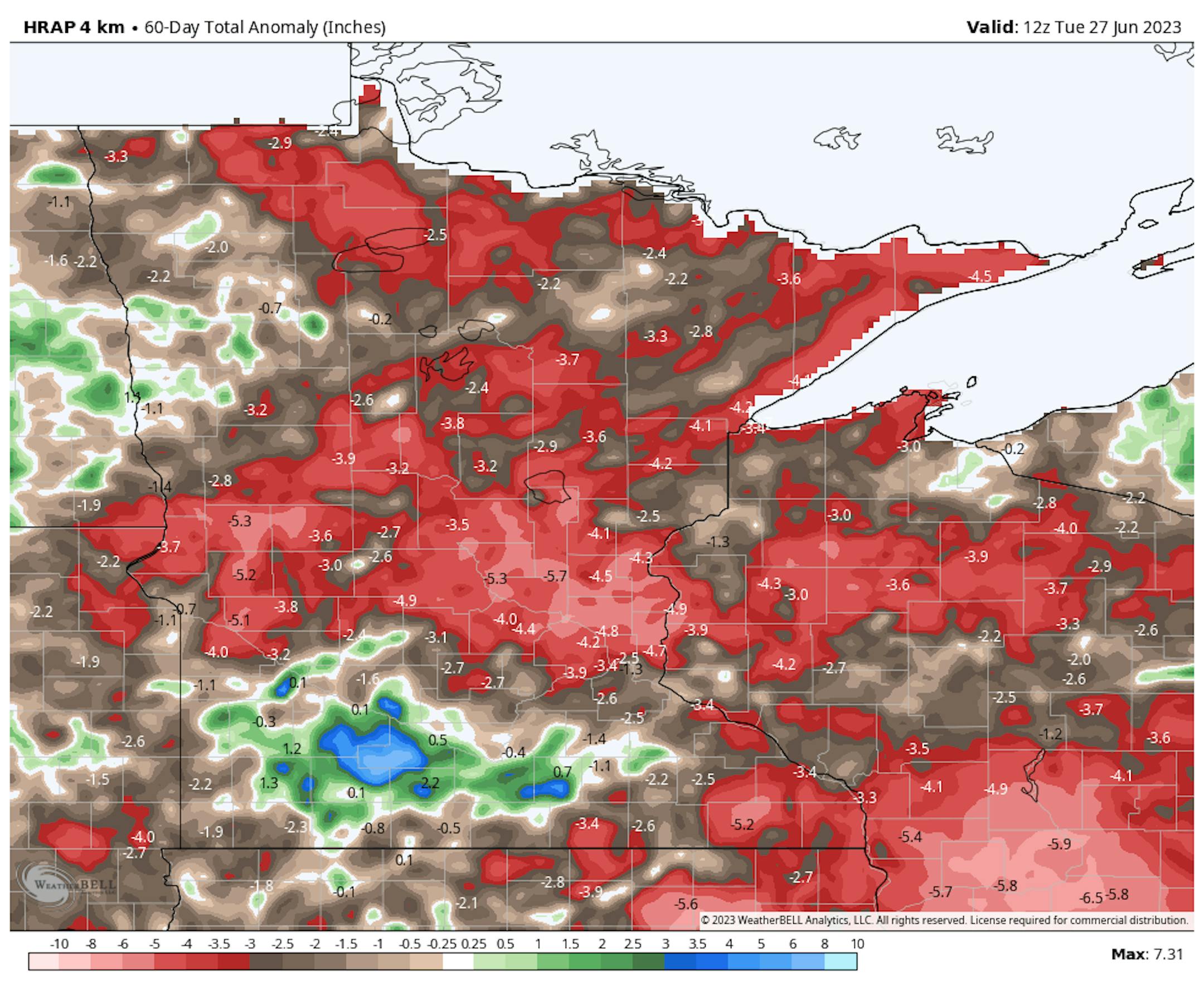
60 Day Precipitation Anomaly
The map below shows the 60 day precipitation anomaly, which indicates that some locations are nearly -3.00" to nearly -6.00" below average (in red) since mid May. This is where drought conditions are expanding.
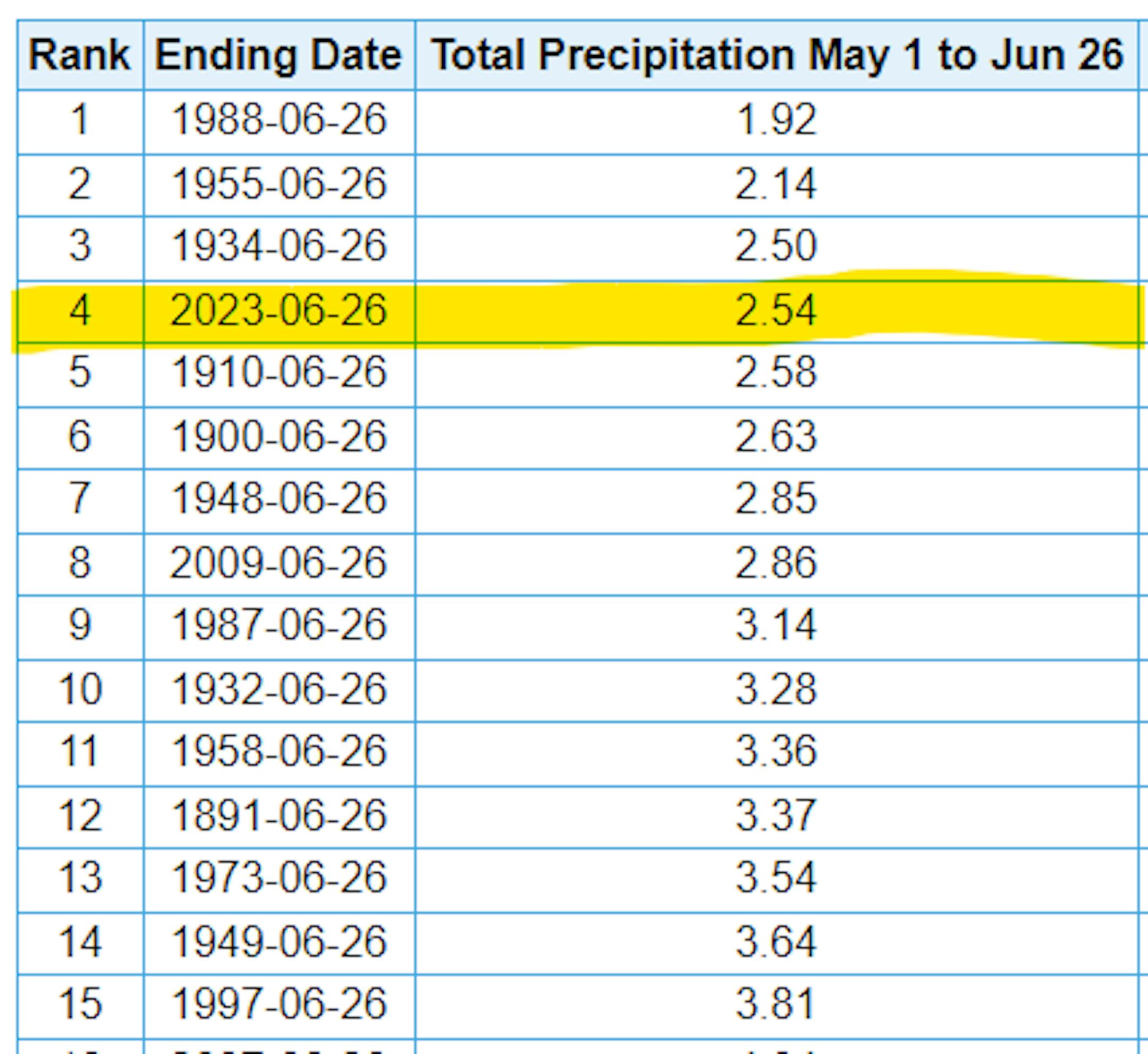
4th Driest May 1st - June 26th on Record at MSP
There has only been 2.54" of rain at the MSP Airport since May 1st, which is the 4th driest May 1st - June 26th on record. The driest such stretch was back in 1988, when only 1.92" of rain fell.
Twin Cities Weather Outlook For Wednesday
The weather outlook for the Twin Cities on Wednesday, June 28th shows chances of showers and thunderstorms moving through the region, some of which could be strong to severe with hail and gusty winds in the afternoon.


