
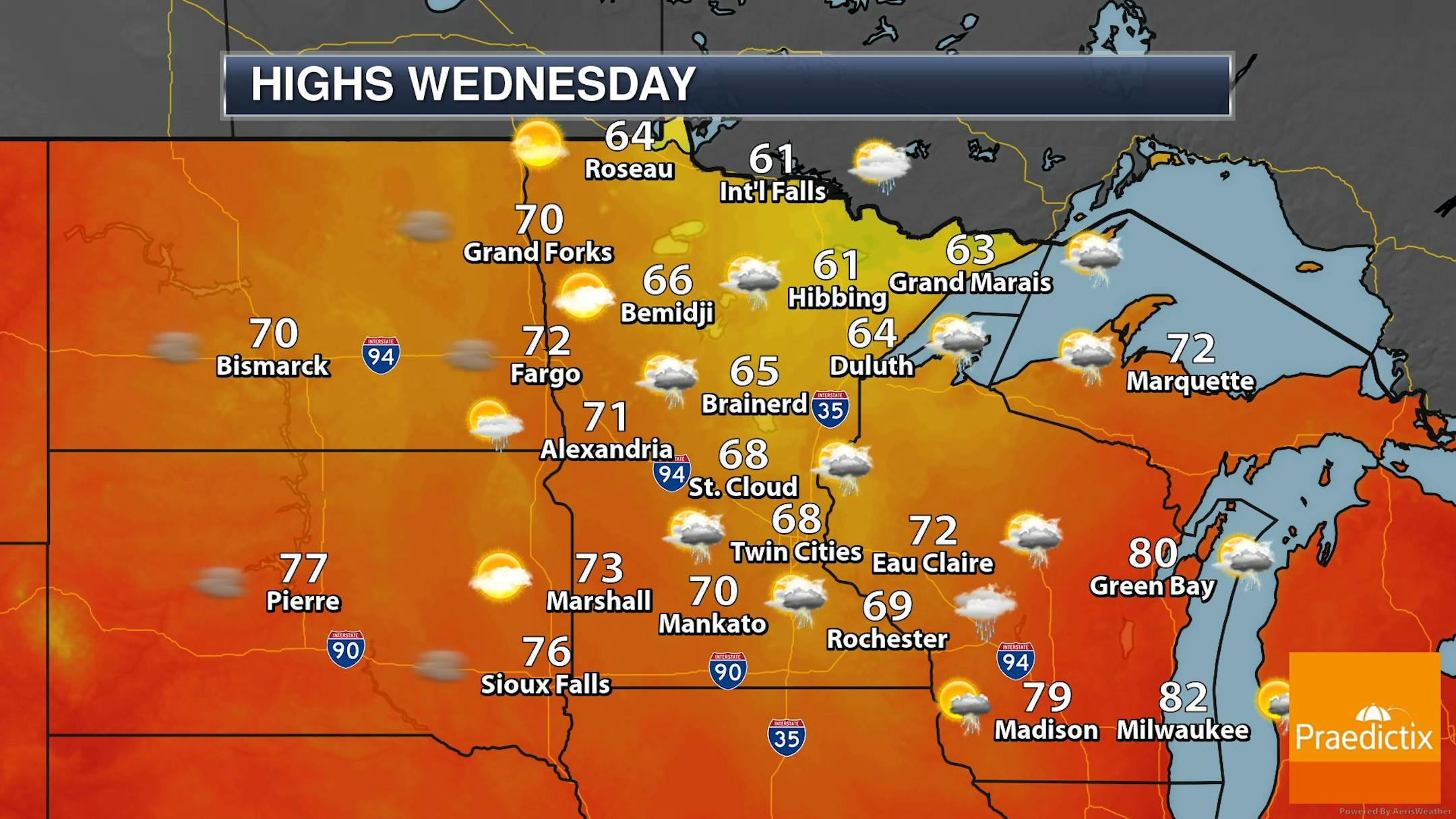
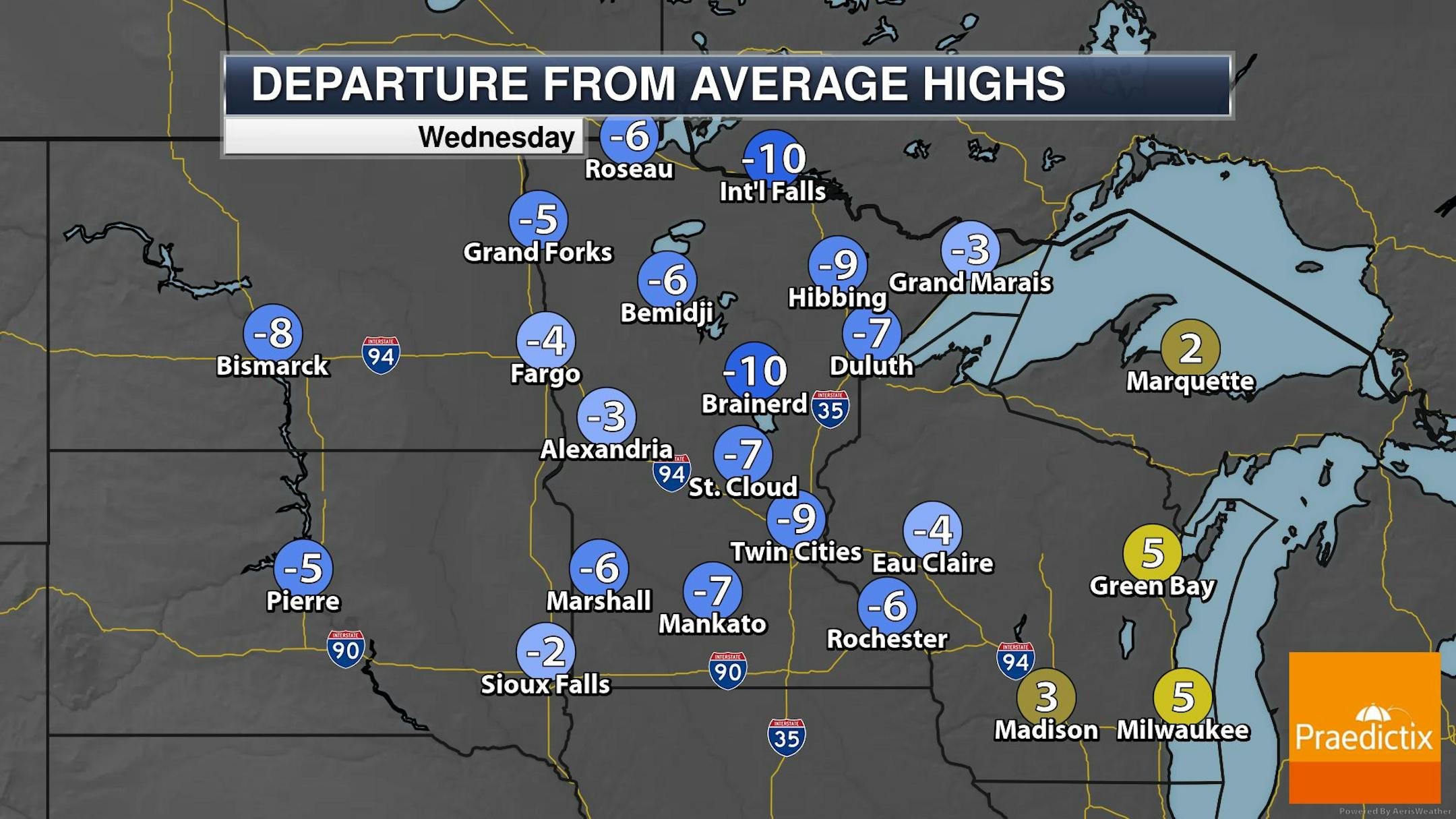
MUCH Cooler Weather Ahead
Temps on Wednesday will be MUCH cooler than it was over the last several days. In fact, it'll be almost 25F to 30F cooler than it was this weekend. The Twin Cities might not even make it to 70F, while some folks in the Arrowhead may have a hard time making it into the 60s. There may be a few lingering showers or storms, but there will be a gradual drying and clearing trend throughout the day.
Number of 90F Days So Far This Year
The hottest days of 2023 (so far) were back to back on August 22nd and 23rd, when the MSP hit 98F and heat index values peaking around 110F to 120F around the metro. Uffda! Through Tuesday, September 5th, there have been (32) 90F days this year and is the 6th most number of 90F days in any year and the most since 1988.
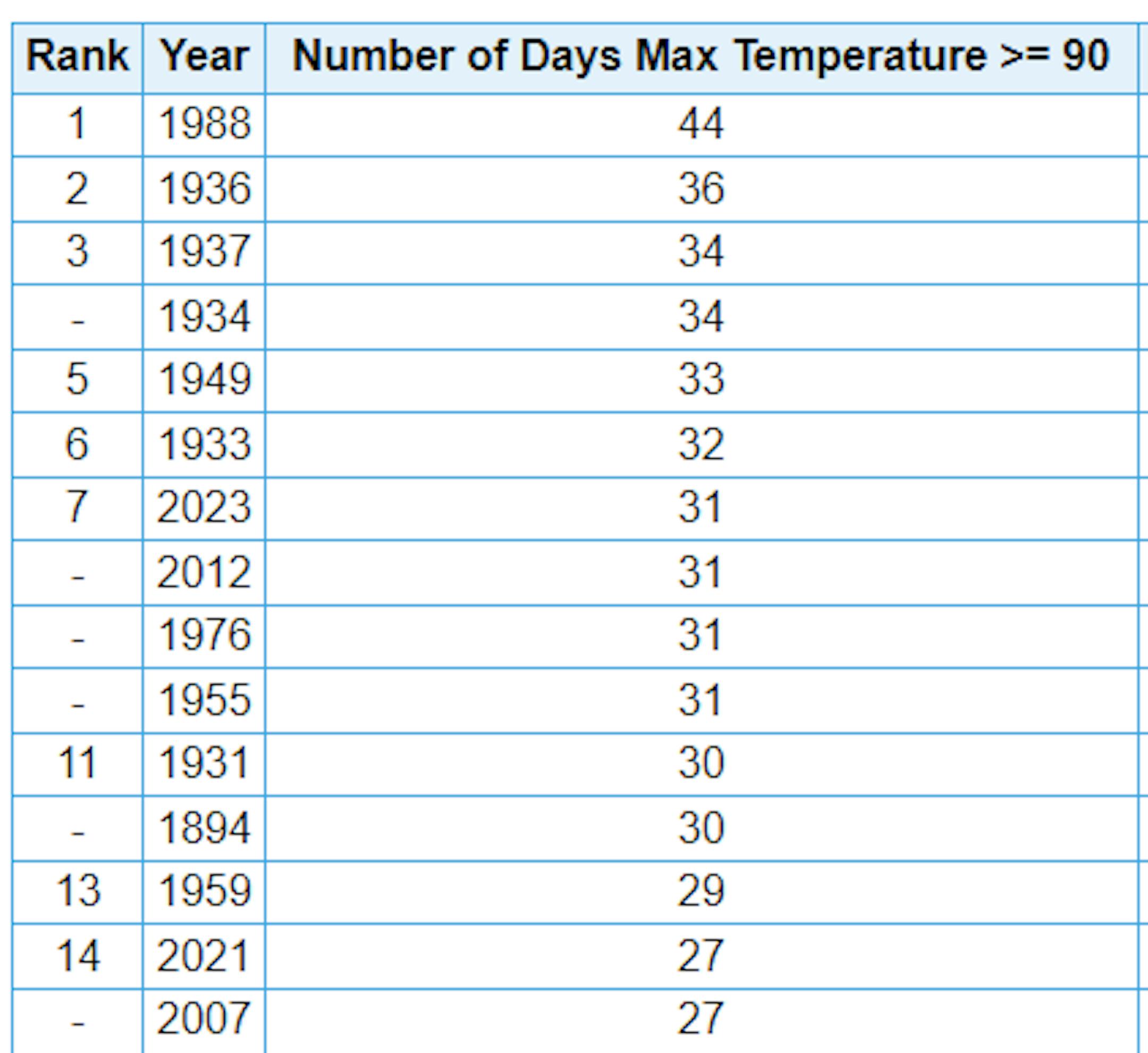
Average Number of 90F Days At MSP
Looking at the last 30 years, the average number of 90F days at the MSP Airport is (14). July is the hottest month with an average of (6) 90F days. This year we've had (23) 90F days, last year we had (18) days in the 90s and in 2021 there were (27) days in the 90s. The most number of 90F days in any single year was (44) set in 1988.

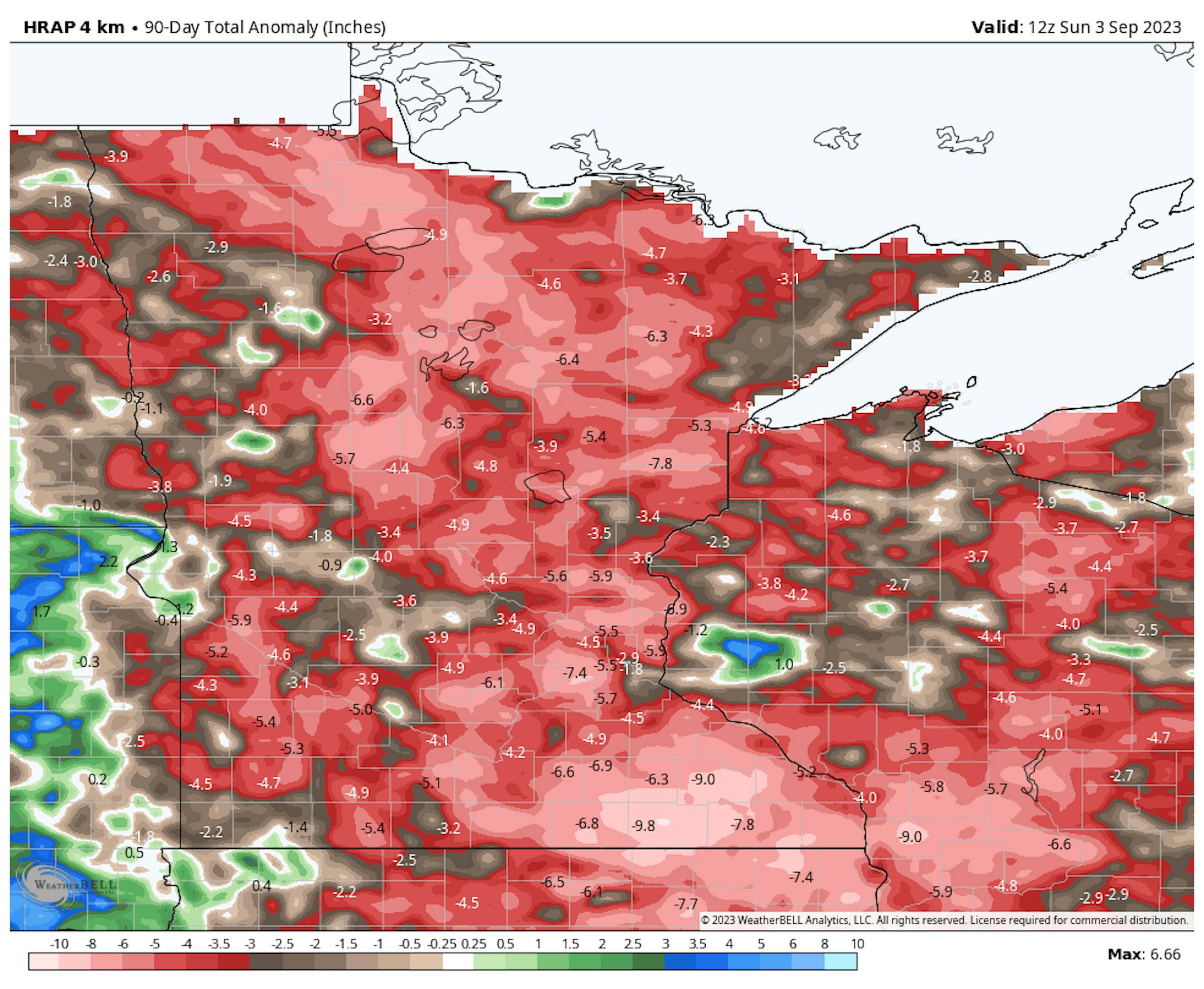
90 Day Precipitation Anomaly
On average, the wettest time of the year is in the summer, with the months of June, July and August seeing nearly 13" of rain at the MSP Airport. If we take a look at the 90 day precipitation anomaly, which dates back to early June, some locations are nearly -3.00" to nearly -7.00" below average (in red/pink). Note that some locations across southeastern Minnesota are nearly -8.00" to -10.00" below average.
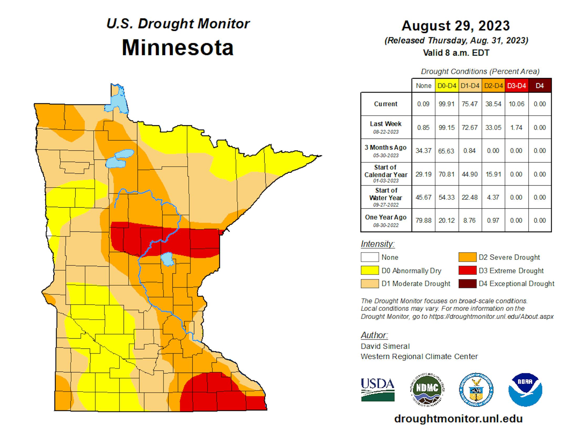
Drought Update
Drought continues and expanded from last week with nearly 10% of the state now in an Extreme Drought. Severe Drought is now almost 40% and includes much of the Twin Cities metro. 3 months ago, 65% of the state was considered just abnormally dry.
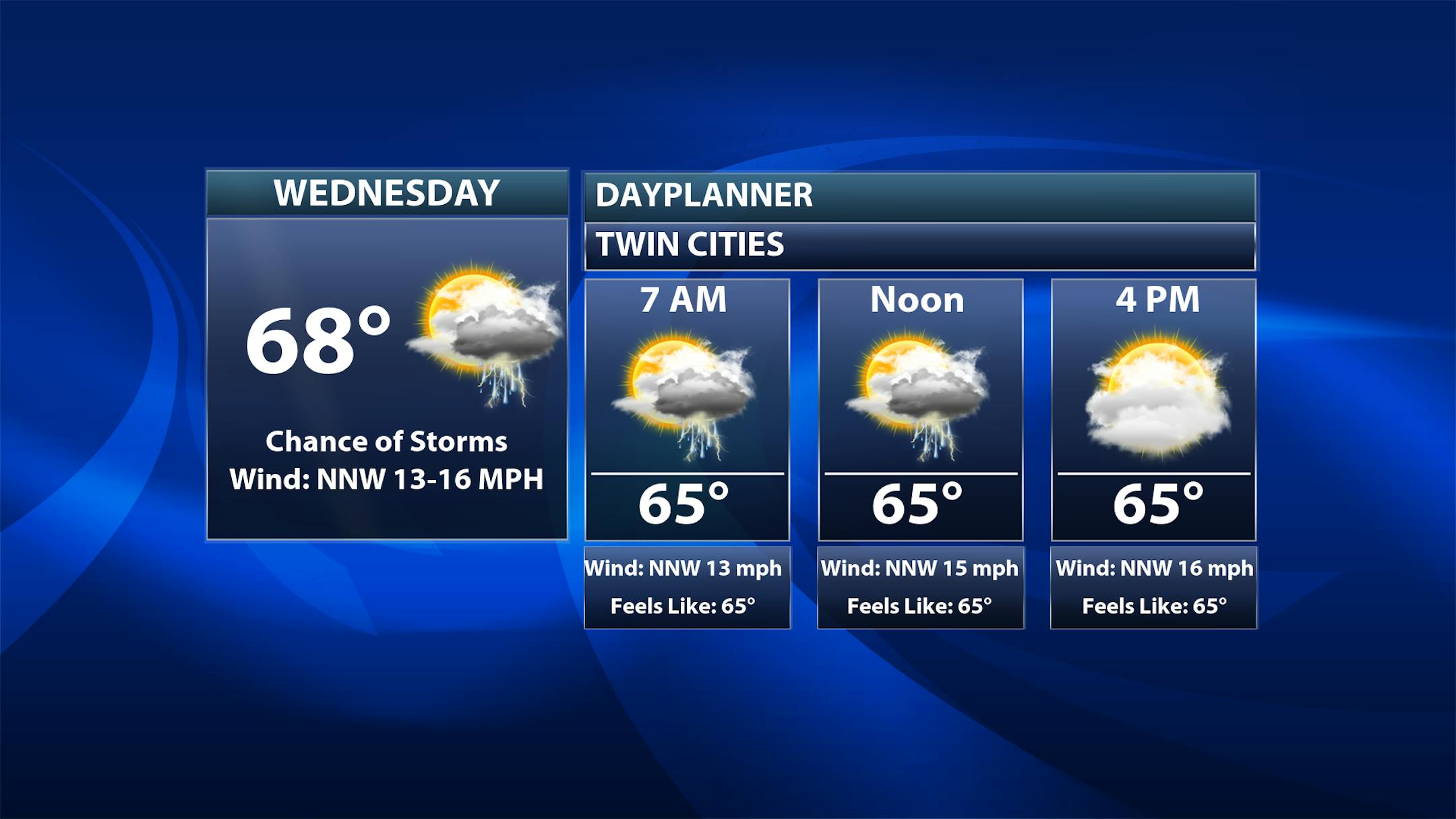
Twin Cities Weather Outlook For Wednesday
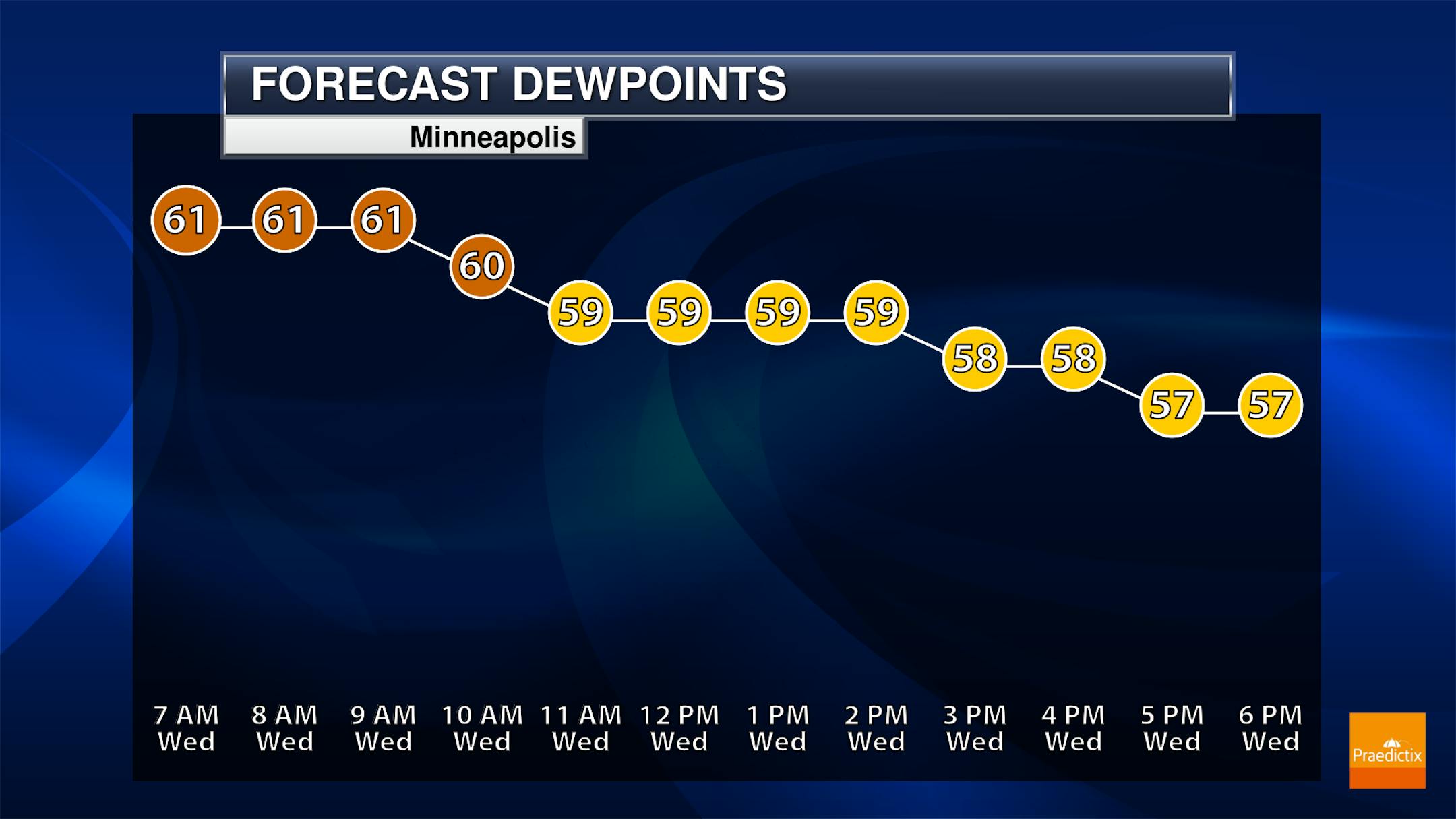
The weather outlook for the Twin Cities on Wednesday, September 6th will be MUCH cooler than it was over the last several days with highs only warming into the upper 60s, which will be nearly 25F to 30F cooler. There could be a few lingering showers and storms during the early part of the day with gradual drying and clearing throughout the day. The hourly dewpoint forecast for Minneapolis shows much more comfortable dewpoints with readings in the upper 50s
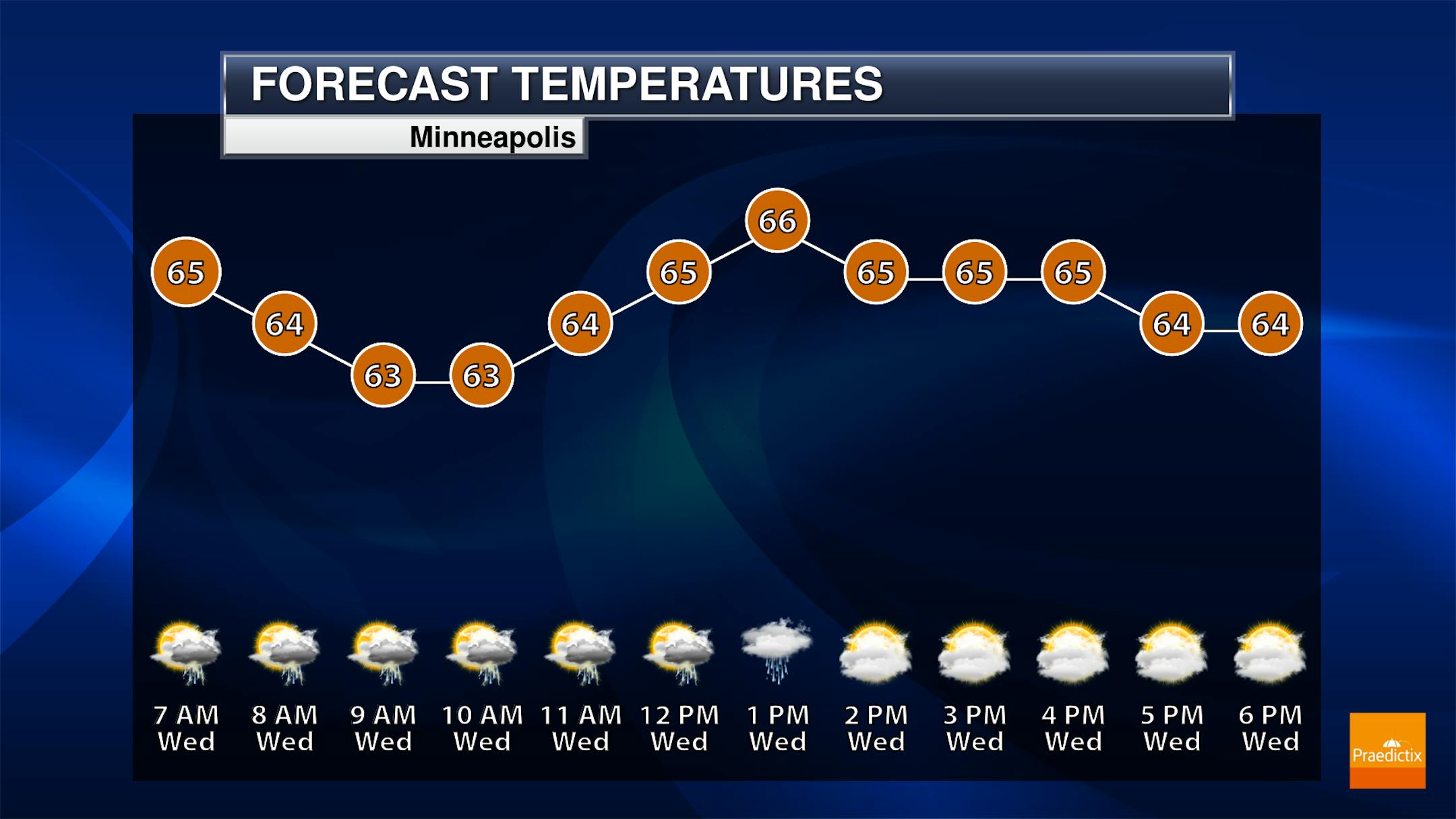
Meteograms For Minneapolis
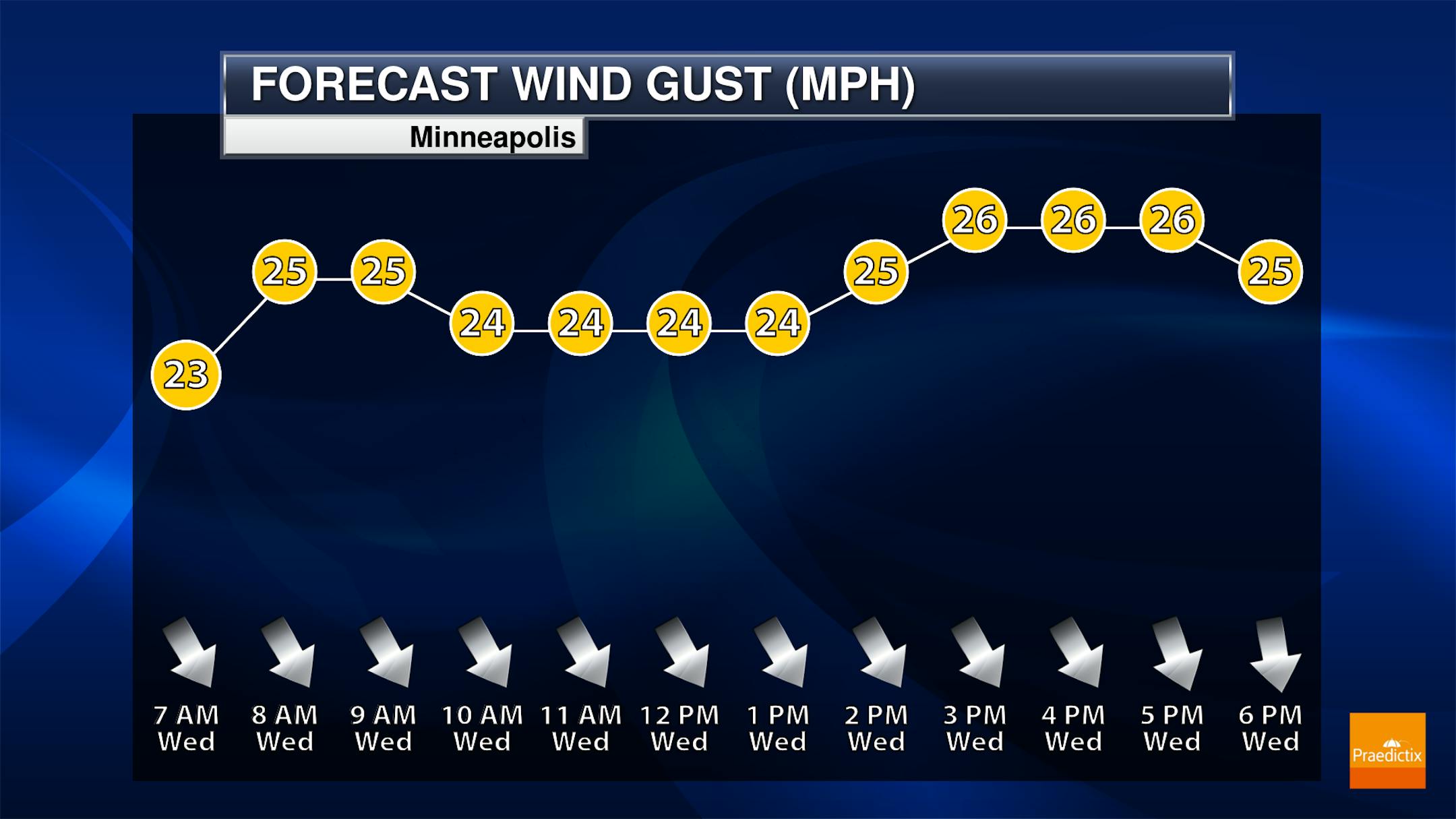
Weather conditions for Minneapolis on Wednesday will be quite a bit cooler with readings in the 60s. There could be a few lingering showers or storms in the morning, but there will be a gradual drying trend through the day. Winds will be a bit breezy with gusts approaching 25mph to 30mph.
Extended Temperature Outlook For Minneapolis
The 5 day temperature outlook for Minneapolis will be more seasonable with readings warming into the upper 60s and 70s over the next several days. It may get a little warmer on Saturday with readings close to 80F once again.


