

Monday Weather Outlook
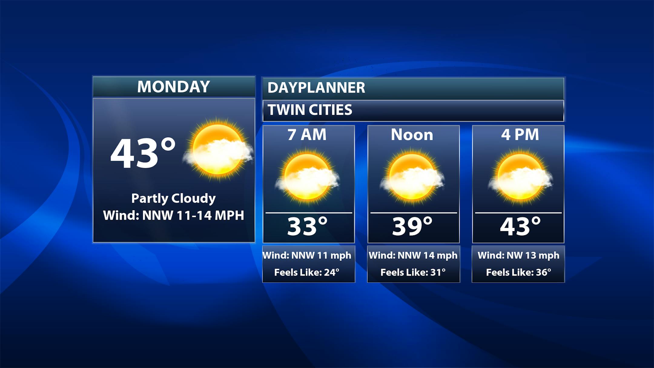
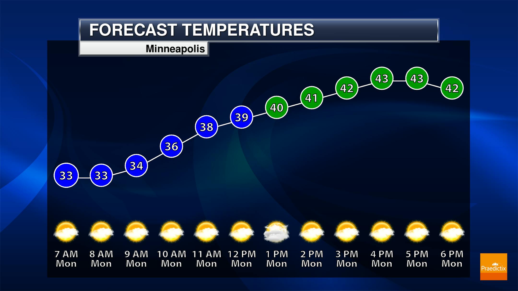
A quiet, chilly start to the work week is expected in the Twin Cities Monday. While the graphics say partly cloudy, I think we will see more clouds than sun - or mostly cloudy skies - throughout much of the day. Temperatures start the day off around freezing, only climbing into the low 40s for highs.
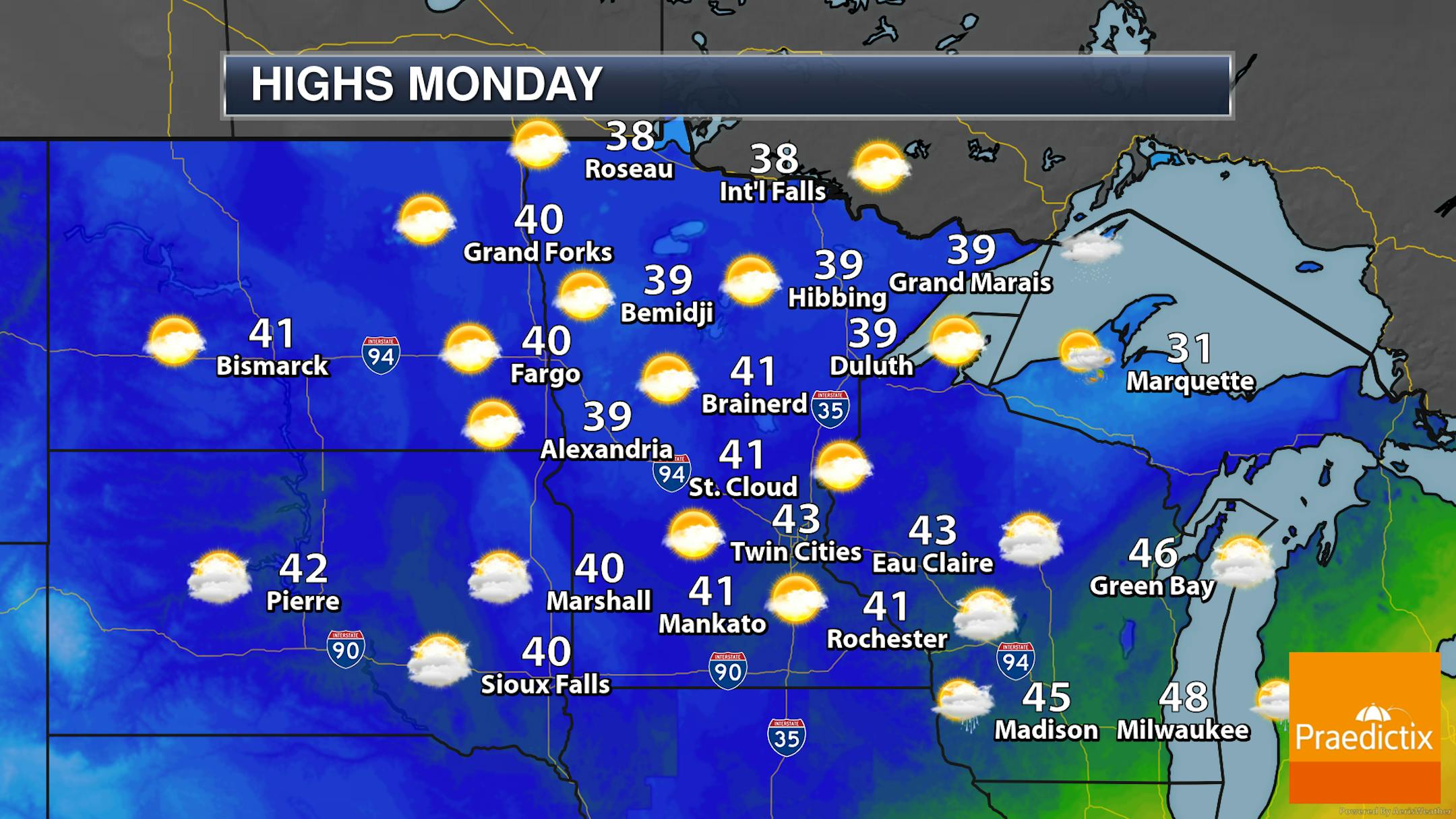
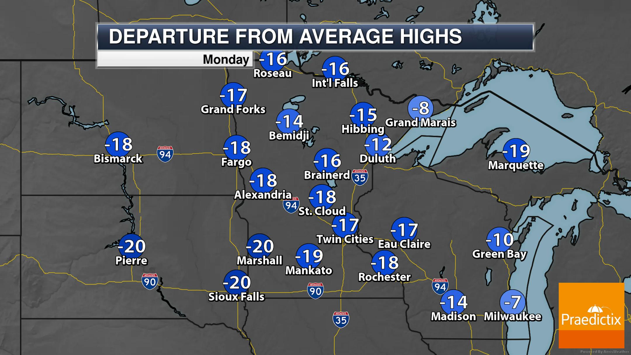
Monday should be fairly dry across the state, but I can't rule out a few spare sprinkles at times. Clouds will be on the decrease from northern and western Minnesota southeastward, so we'll call the day partly to mostly sunny. It'll be a cool day statewide, with highs only in the upper 30s to low 40s in most locations. These highs will be 10F-20F degrees below average.
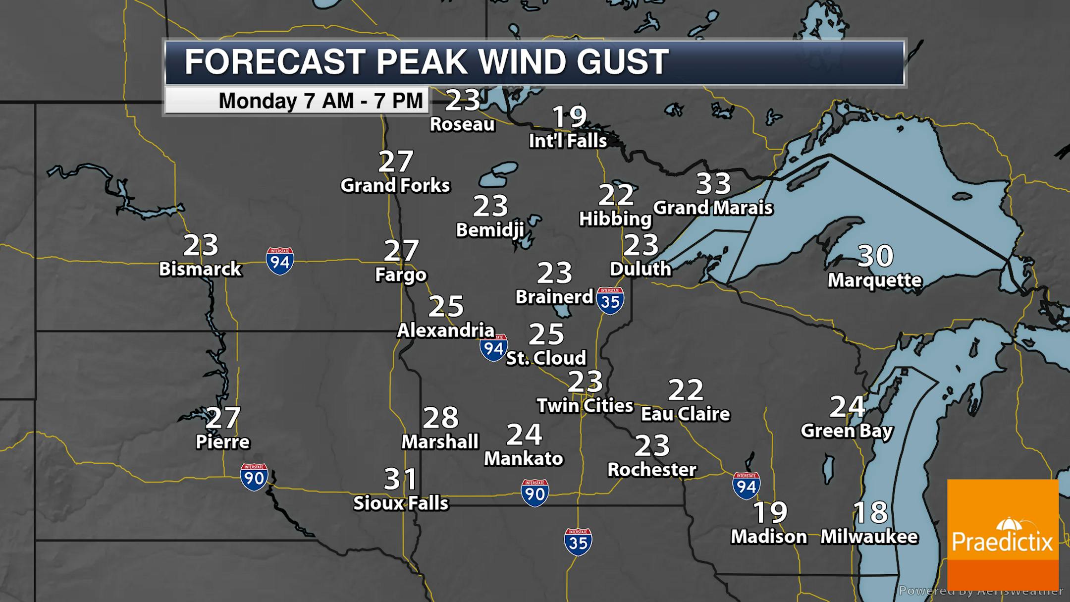
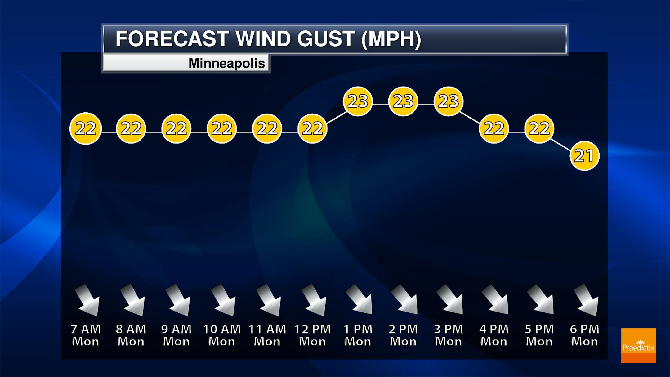
Winds will be breezy once again on Monday, with north-northwest winds gusting up to around 25 mph at times in the Twin Cities.
_______________________________________________
Extended Temperature Outlook
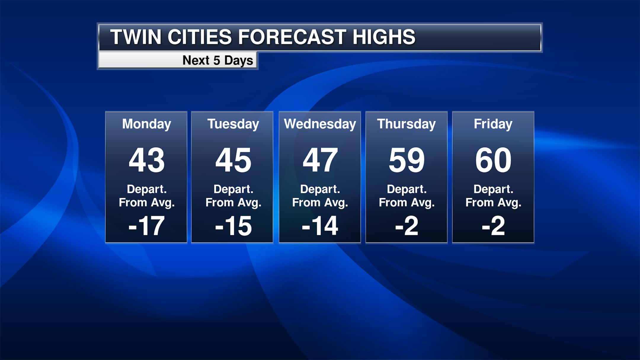
It'll be a cool start to the week in the Twin Cities, with highs only in the 40s Monday through Wednesday behind the cold front that moved through late Sunday. Warmer weather returns for Thursday and Friday with highs back around 60F - just a couple of degrees shy of average, which by Friday is 62F.
_______________________________________________
April Summary Through Saturday
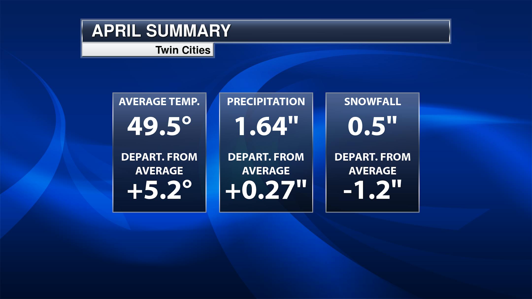
Despite some of our cooler and wetter weather, it has still be a warmer than average start to the month in the Twin Cities. Through Saturday, our average temperature has been 49.5F, +5.2F degrees from average and tied for the 15th warmest start to the month. While we are above average precipitation-wise - and that precipitation has greatly helped the drought situation across the region - we have seen below average snowfall (which I don't think too many people will complain about!).
_______________________________________________


