

40F On Tuesday - Warmest Day Since The 10th
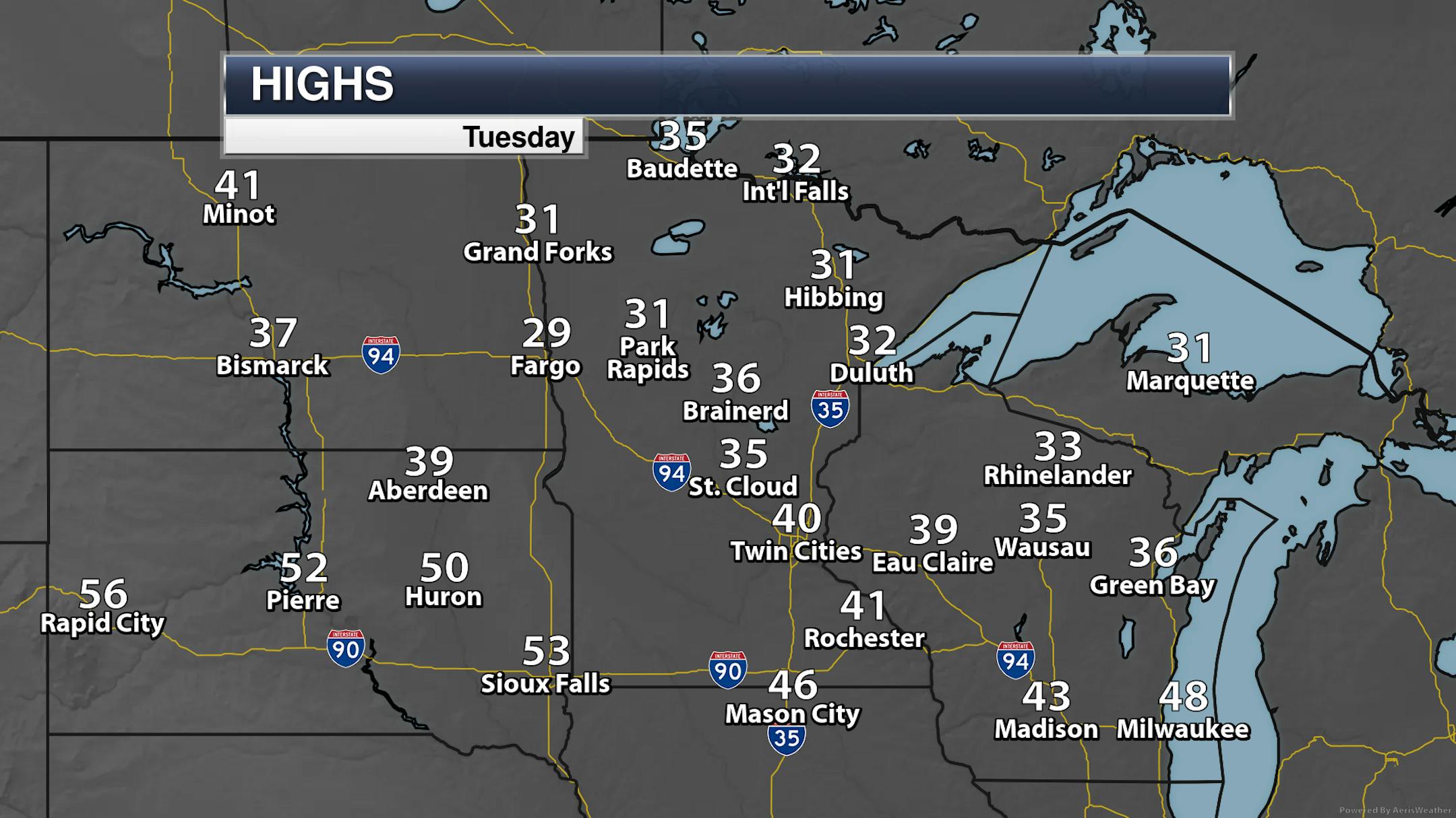
On Tuesday, MSP airport hit 40F for the first time since November 10th - and it was the first day with an above average high since that date as well.
_______________________________________________
Slight Travel Impacts Possible Wednesday Night And Thanksgiving Day Due To Drizzle (Some Freezing)
Forecast loop Thursday from 6 AM to 6 PM.
As we head into your Thanksgiving Thursday, we will be watching a weak system moving through the region. This will bring the chance of some drizzle to the metro (mainly in the morning), and some light freezing drizzle/drizzle/snowflakes across northern Minnesota. While this will be light in nature, any icing could cause slick roadways, so be careful while going over the river and through the woods to grandmother's house!
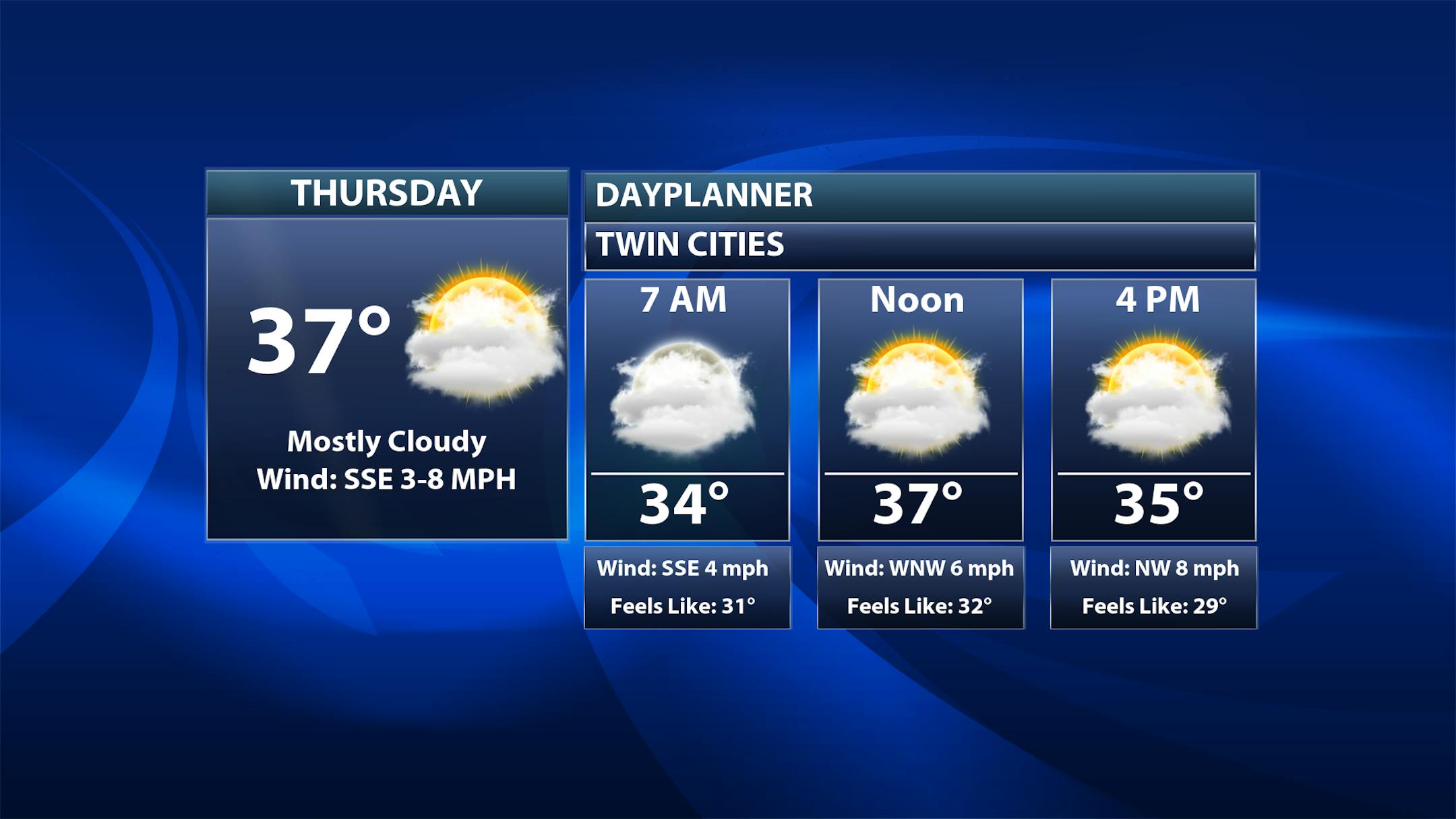
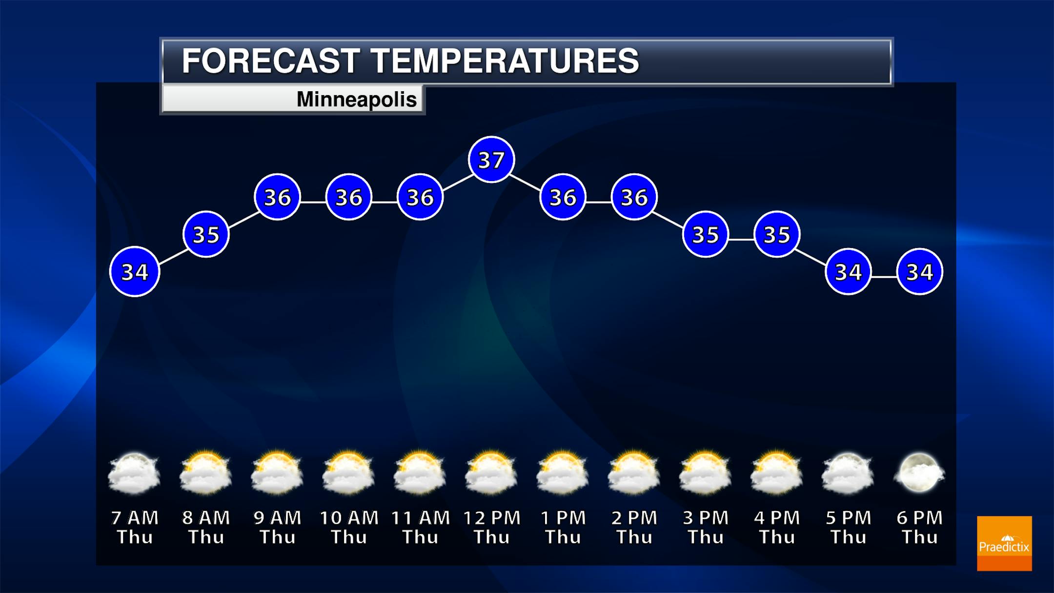
Besides our slight chance of some drizzle or freezing drizzle, we'll see mainly cloudy conditions for your Thanksgiving Day with temperatures somewhat steady in the mid-30s. Winds will make it feel slightly cooler than the air temperature.
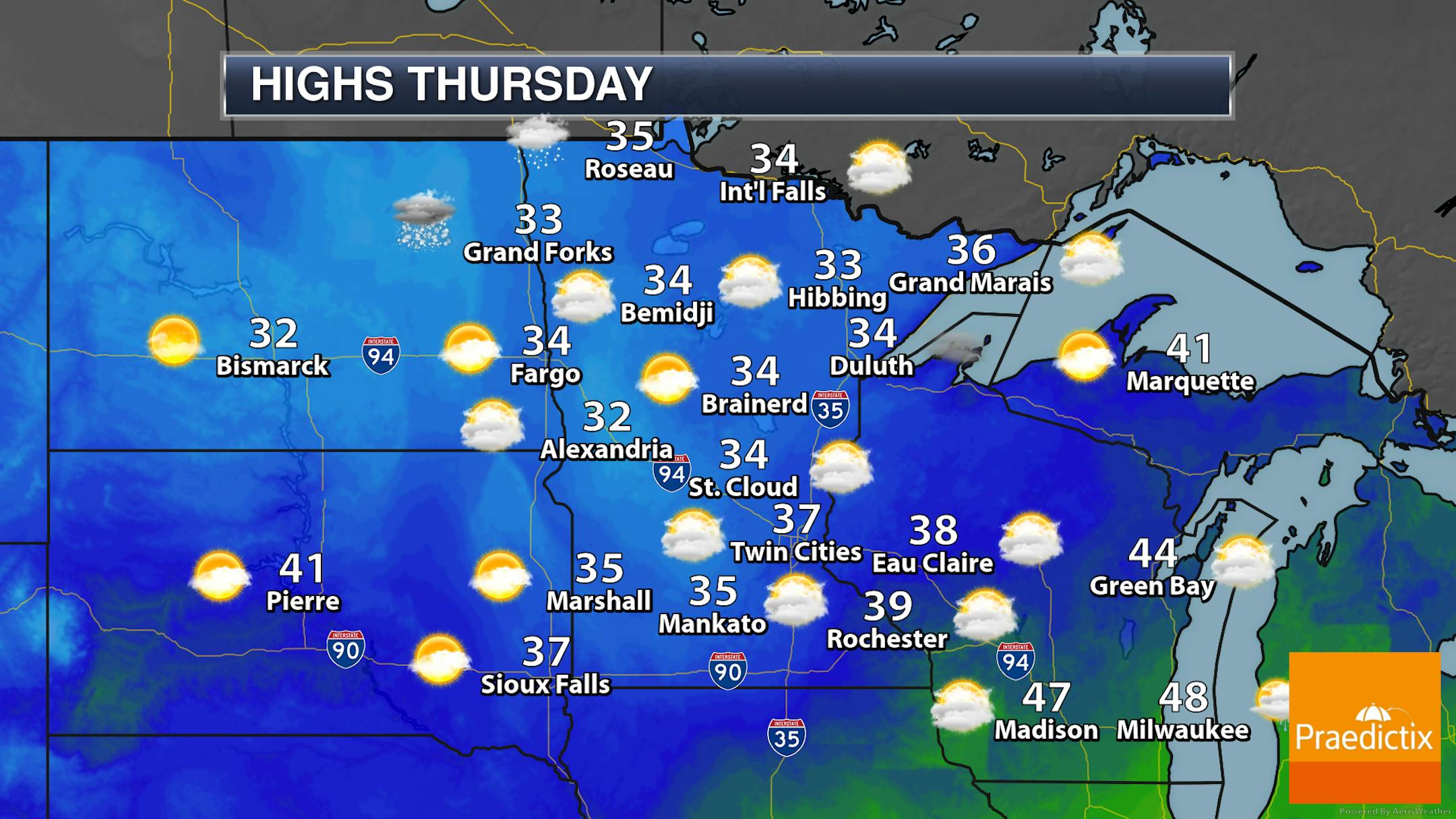
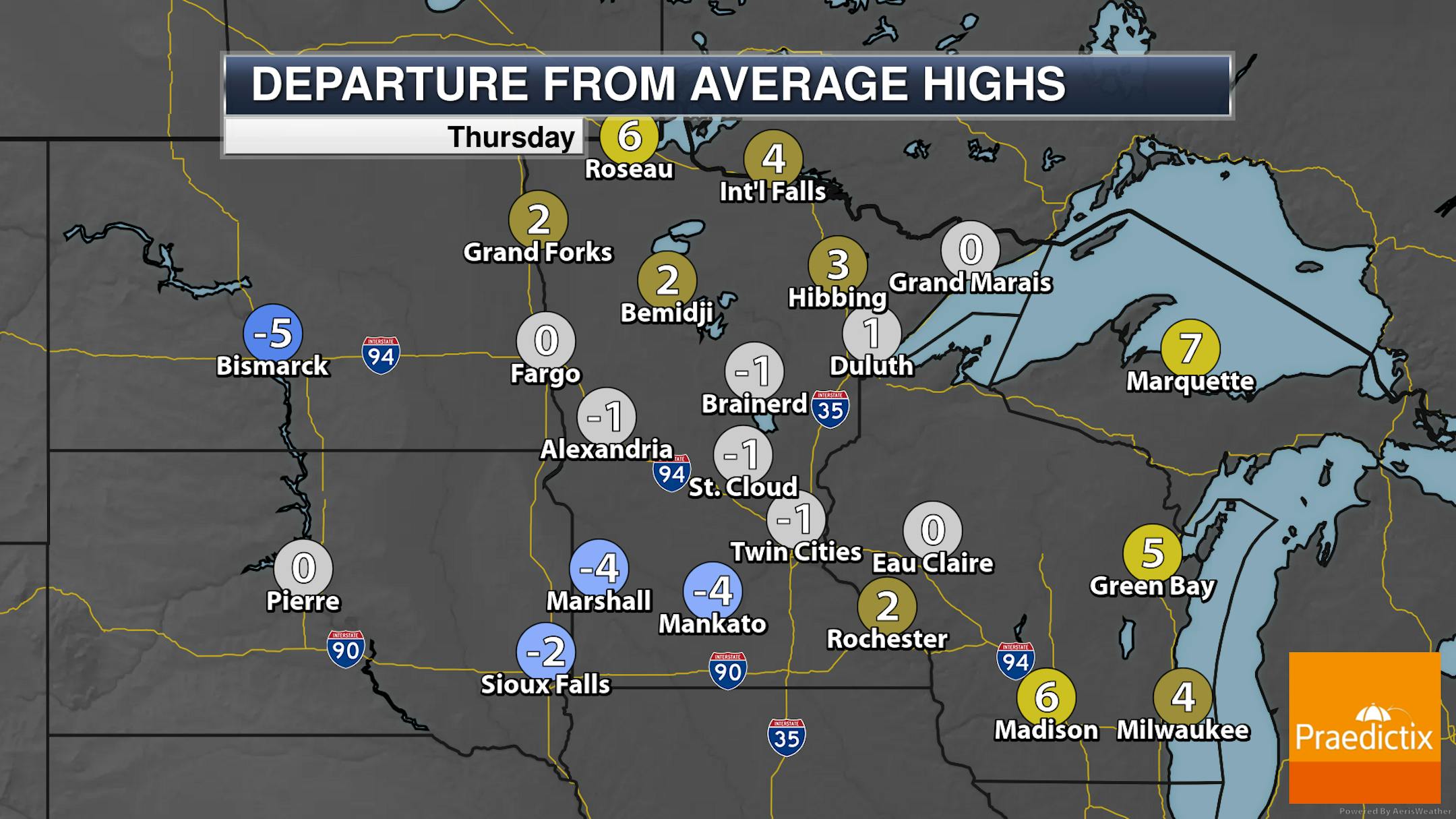
So across the state as you have your turkey dinner highs will top off in the 30s under those mostly cloudy skies with some drizzle/freezing drizzle/snowflake chances. These highs will be somewhat around average.
_______________________________________________
Quiet Black Friday And Extended Holiday Weekend

As we look ahead toward Black Friday and the extended holiday weekend - it looks quiet and dry! Highs will be in the 30s to low 40s, with the warmest day expected to occur on Saturday. Sunday looks to be the cloudier day of the three with a mix of clouds and sun. Mainly sunny skies will dominate the other two days.


