

Wet Week Of Weather
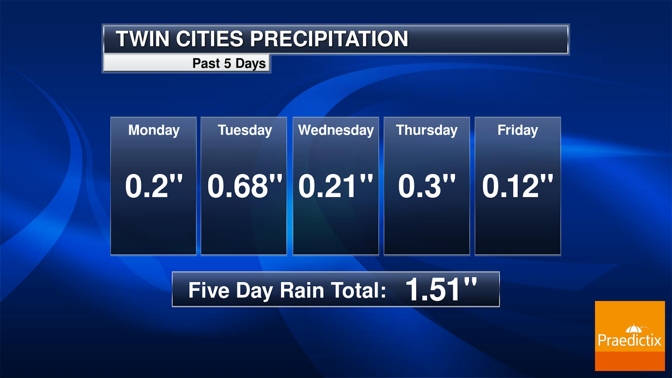
It's been a wet week of weather in the Twin Cities, with five straight days of accumulating rain - the most consecutive days with precipitation since October 2019. Overall through the work week we saw a total of 1.51" of rain fall in the Twin Cities. Tuesday saw the most with 0.68" of rain fall. Of course, we did see rain during the Twins game Thursday, causing a slight rain delay.
_______________________________________________
Record Rain Friday
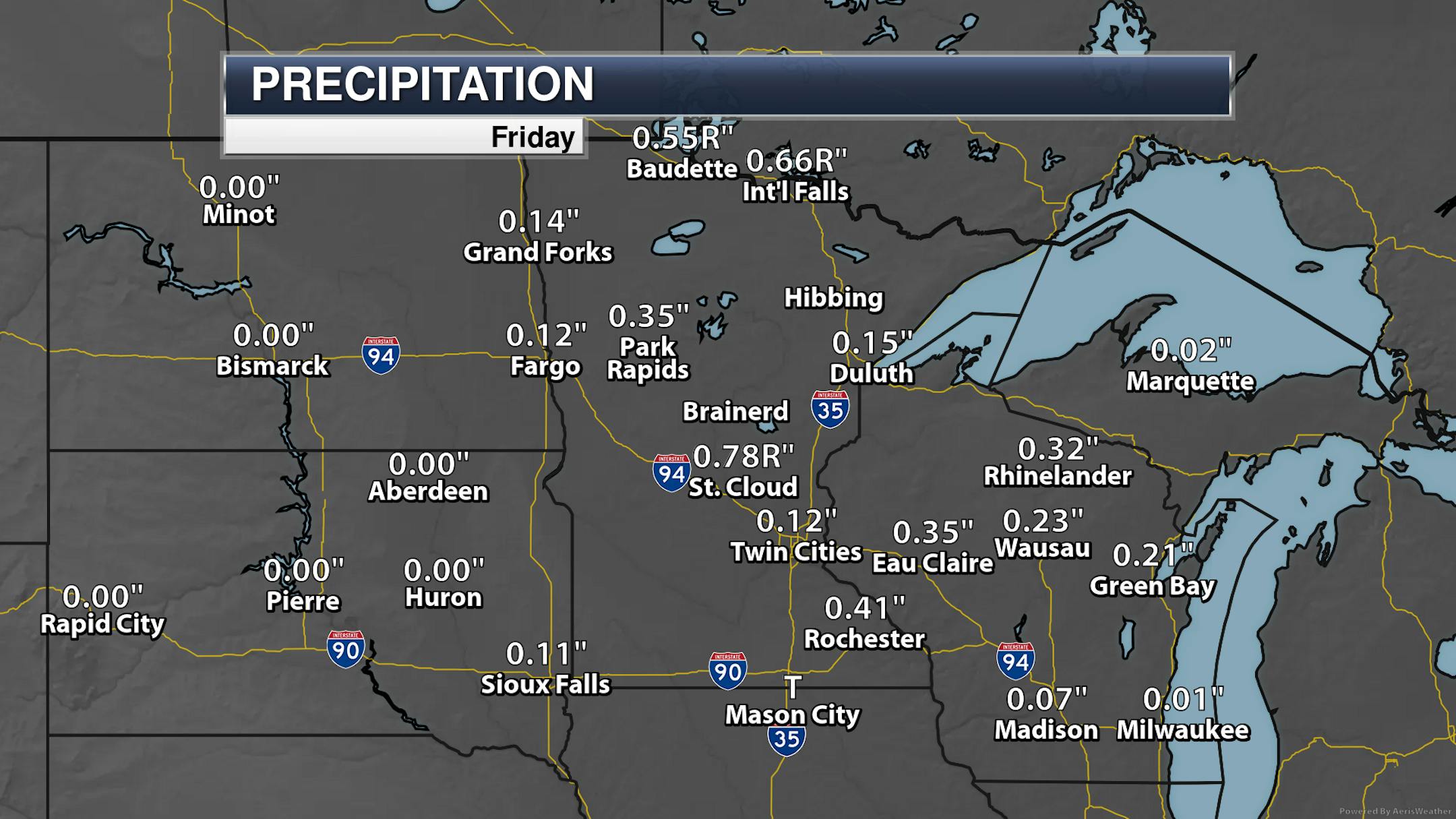
A lot of the rain on Friday was focused in on portions of central and northern Minnesota, with record rain observed in St. Cloud, International Falls, and Baudette.
_______________________________________________
April Precipitation So Far
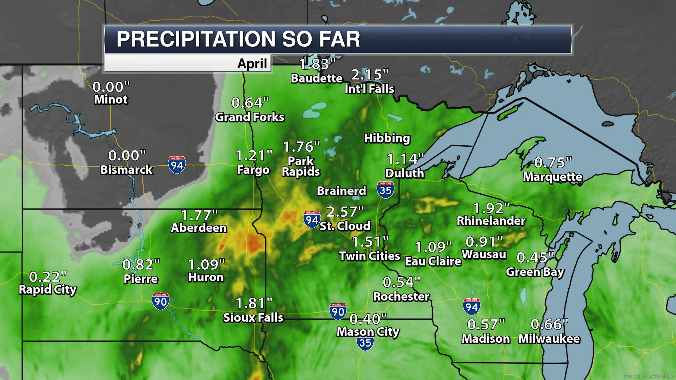
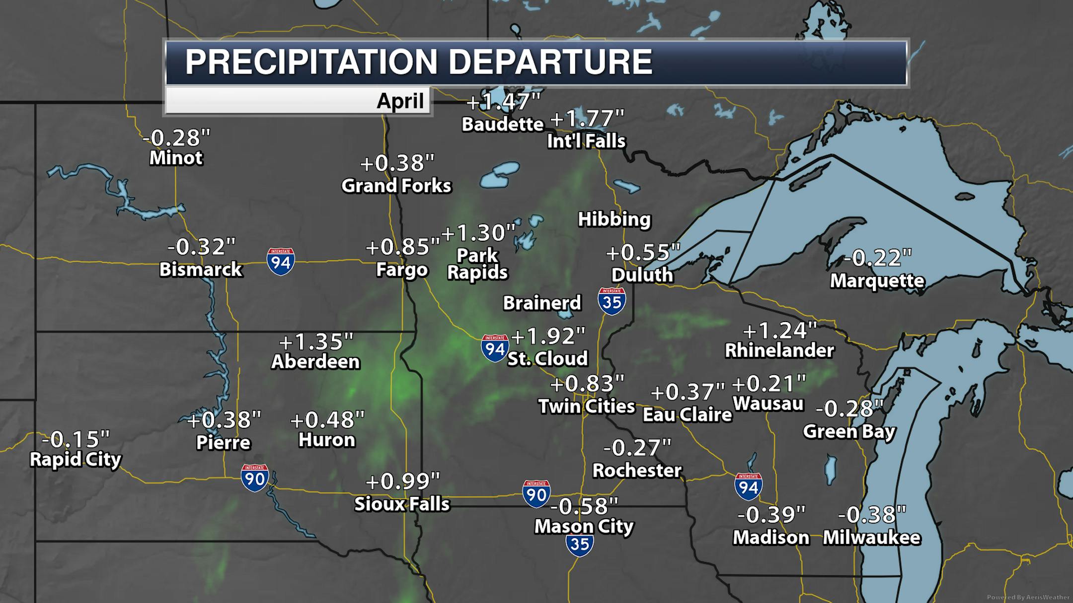
The saying goes that "April showers bring May flowers." Well, we should have a lot of flowers around come May with the rain that we've seen so far this month! Most climate sites across the state (except Rochester) are running above average precipitation-wise through Friday, with St. Cloud almost two inches above average. No wonder lawns are quickly greening up out there!
_______________________________________________
Warmest Start To April On Record
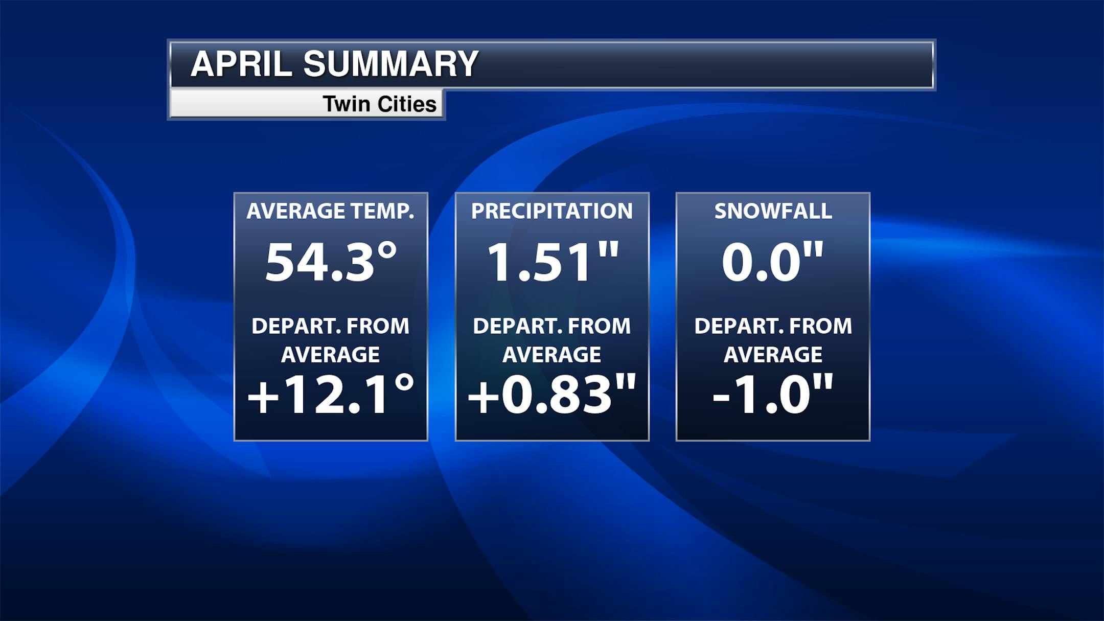
Meanwhile, due to the warm weather we've seen this month - including the record high of 85F from Monday - we sit atop the list for the warmest start to April on record (through the first nine days of the month). Our average temperature of 54.3F just narrowly beats out the 54.2F back in 1910. Precipitation-wise, we sit at the 9th wettest start to April through the same time period. The wettest first nine days of the month was back in 2006 when 3.64" of precipitation fell.
_______________________________________________


