
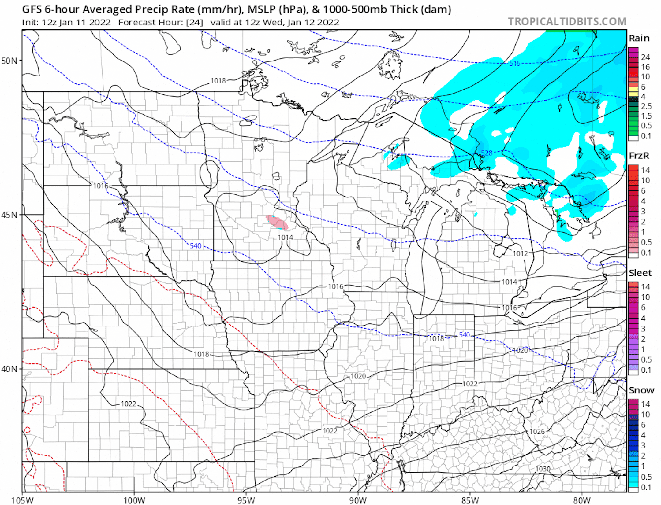
Increasing Snow Potential Friday
Active weather in the Pacific Northwest will lead to snowfall potential closer to home on Friday. It is still too early to tell where the heaviest snow will set up, but over the last few days we've seen a trend shifting west. Stay tuned...
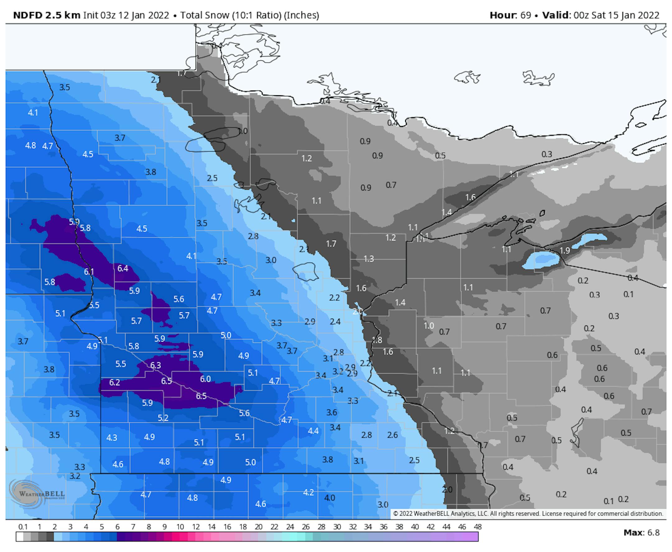
Snowfall Potential Through PM Friday
Here's NOAA's NDFD snowfall potential through PM Friday. Latest model runs are showing a fairly heavy band of snow across western MN and the eastern Dakotas with some plowable amounts. The Twin Cities could see some snow, but at this point, it looks a little lighter.
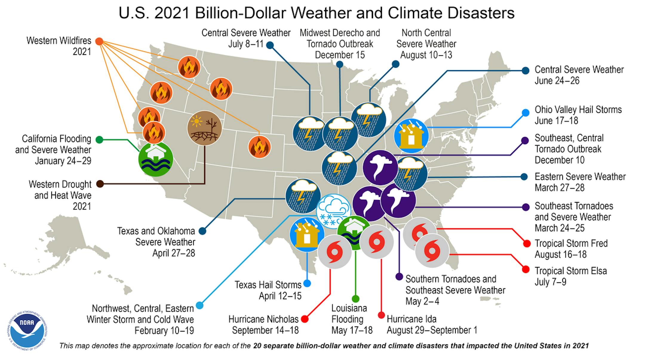
Assessing the U.S. Climate in 2021
"Contiguous U.S. ranked fourth warmest during 2021; 20 billion-dollar disasters identified. For 2021, the average contiguous U.S. temperature was 54.5°F, 2.5°F above the 20th-century average and ranked as the fourth-warmest year in the 127-year period of record. The six warmest years on record have all occurred since 2012. The December contiguous U.S. temperature was 39.3°F, 6.7°F above average and exceeded the previous record set in December 2015. There were 20 separate billion-dollar weather and climate disasters in 2021, just two events shy of the record set in 2020. These events caused at least 688 fatalities and scores more injured. Two disasters occurred in December — the Southeast, Central Tornado Outbreak and the Midwest Derecho and Tornado Outbreak. The annual precipitation total for the contiguous U.S. was 30.48 inches, 0.54 inch above average, ranking in the middle third of the historical record. Despite near-normal precipitation at the national scale, 2021 witnessed several significant events at the regional scale, including an above-average monsoon season across the Southwest and several atmospheric river events along the Pacific Coast. Drought remained extensive across much of the western U.S. throughout 2021."
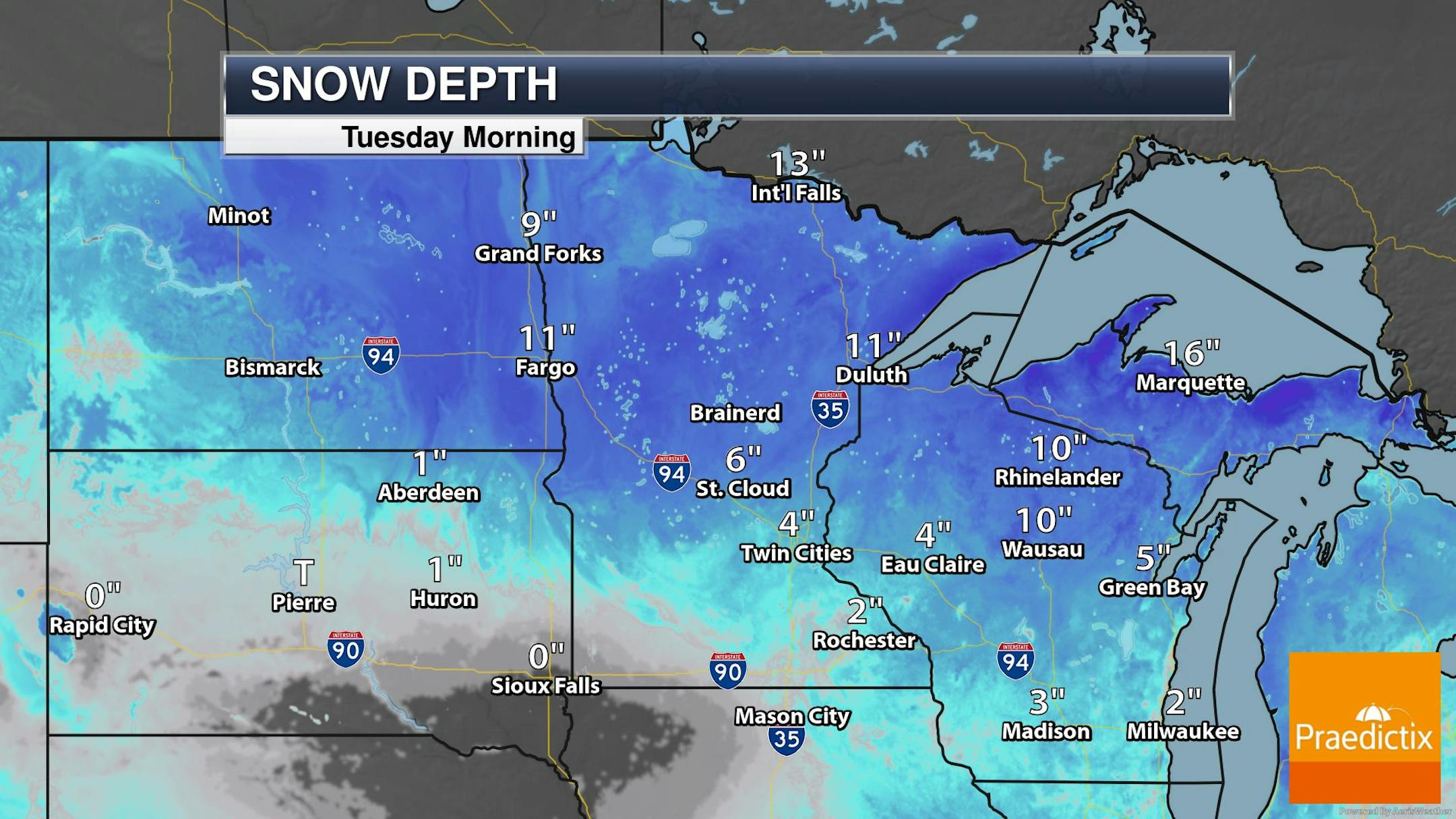
Snow Depth
The latest snow depth reports show a fairly decent base across the region. The Metro was reporting around 4", but has you head north, there are some double digit reports. According to the MN DNR Snowmobile and cross-country ski trails are generally reported to be in good to very good conditions across the northern half of the state. Trails in the southern half of the state are reported to poor condition with little to now snow on the ground there.
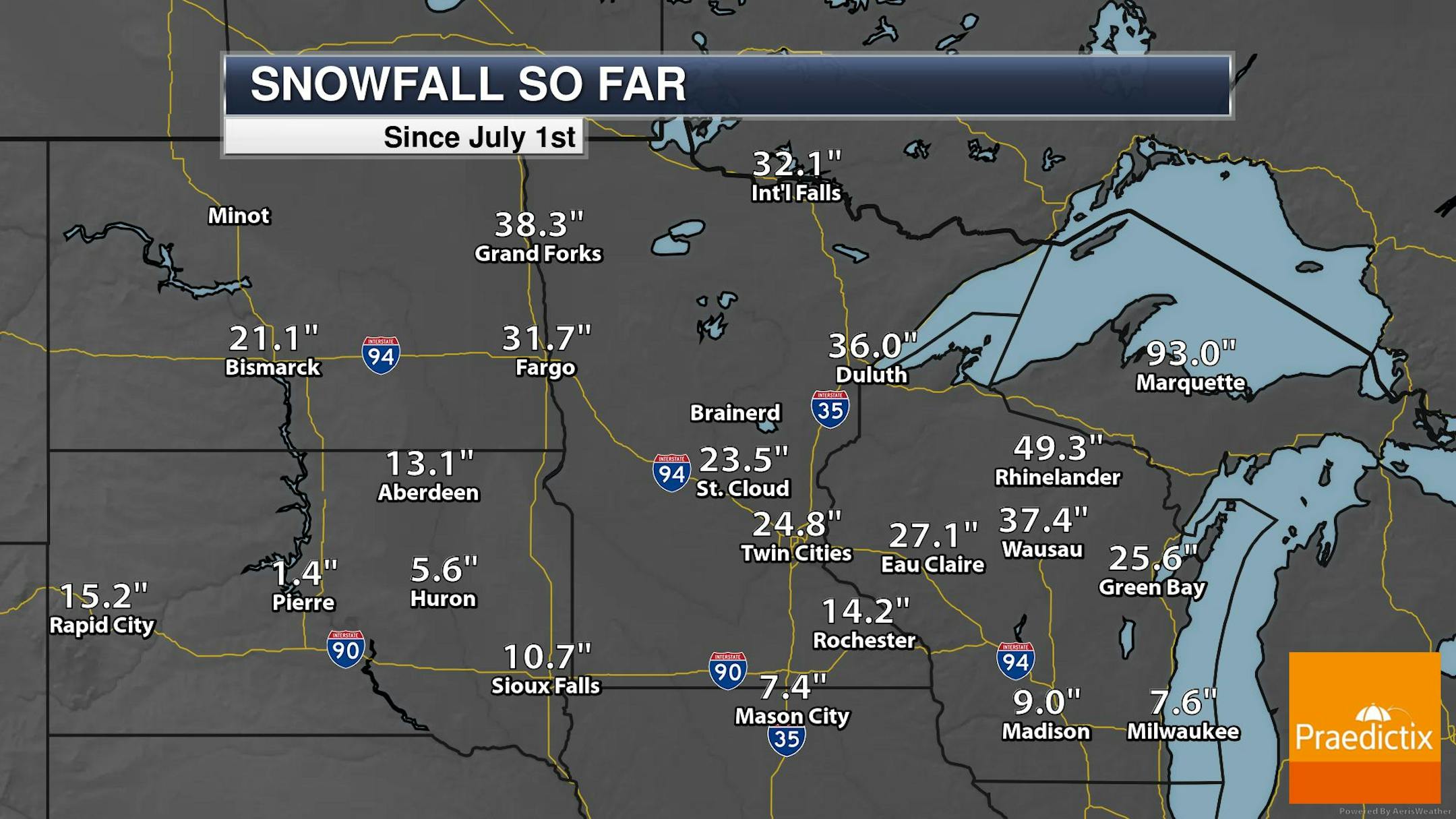
Seasonal Snowfall So Far
Here's a look at how much snow we've seen so far this season. Note the Twin Cities has seen nearly 25", which is nearly +3.0" above average. Grand Forks, ND has seen nearly 40" of snow, which is more than 1ft above average! Heading south into South Dakota, many locations there are below average and more than 1ft below average in Pierre and Huron.
Warmer End of Week, Then Chillier Weekend
Here's the 850mb temp anomaly through the weekend. Note that temps will be 'warmer' through the second half of the week, but will be a bit cooler over the weekend.


