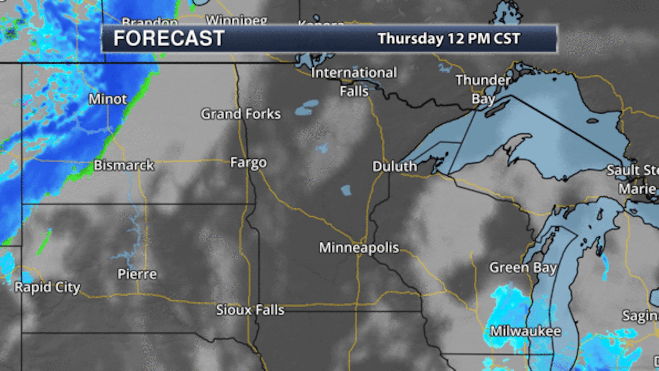
Chilly But Sunnier Thursday

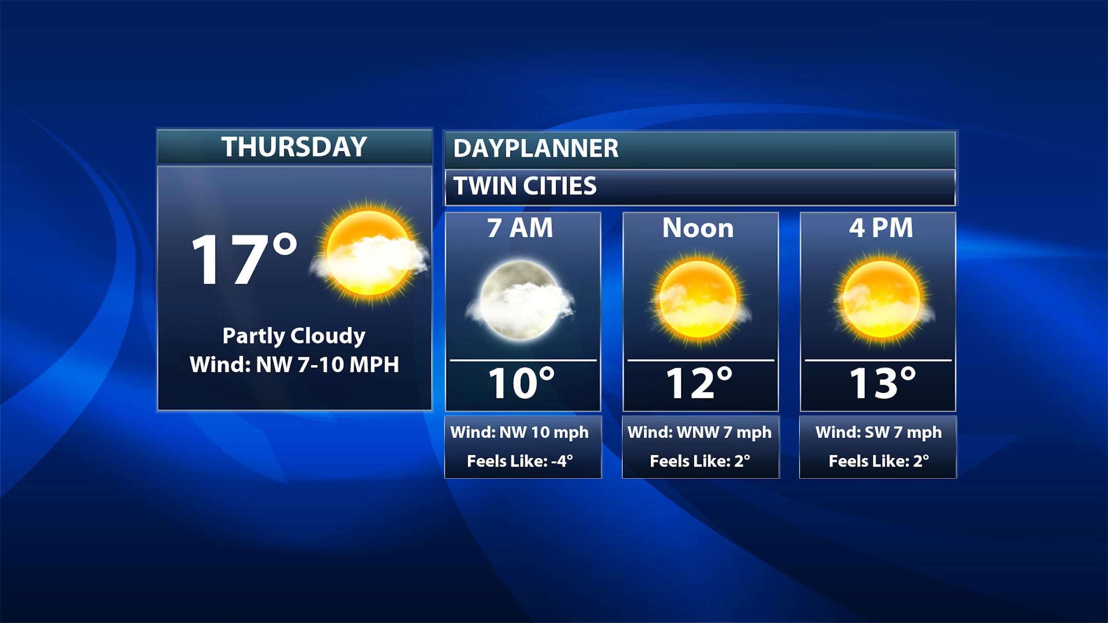
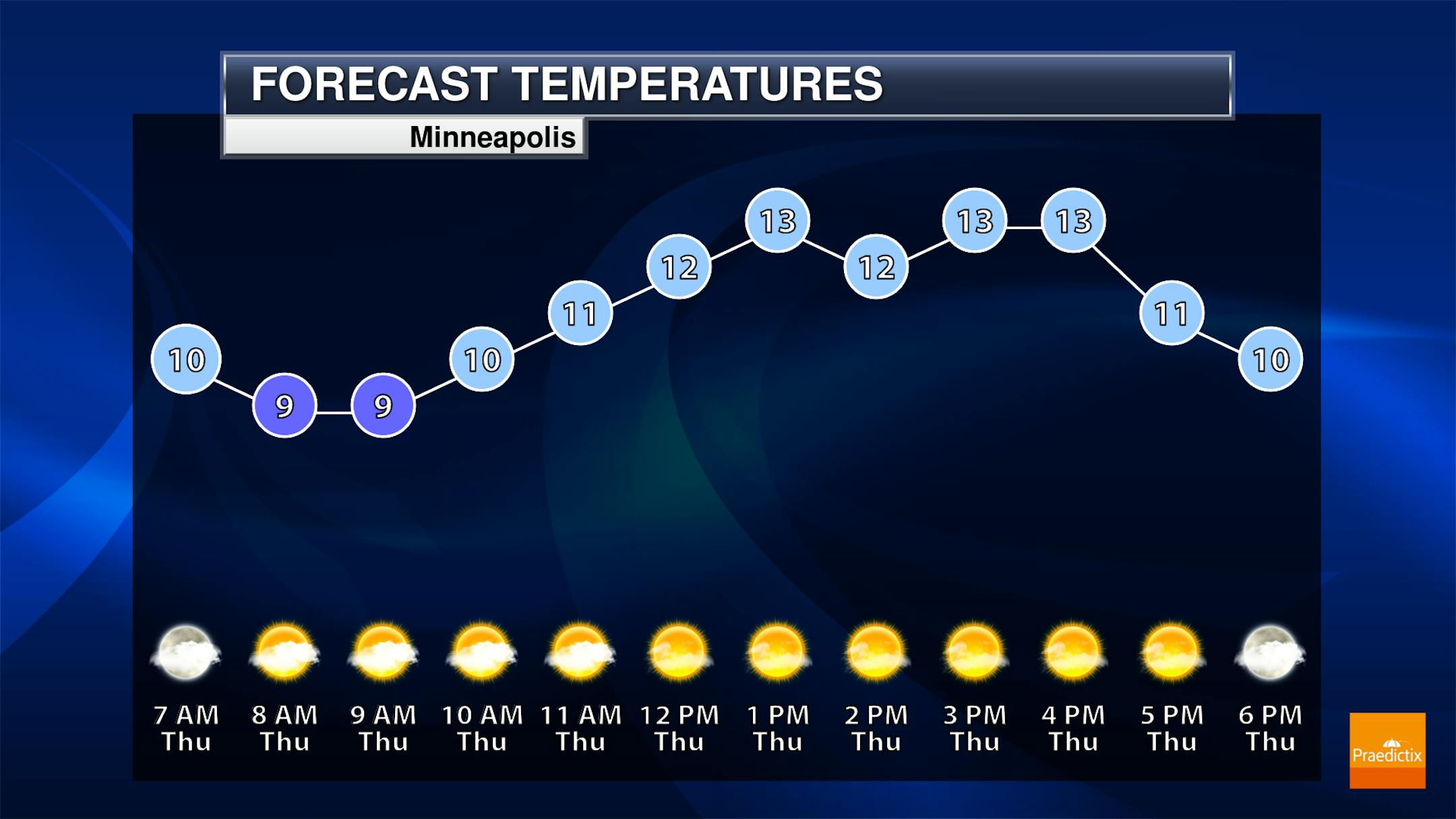
As we head into Thursday, you may look up into the sky and wonder what that bright orb up there is. It's the sun... and we'll see mainly sunny skies in the metro on Thursday with increasing clouds into the evening ahead of a clipper system. Temperatures will be in the upper single digits to low teens through the daytime hours, but they will start to rise into the overnight hours with that clipper moving in.

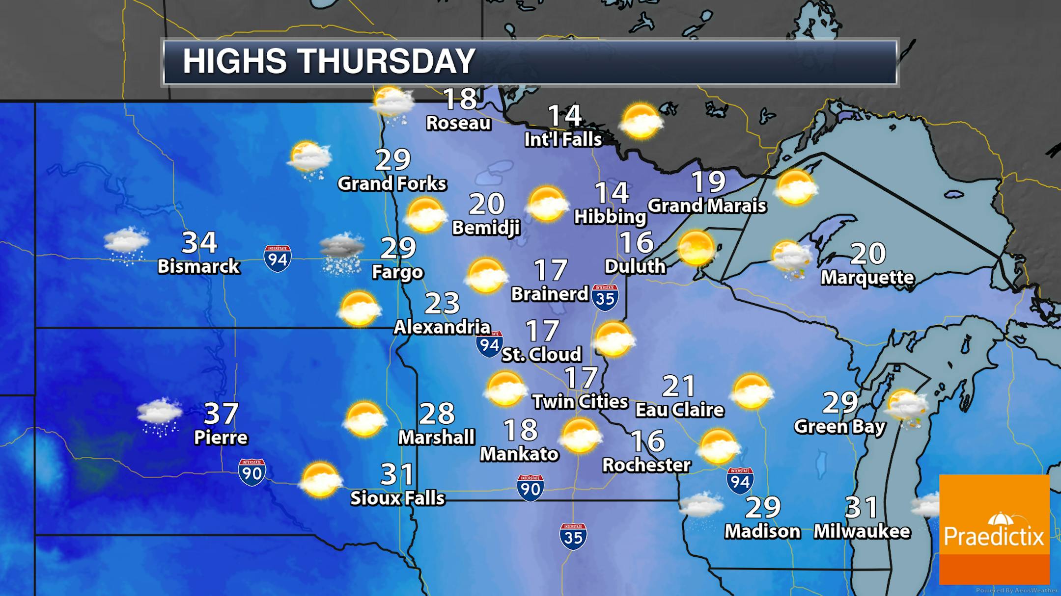
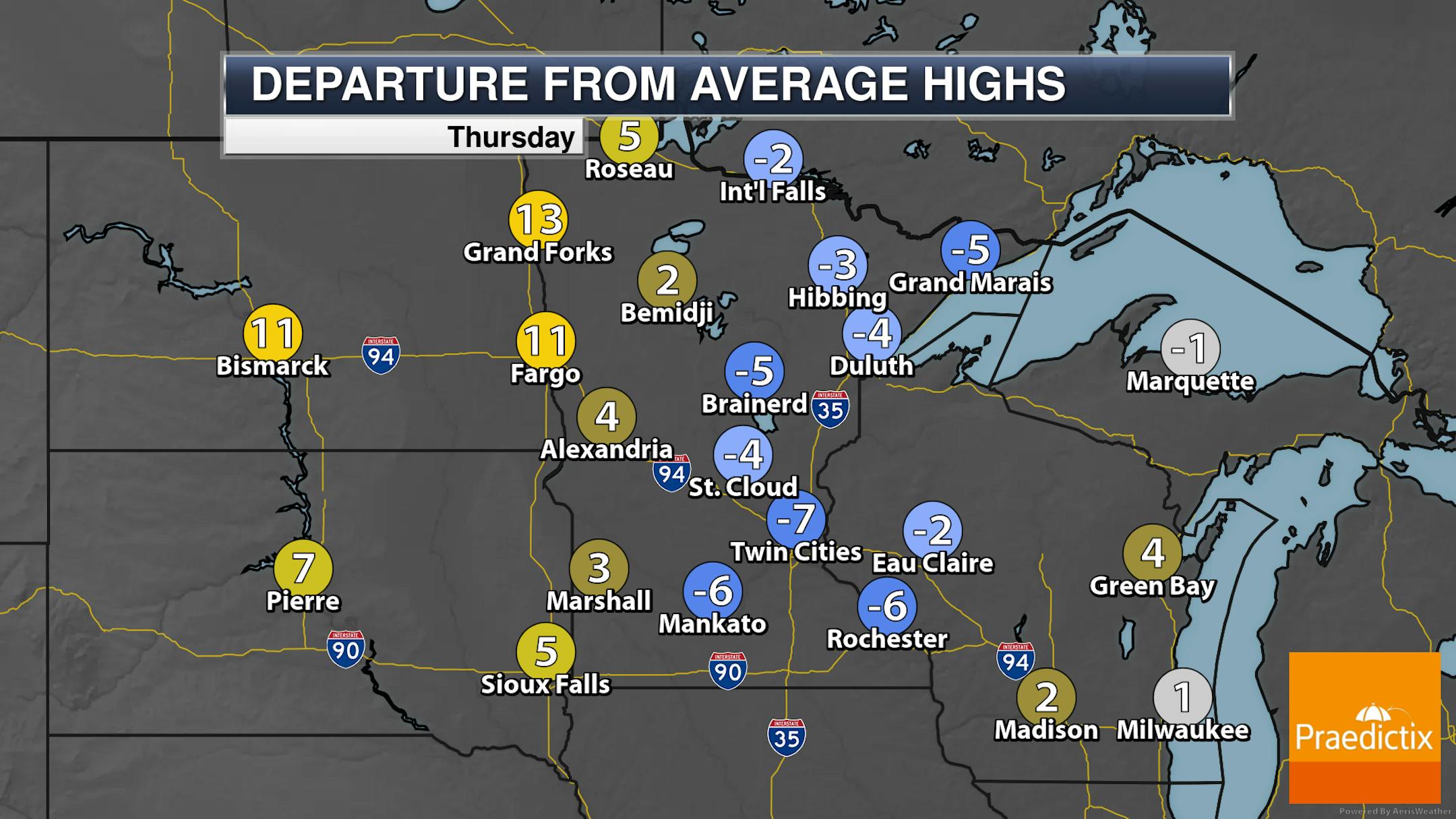
Statewide, highs will range from the 20s out in western Minnesota to the teens farther east during the daytime hours on Thursday, with warming temperatures into the overnight hours ahead of a fast-moving clipper that'll start impacting parts of northwestern Minnesota during the afternoon.

_______________________________________________

Clipper Thursday Night Into Friday Morning

As mentioned above, we will be tracking a more progressive and quick-hitting band of snow moving across the state late Thursday into early Friday that could bring another 1-3" of snow along with it - this time in a 6-12 hour period. Breezy winds along with this system could cause some blowing and drifting snow.

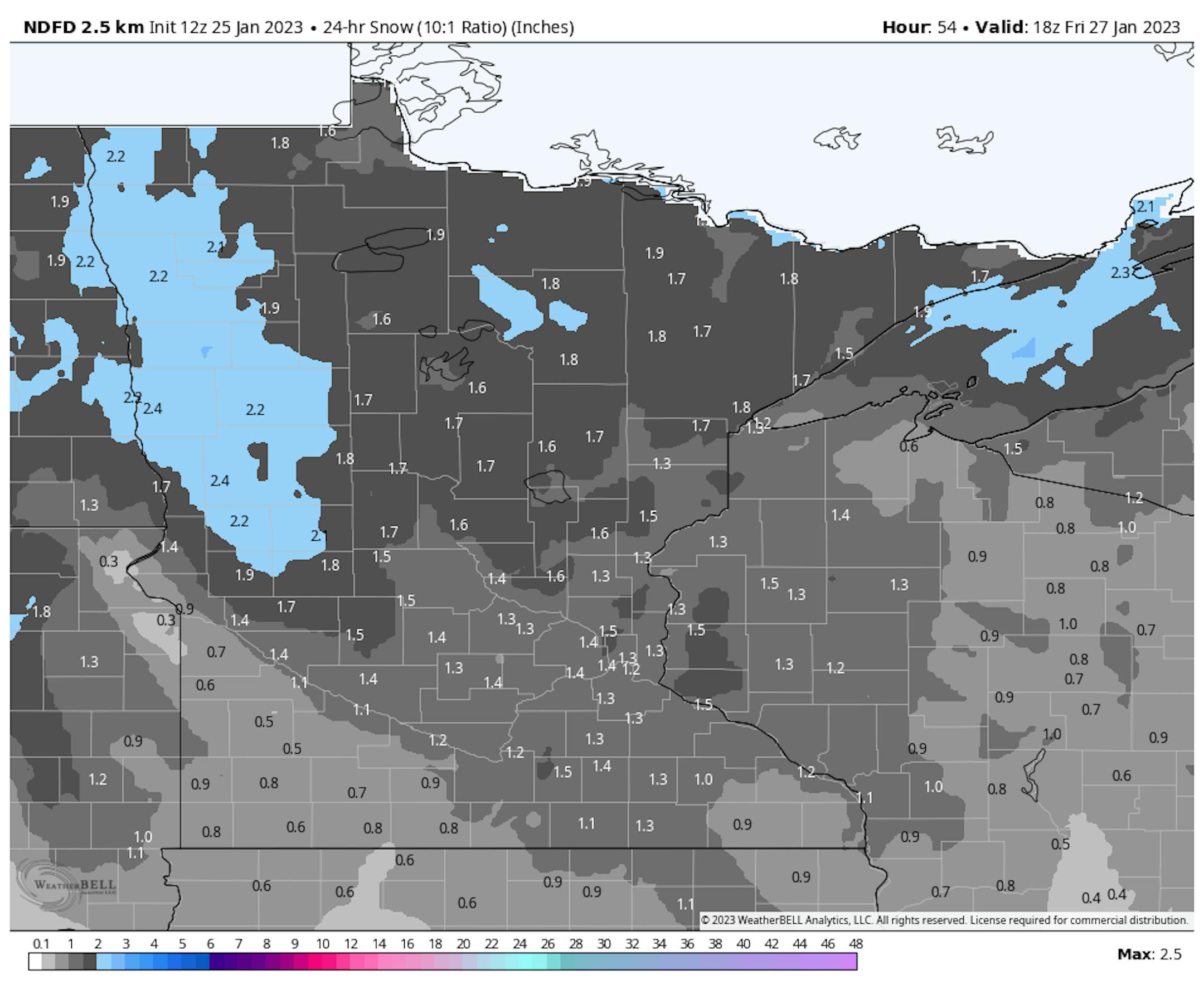
As this clipper quickly moves across the state late Thursday into early Friday, a widespread 1-3" of snow can be expected. A lot of this will fall within about a 6-hour period - in western Minnesota between 6 PM and Midnight Thursday Night, and in eastern Minnesota between Midnight and 6 AM Friday morning.

_______________________________________________

Colder Temperatures Incoming

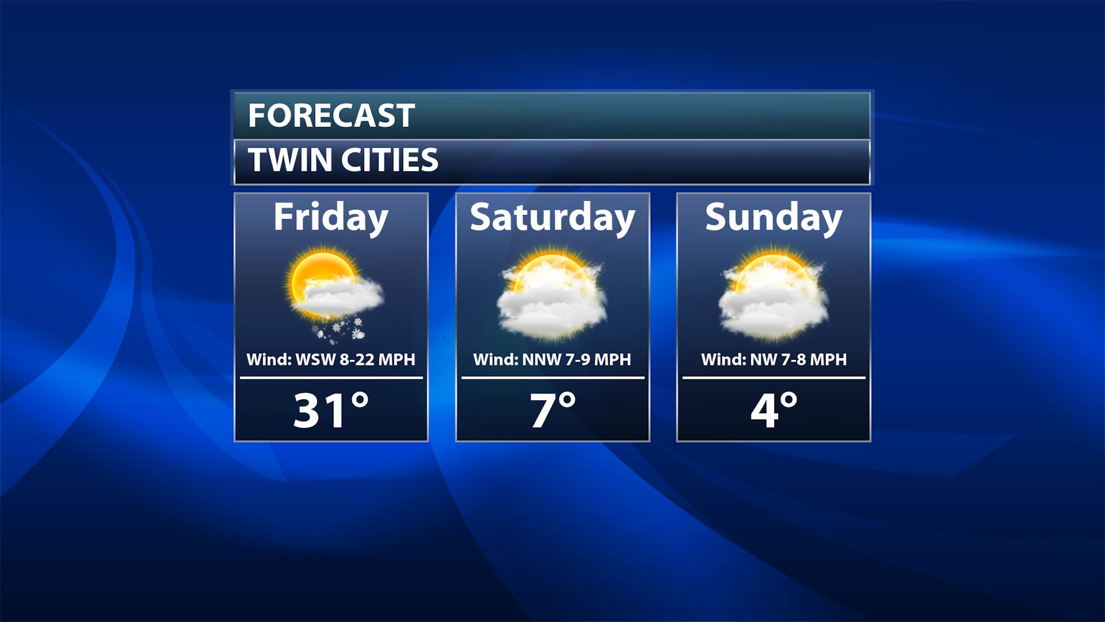
Heads up - colder weather is incoming in time for the weekend and Hockey Day Minnesota. That high around 30F on Friday will be during the morning hours, with falling temperatures expected by the afternoon hours with breezy northwest winds (gusts to 35 mph). Highs will only be in the single digits as we head into the weekend, and with winds at 5-10 mph, it'll continue to feel like it's subzero during the daytime hours.

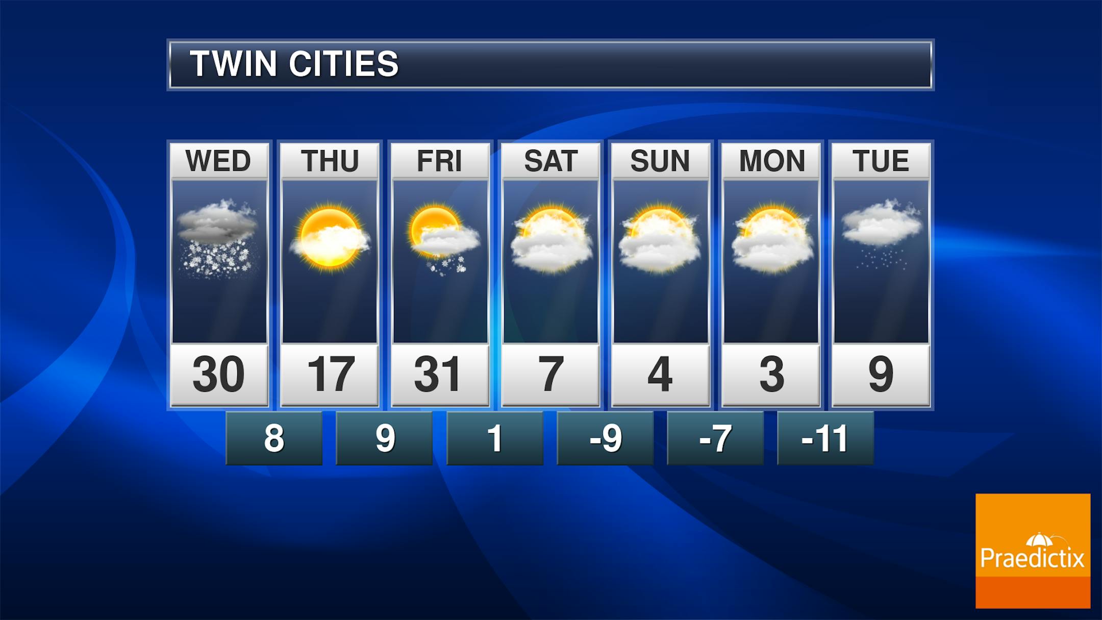
And the cold weather will continue through next week here in the metro, with highs in the single digits and lows below zero. The "best" chance of snow after Thursday Night's clipper here in the metro may end up being Tuesday Night; otherwise, it should be mostly quiet to begin next week.

_______________________________________________

Another Snowy Clipper Tonight, Then Temps Tumble
By D.J. Kayser, filling in for Paul Douglas

Despite all the snow we've seen so far this winter, we've had it somewhat easier in the temperature department. While December was 4F degrees below average, so far this month we are 7.5F degrees above the norm. According to the National Weather Service, we have spent 16% less than normal heating our homes this month, but we are within 5% of average since December 1st.

That above-average overall temperature for the month will take a hit as we head into the last few days of January. Behind Wednesday's light snow, highs will barely make it to the teens today. Another clipper brings 1-3" of snow tonight into Friday morning along with gusty winds and a real push of Arctic air into the region. Highs through the weekend and much of next week will be in the single digits, but it'll feel like it's subzero during the daytime hours.

This cold blast will also usher in a stretch of subzero lows. We've only had six subzero lows so far this winter. Over the past 30 winters - through January 25th - we have typically seen 12 such nights.

_______________________________________________

D.J.'s Extended Twin Cities Forecast

THURSDAY: Sunny daytime skies. 1-3" snow tonight. Wake up 9. High 12. Chance of precipitation 90%. Wind SW 5-10 mph.

FRIDAY: AM snow. Breezy. Waking up near the high of 29, with PM dropping temperatures. Chance of precipitation 40%. Wind NW 15-30 mph.

SATURDAY: Colder. Snow slides across southern MN. Wake up 0. High 8. Chance of precipitation 20%. Wind NW 5-10 mph.

SUNDAY: Chilly sunshine. Overnight light snow? Wake up -8. High 4. Chance of precipitation 20%. Wind NW 5-10 mph.

MONDAY: Frigid. Decreasing clouds. Wake up -9. High 2. Chance of precipitation 0%. Wind NW 5-10 mph.

TUESDAY: Clouds return. Overnight snow chance. Wake up -12. High 6. Chance of precipitation 20%. Wind SW 5-10 mph.

WEDNESDAY: Sunnier. Still cold to begin February. Wake up -7. High 7. Chance of precipitation 10%. Wind W 5-15 mph.

_______________________________________________

Minneapolis Weather Almanac And Sun Data
January 26th

*Length Of Day: 9 hours, 33 minutes, and 2 seconds
*Daylight GAINED Since Yesterday: 2 minutes and 20 seconds

*When do we see 10 Hours of Daylight?: February 6th (10 hours, 1 minute, 13 seconds)
*When is Sunrise at/before 7:30 AM?: February 3rd (7:30 AM)
*When is Sunset at/after 5:30 PM?: February 8th (5:30 PM)

_______________________________________________

This Day in Weather History
January 26th

1916: A severe ice storm hits Mower County. Hundreds of birds were killed.

_______________________________________________

National Weather Forecast

On Thursday, what is left of the system that has been impacting the southern U.S. and Ohio Valley earlier in the week will continue to bring snow and ice concerns to New England. Meanwhile, we're tracking two clipper systems - one impacting the Ohio Valley and another moving into the Northern Plains and Upper Midwest.

Heavy snow will continue into New England on Thursday, with over a foot total possible for parts of Maine. Meanwhile, heavy snow will also be possible in the northern Rockies, with over a foot for higher elevations.

_______________________________________________

Moon near Jupiter January 25 and 26

More from EarthSky: "You can't miss Jupiter near the moon on the evenings of January 25 and 26, 2023! Jupiter is the largest planet in our solar system. It reached opposition – when Earth flew between Jupiter and the sun – on last September 26. While it's not as bright now as it was then, it still outshines the brightest stars at -2.1 magnitude. Both the moon and Jupiter are in the constellation Pisces the Fish. But you'll need a dark sky to see the faint stars of Pisces."

Report forecasts clean-energy boost from turning cornfields into solar power fields

More from the Wisconsin Examiner: "About 1 million acres of Wisconsin farmland produces corn for ethanol fuel, but an environmental group says the land could produce 100 times as much energy if planted with solar farms instead. In addition, it would take less than one-third of the land currently used for ethanol corn to house enough solar generation to eliminate carbon-based energy in the state by 2050, according to Clean Wisconsin. The organization released a report Tuesday comparing the efficiency of using farmland to grow corn for ethanol with using it for solar power. "There is a concern that we're going to take too much farmland out of production to put on solar panels," said Paul Mathewson, Clean Wisconsin's science program director, in the organization's press announcement. "But we're already using a lot of land to primarily harvest energy in the form of corn made into ethanol. This analysis demonstrates how, with solar, we can harvest more energy using far less land.""

Proactive offshore wind transmission planning could save billions, report finds

More from Renewable Energy World: "The U.S. has ambitious goals to generate clean energy from offshore wind farms. But inadequate or non-existent transmission infrastructure remains a well-known hurdle to achieving those targets. Proactive and collaborative transmission planning to support offshore wind development in the coming decades could save at least $20 billion and reduce environmental and community impacts by 50%, according to a new report conducted by the Brattle Group on behalf of clean energy advocacy organizations."

_______________________________________________

Follow me on:

Thanks for checking in and have a great day!

- D.J. Kayser