
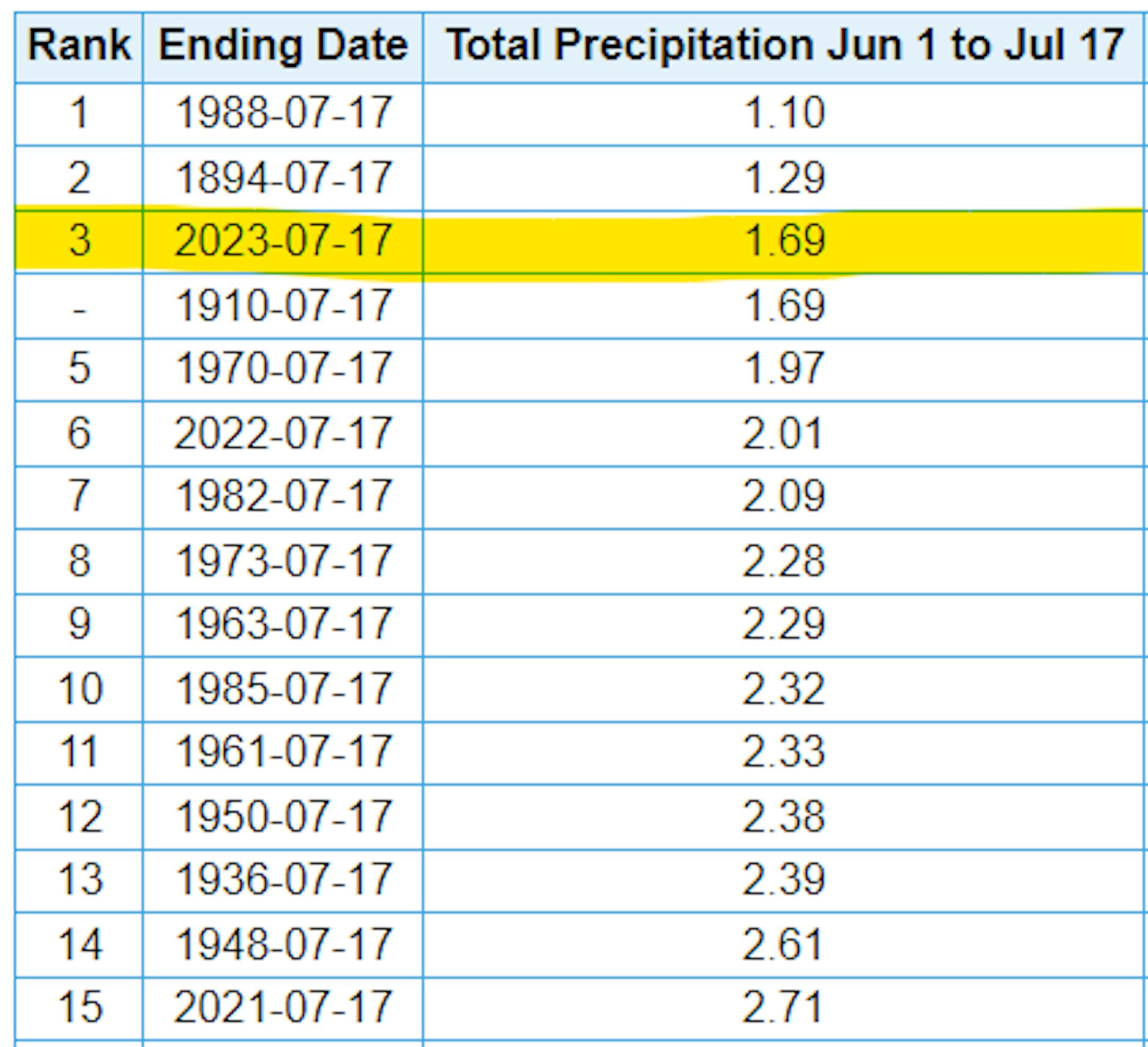
3rd Driest Summer Halfway Point For MSP
The stretch from June 1st to August 30th is known as meteorological summer, which is typically the warmest 3 months on average for the northern hemisphere. This is also the wettest season of the year, averaging nearly 13" of rain. We've now just passed the halfway point of meteorological summer and we've only picked up 1.69" of rain at the MSP Airport, which is tied for the 3rd driest start to any summer on record. The driest such period was back in 1988, when only 1.10" of rain fell.
60 Day Precipitation Anomaly
The map below shows the 60 day precipitation anomaly, which indicates that some locations are nearly -3.00" to nearly -7.00" below average (in red/pink) since mid May. Spots in Southwestern and northwestern Minnesota still have a bit of a surplus, but much of the region is well below average precipitation.

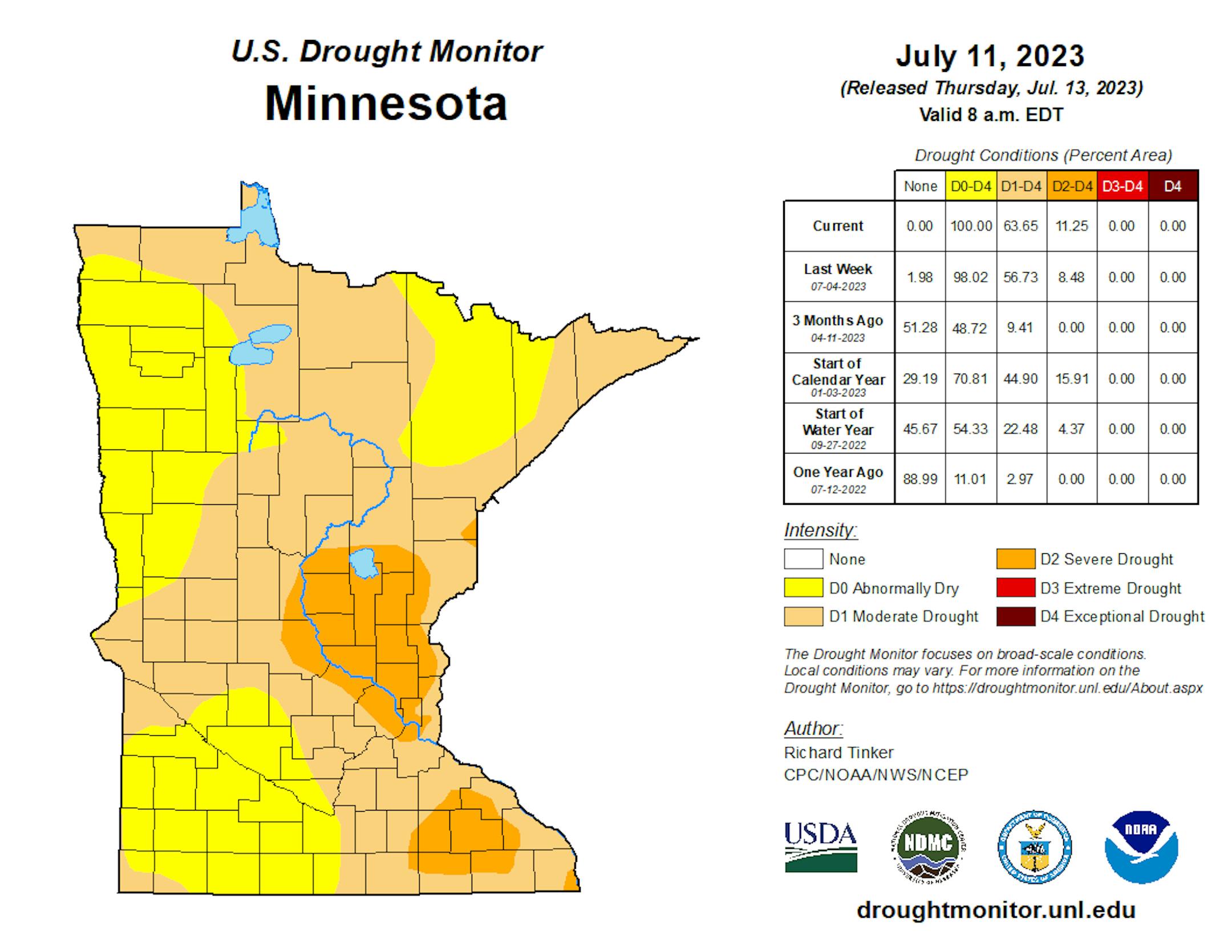
Drought Update
It has been an extremely dry stretch of weather across much of the station over the last several weeks. Only a few locations have seen decent pockets of rain, but the drought is expanding. Severe drought conditions have expanded from nearly 8.5% last week to nearly 11% this week, which encompasses parts of the east Metro. Moderate drought increased from 57% last week to 64% this week. We need rain!
Extended Precipitation Outlook
The extended precipitation outlook through the upcoming weekend shows a few pockets of heavier rain, mainly across the northern half of the state. Folks across the southern half of the state will stay mainly dry with only a few tenths of an inch of rain here and there.

Severe Risk on Wednesday
According to NOAA's SPC, there is an isolated risk of strong to severe thunderstorms across parts of Central and Southern Minnesota on Wednesday. A few storms later in the day could produce gusty winds and hail, which includes the Twin Cities.

Simulated Radar
The simulated radar from AM Tuesday to Wednesday Night sows another storm system moving through the region with a few showers and thunderstorms, mainly on Wednesday. Some of the storms could be a little on the strong side with gusty winds and hail possible. There could be a few pockets of heavier rainfall in some of the stronger storms, but beneficial rains won't be widespread.

Twin Cities Weather Outlook For Tuesday
The weather outlook for the Twin Cities on Tuesday, July 18th will be quiet and dry with temperatures warming into the lower 80s by the afternoon. Skies may still be a little hazy, but certainly not as hazy as it was over the weekend.

Meteograms For Minneapolis
The hourly temps through the day Tuesday shows temps starting around 60F in the morning and topping out in the lower 80s in the afternoon. Skies will be dry with a few clouds and a little bit of haze thanks to those Canadian wildfires. Southerly winds won't be strong as they were yesterday, but there could be a few 15mph gusts later in the day.


