"The top 10 weather and climate events of a record-setting year"
"In an all-around bizarre and largely unpleasant calendar year, extreme weather and climate-related changes contributed to the woes of 2020. Calendar year 2020 was an extreme and abnormal year, in so many ways. The global coronavirus pandemic altered people's lives around the world, as did extreme weather and climate events. Let's review the year's top 10 such events. 1. Hottest year on record? The official rankings will not be released until January 14, but according to NASA, Earth's average surface temperature in 2020 is likely to tie with 2016 for the hottest year on record, making the last seven years the seven hottest on record. Remarkably, the record warmth of 2020 occurred during a minimum in the solar cycle and in a year in which a moderate La Niña event formed. Surface cooling of the tropical Pacific during La Niña events typically causes a slight global cool-down, as does the minimum of the solar cycle, making it difficult to set all-time heat records. The record heat of 2020 in these circumstances is a demonstration of how powerful human causes of global warming have become."

Winter Storm Possible Tuesday - Wednesday
"Forecast trends continue to show the potential for accumulating snow and travel impacts next week starting Tuesday afternoon and lasting into Wednesday. The exact track is still unknown, but at this point there is a high potential for the southern half of Minnesota and Wisconsin to receive at least several inches of snowfall. Monitor forecast updates for refinements of snowfall amounts and timing over the next couple days."

Another Plowabe Snow Event Tuesday & Wednesday?
The weather forecast sill looks a bit snowy Tuesday into Wednesday, but latest model trends have the heaviest snow falling south of the Twin Cities. With that being said, most locations across the southern half of the state and into Wisconsin will have some shovelable / plowable snow amounts.

Snowfall Potential Through PM Friday
Here's the latest GFS & ECMWF snowfall potential. Again, it appears that the heaviest snowfall amounts are trending a little farther south than they were just a few days ago. However, most locations across the southern half of the state and into Wisconsin could see some shovelab / plowable snow. Stay tuned!


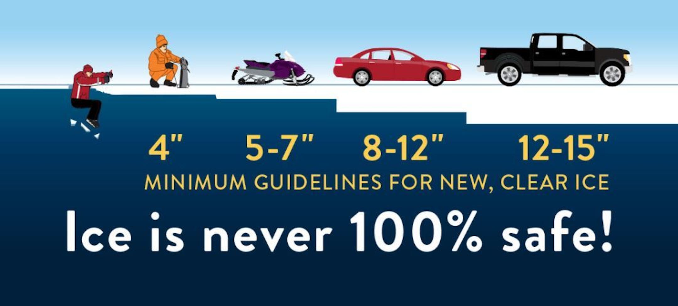
Ice Safety Guidelines
We're starting to see more folks venture out on frozen lakes and ponds, but keep in mind that that ice is never 100% safe!! You need at least 4" of ice to safely walk and close to a foot (12") to drive a small car on the ice. Stay safe out there!!