
September 10th: Peak of the Atlantic Hurricane Season
The Atlantic hurricane season runs from June 1st to November 30th, but did you know that the typical peak is September 10th? This is when the Atlantic Basin has had the most hurricanes and named storms since records began. This is also when weather conditions are at optimal levels for these types of storms.

Typical Tracks and Points of Origin
(September 11th - 20th)
Here's a map of all the tropical cyclone points of origin and their tracks from September 11th to the 20th from 1851 to 2015. As you can see, it has historically been a very active time period with tropical systems developing just about anywhere in the basin.

Hurricane Lee in the Atlantic
Here's a look at Hurricane Lee from Saturday, which was still a major storm with sustained winds exceeding 110mph. At one point early Friday morning, Lee was a major category 5 storm with sustained winds of 165mph and a central pressure down to 924mb.

Tracking Lee
According to NOAA's NHC, the track for Lee keeps it as a major hurricane through most of next week as it steers north and east of any major land masses in the Caribbean and the western Atlantic. However, we'll have to keep a close eye on Bermuda as Lee approaches the island next weekend. Stay tuned...

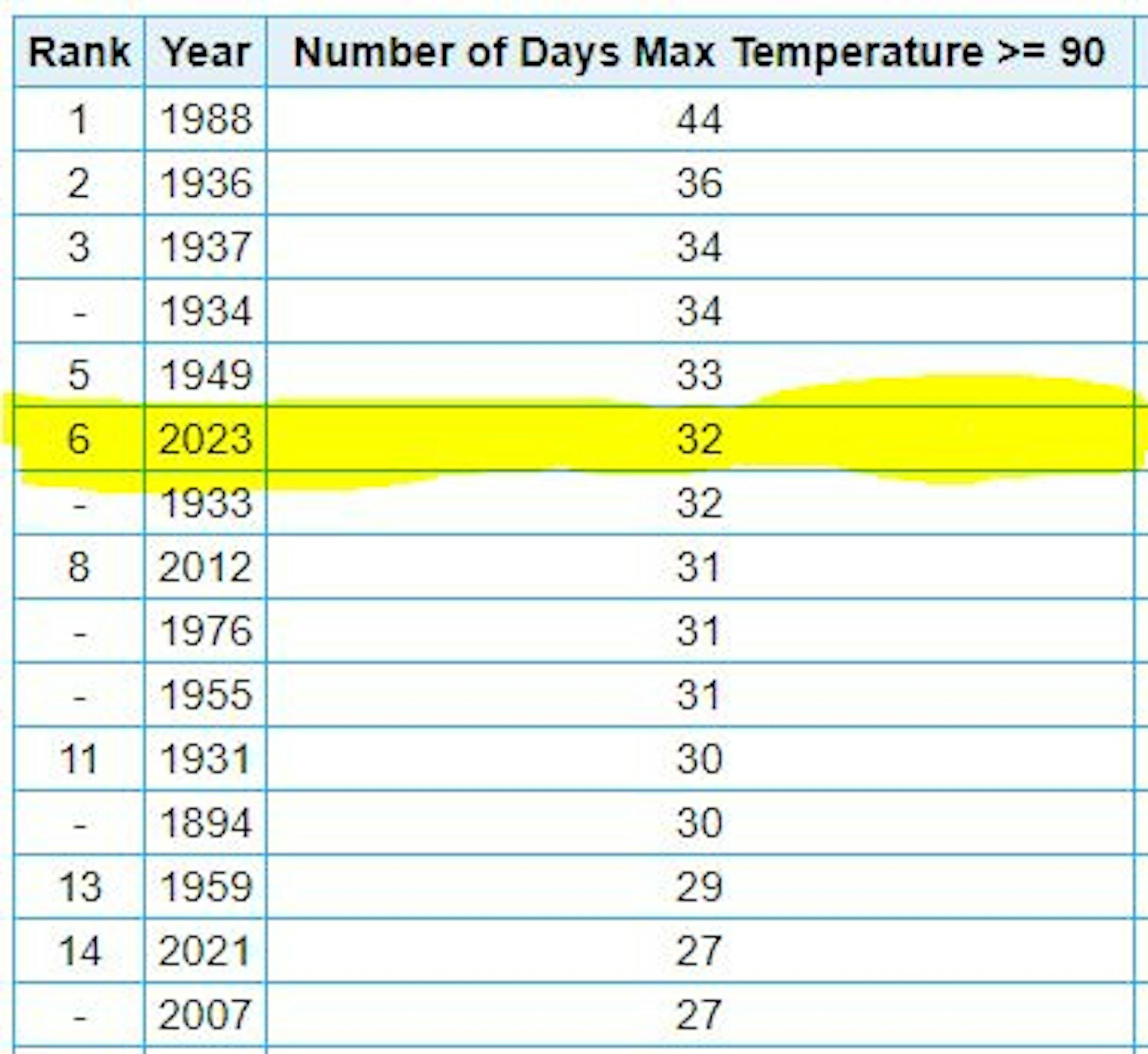
6th Most 90F Days on Record at MSP
It has been a hot summer with (32) days with highs at 90F degrees or warmer. This is the 6th most number of 90F degree days on record, the most recent being 1988 when there were 44 days.
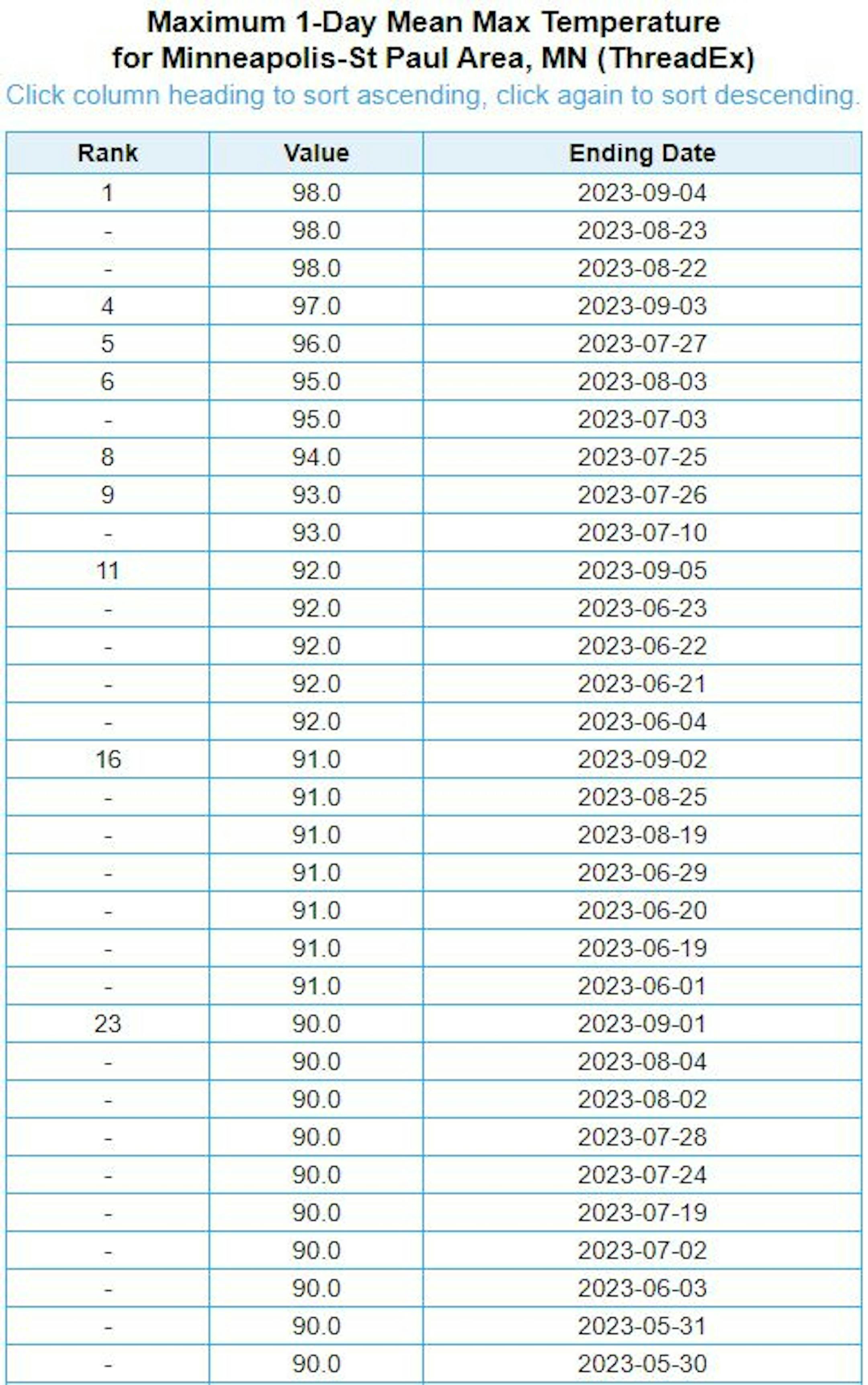
Number of 90F Days So Far This Year
Here's a list of all the 90F degree days that we've seen so far this year. The hottest days, were back to back on August 22nd and 23rd, when the MSP hit 98F and heat index values peaking around 110F to 120F around the metro. We also hit 98F on September 4th, but the dewpoint wasn't has high, so the heat index was an intense. Uffda!
Average Number of 90F Days At MSP
Looking at the last 30 years, the average number of 90F days at the MSP Airport is (14). July is the hottest month with an average of (6) 90F days. This year we've had (23) 90F days, last year we had (18) days in the 90s and in 2021 there were (27) days in the 90s. The most number of 90F days in any single year was (44) set in 1988.

90 Day Precipitation Anomaly
On average, the wettest time of the year is in the summer, with the months of June, July and August seeing nearly 13" of rain at the MSP Airport. If we take a look at the 90 day precipitation anomaly, which dates back to early June, some locations are nearly -3.00" to nearly -7.00" below average (in red/pink). Note that some locations across southeastern Minnesota are nearly -8.00" to -10.00" below average.


