
Pockets Of Extreme Drought
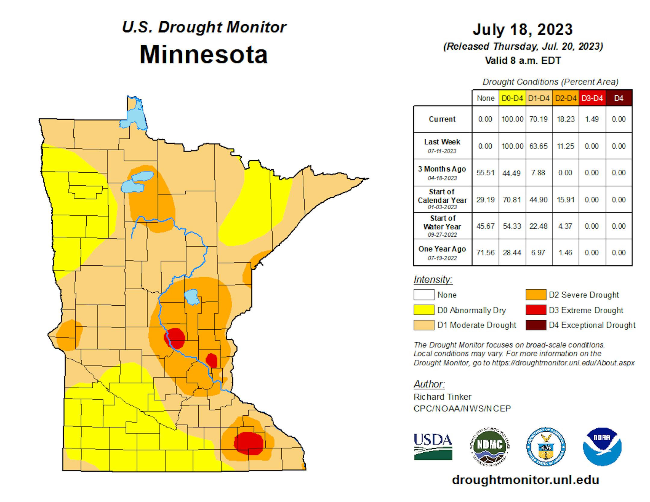
The latest Drought Monitor was released on Thursday, and the big story in this week's update was the introduction of three small areas of D3 (of 4) Extreme Drought, totaling 1.49% of the state. These three areas were centered around St. Cloud, the north metro (Andover and Ham Lake areas), and Rochester. We also saw new pockets of D2 Severe Drought in western and northern Minnesota, with an expansion of the area that was in place in eastern Minnesota.
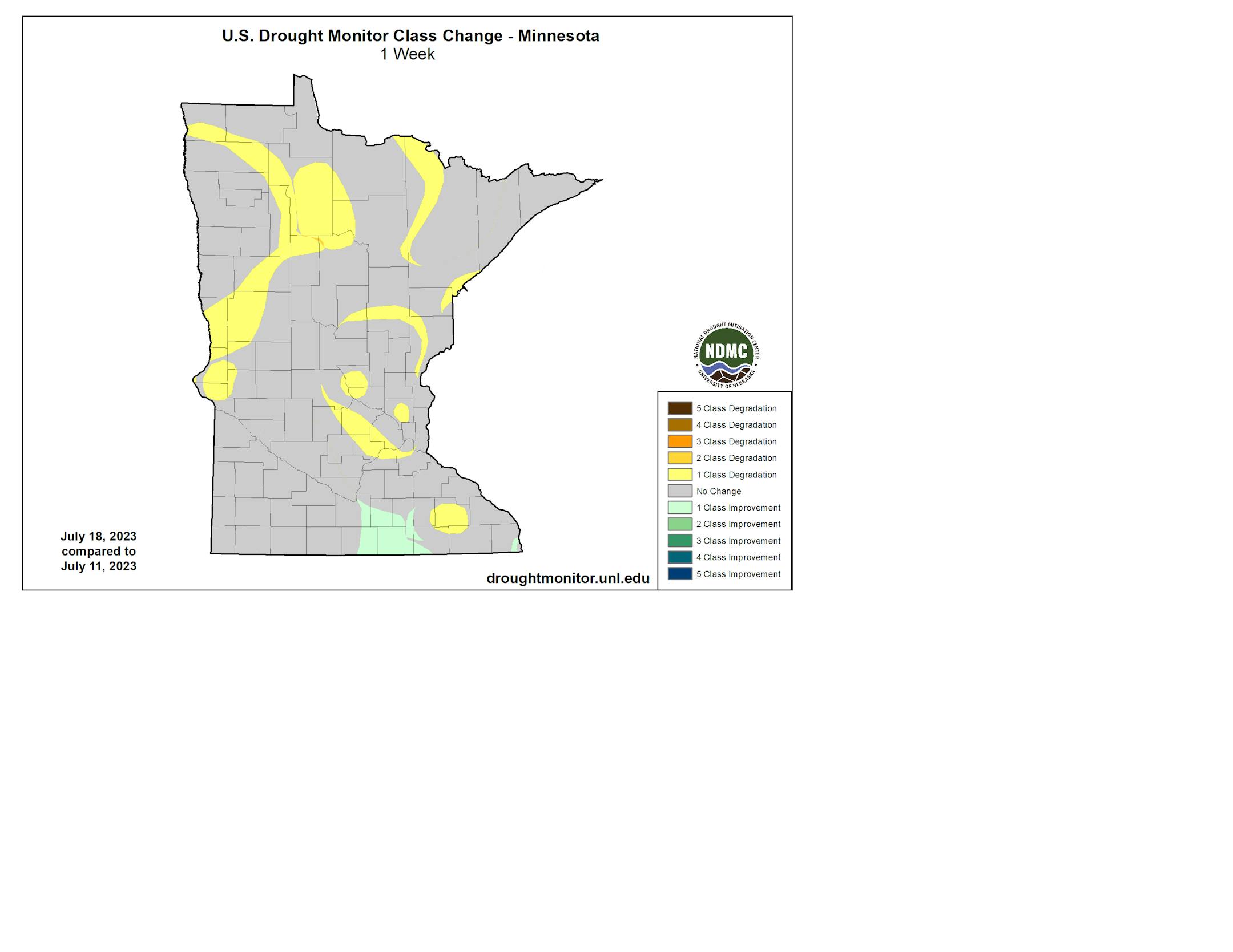
Some slight improvement did occur over the past week in south-central Minnesota - otherwise, we only saw the drought stay steady or worsen. Note that this does NOT include the rain that fell Wednesday evening across the region - that'll factor into next week's Drought Monitor.
_______________________________________________
Some Afternoon Storms Saturday
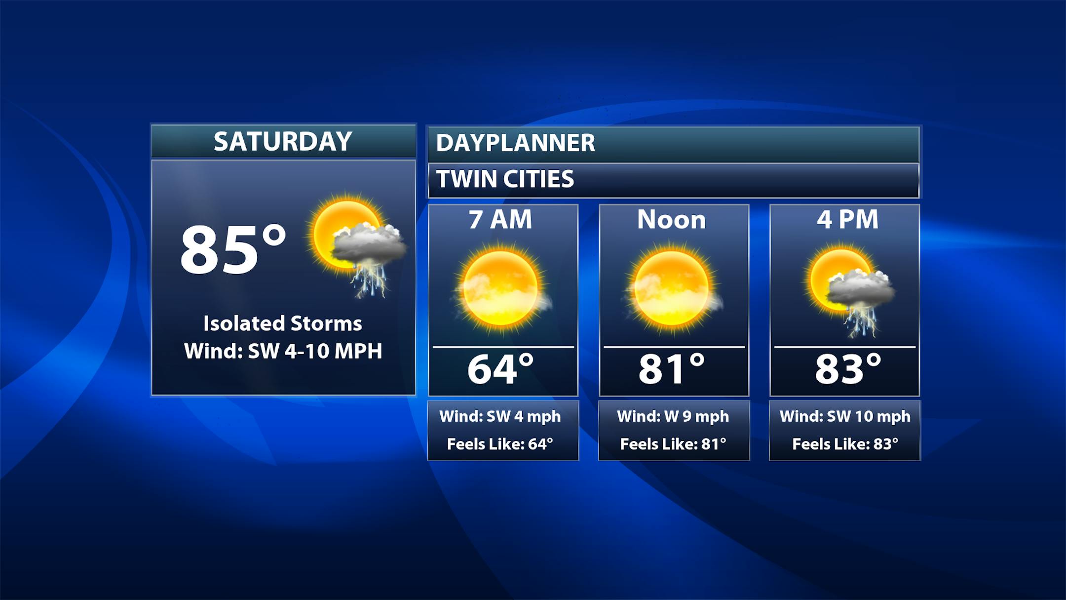
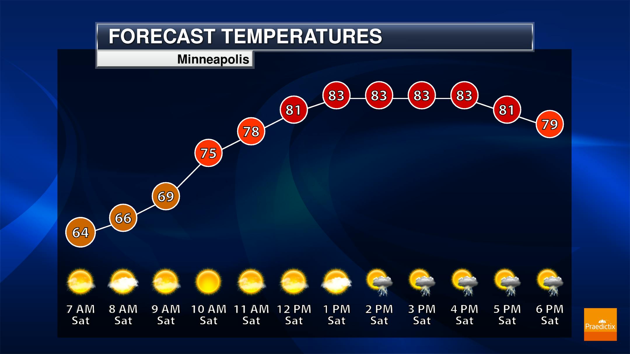
A few scattered showers and storms are possible late Saturday afternoon into the evening hours which could be strong. Patchy fog is expected to start the day off in the mid-60s with otherwise mainly sunny skies, but clouds will be more prevalent in the afternoon with that storm chance as highs climb into the low 80s.
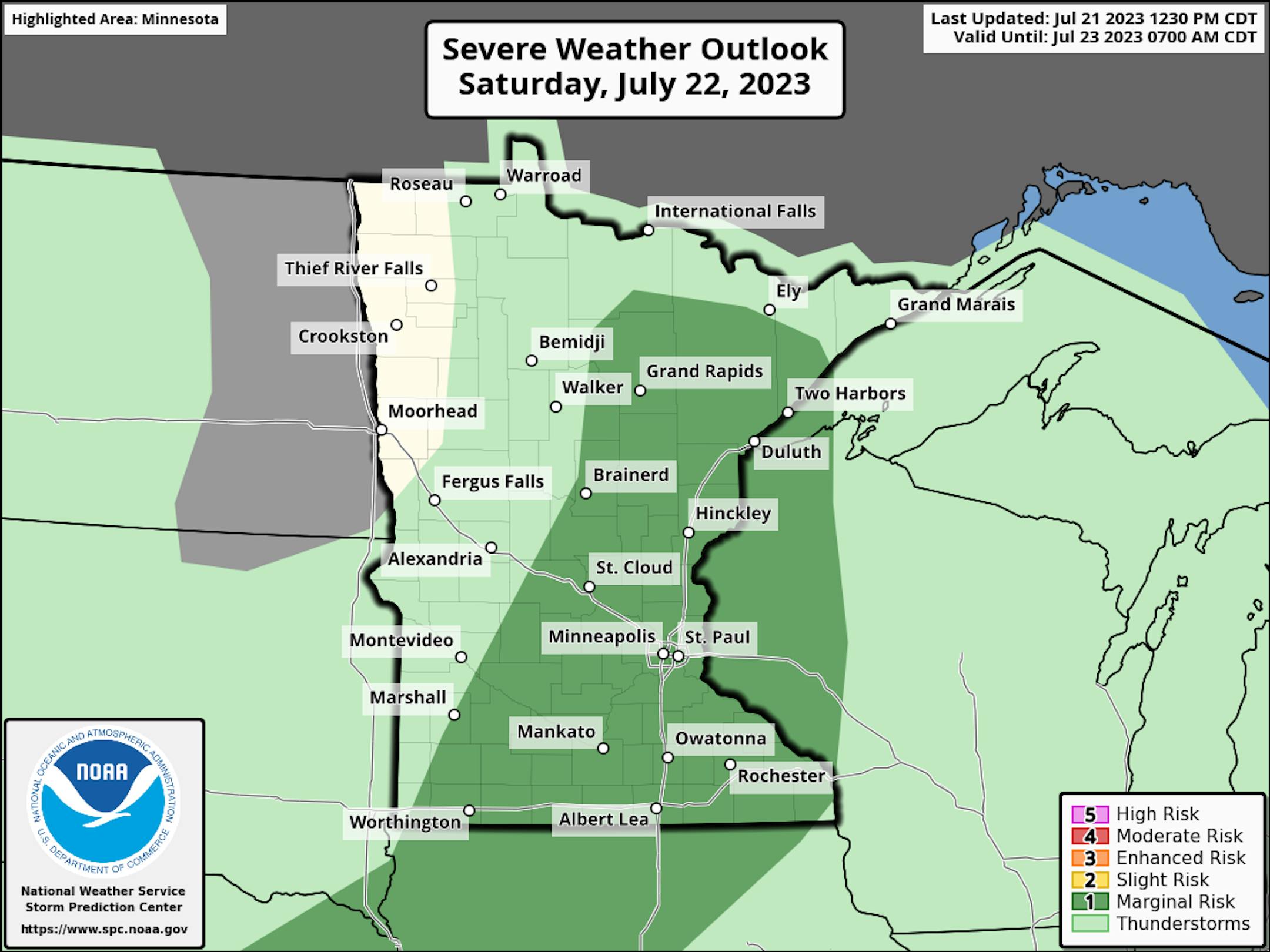
A few of the storms across southern and eastern Minnesota into western Wisconsin could be on the strong side Saturday afternoon and evening, with a Marginal Risk (threat level 1/5) in place. Hail and wind are the primary threats.
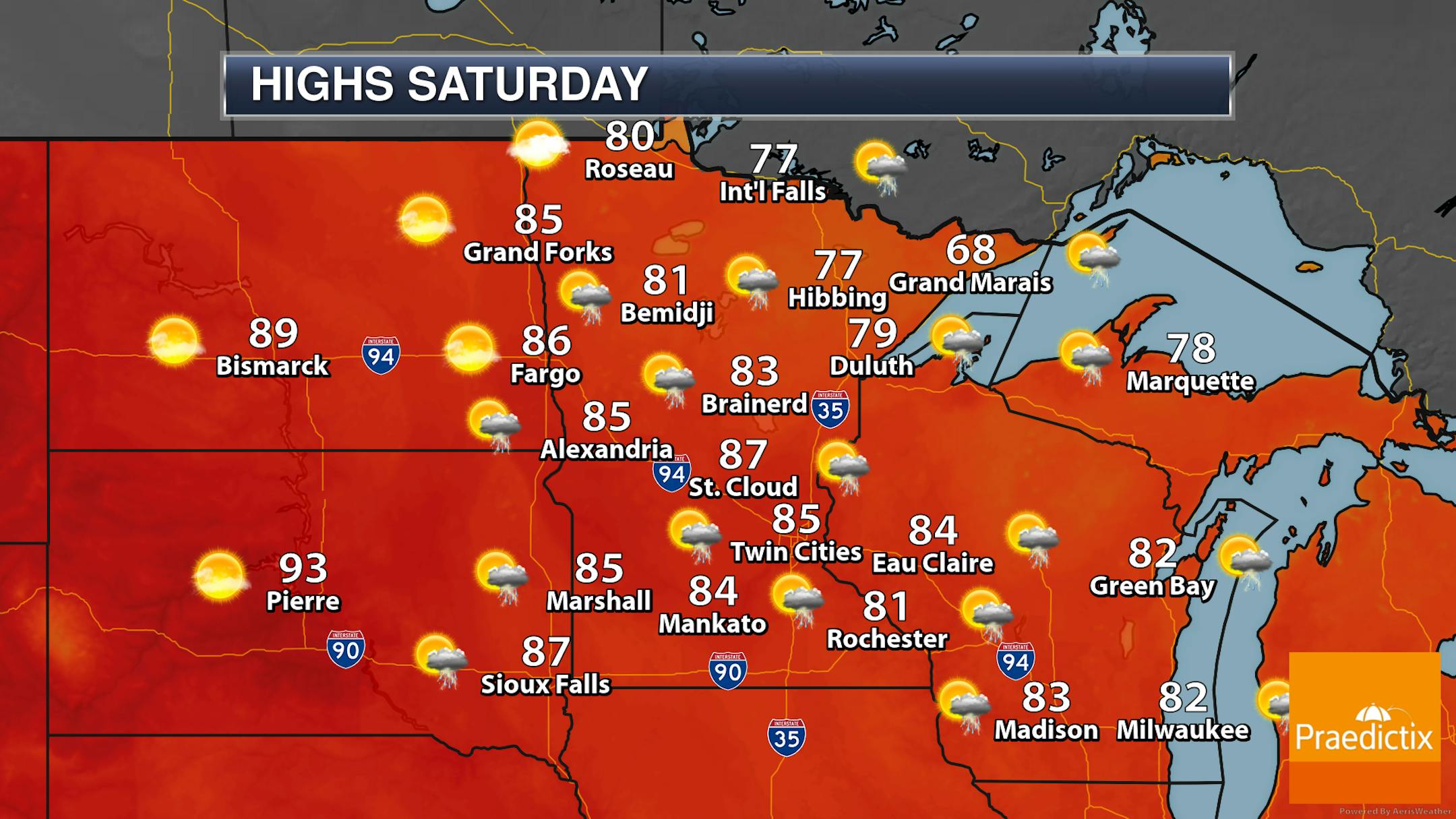

An upper-level system is passing through the region on Saturday, bringing the potential of some showers and thunderstorms across much of the state. However, rainfall totals will generally be under a quarter inch. Highs range from around 70F along the North Shore to the 80s across much of the state.
_______________________________________________
Even Warmer Sunday Into Monday
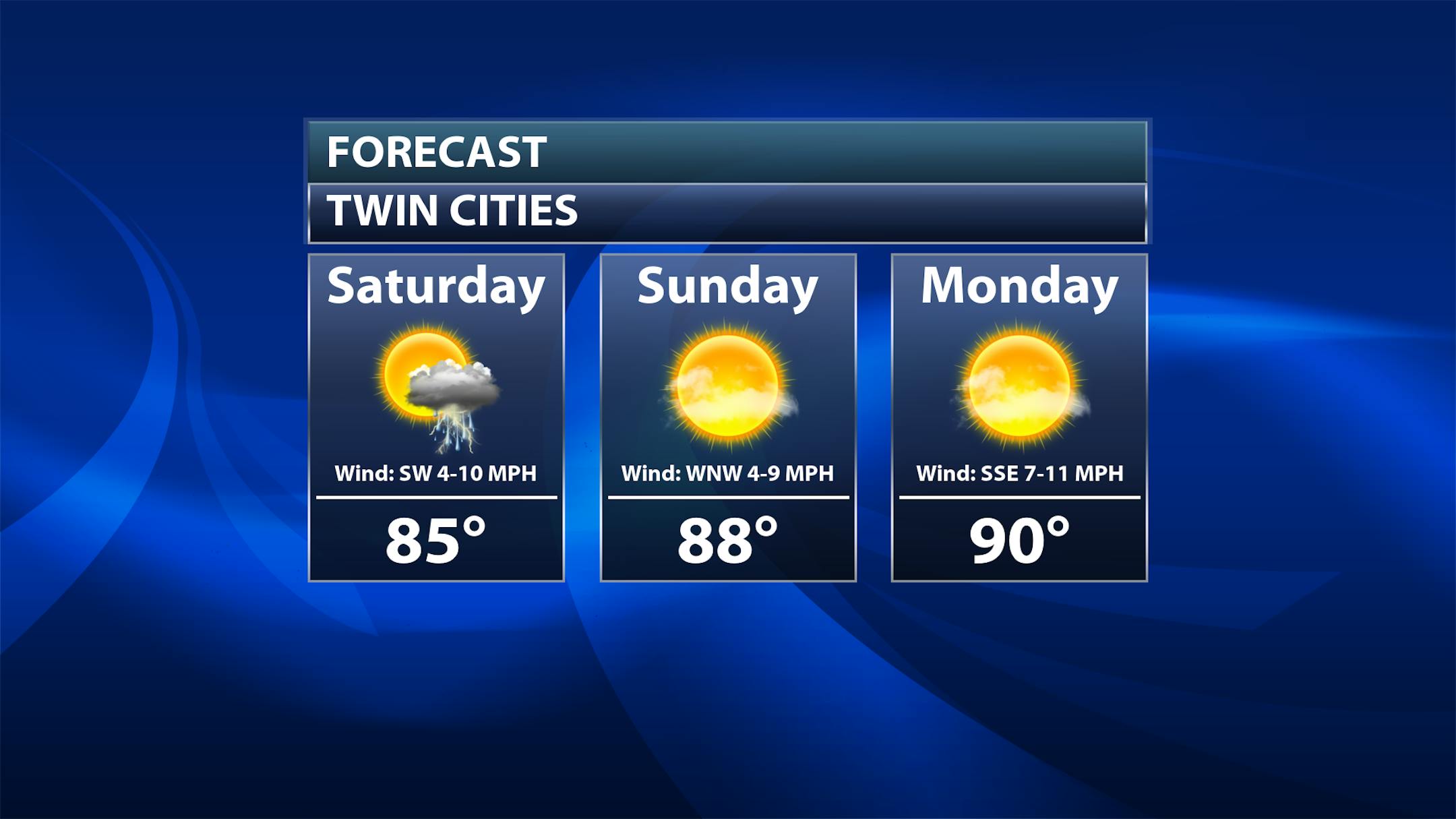
Sunday: Mainly sunny skies are expected as temperatures take another step upward into the upper 80s.


