

Countdown to Spring (Vernal Equinox)
Saturday, March 20th @ 4:37AM
the worst of winter's wrath is generally behind us during the month of March, but it still can be snowy at times. In fact, MSP typically sees around 9" of snow during this month, but more impressively, we gain more than 3 minutes of daylight each day during the month and if you do the math, we gain about an extra 1.5 hour of daylight through the month! The sunset on March 1st is around 6PM, but by the end of the month (and thanks to the time change on March 14th) our sunset on March 31st is at 7:40PM! The official start to spring (Vernal Equinox) is on Saturday, March 20th at 4:37AM this year.

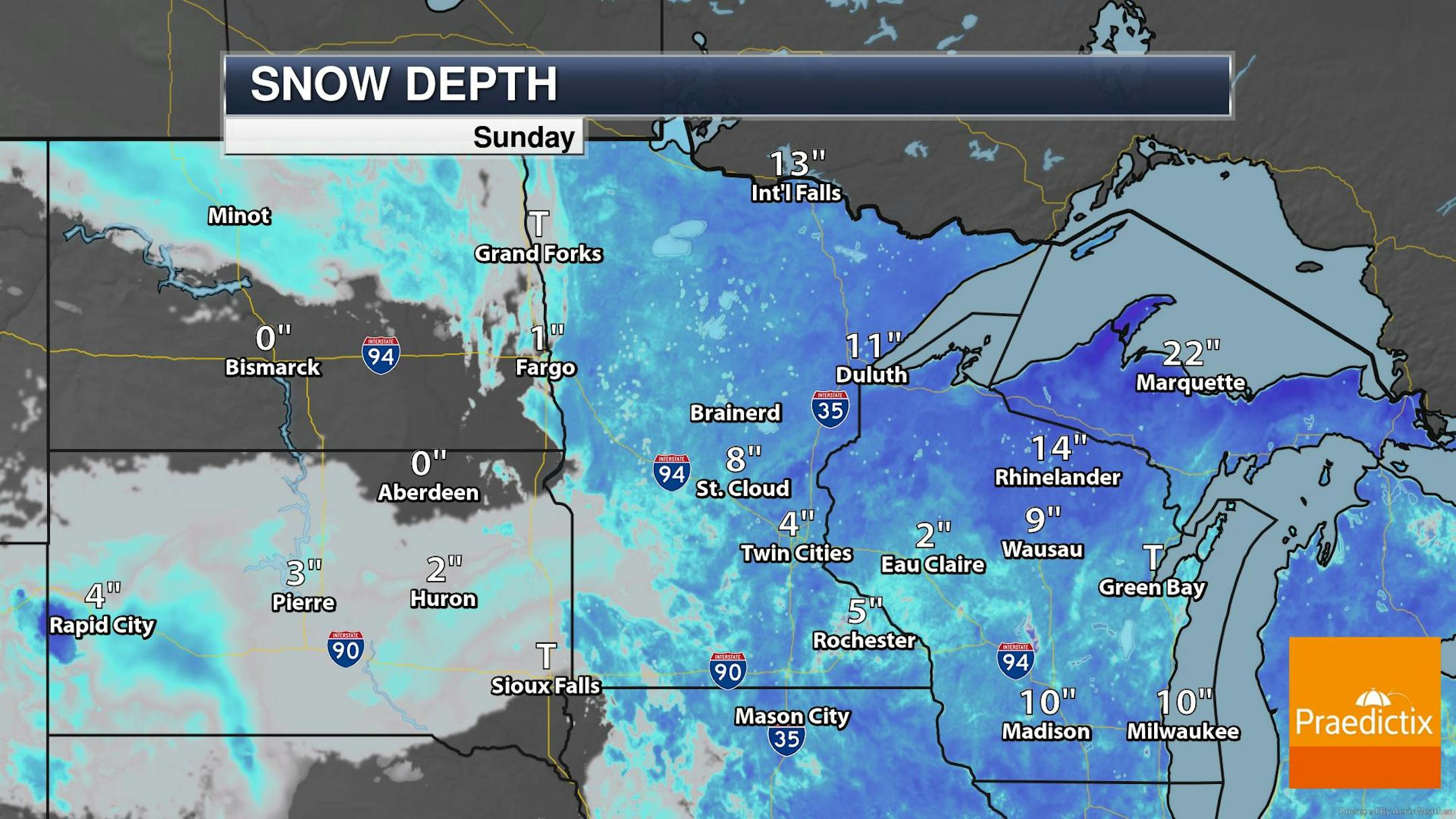
Snowpack Will Melt Fast Next Several Days
Here's a look at the snowpack as of Sunday, February 28th. With several very mild and sunny days in the forecast, the snowpack will likely melt quite quickly across the region over the coming days & weeks. That also means that ice conditions on area lakes could start deteriorating over the coming weeks as well!
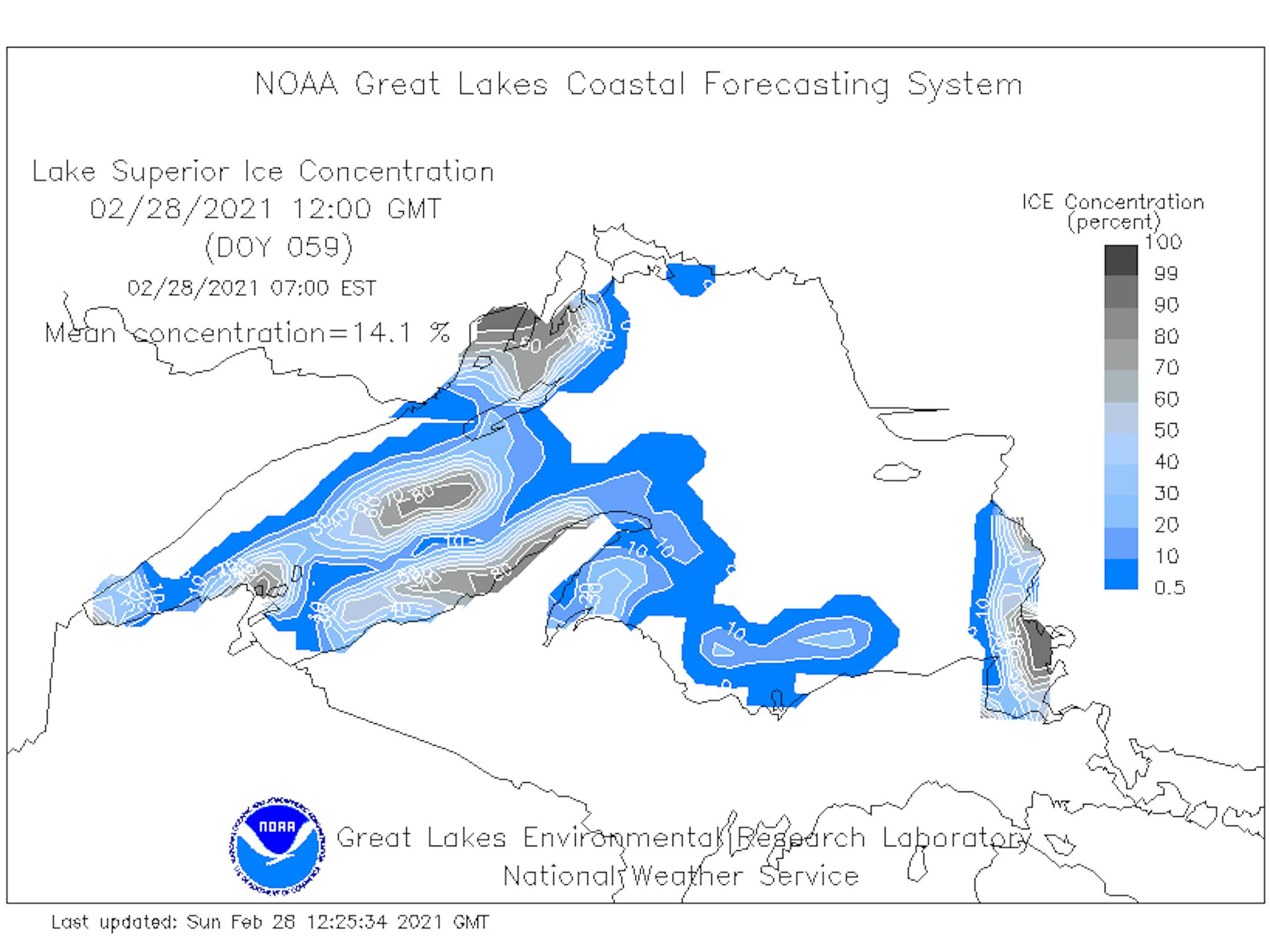
Lake Superior Ice Coverage Update
Thanks to very cold weather during the first half of February, ice coverage across Lake Superior is running much higher than it did during the first 2 months of Meteorological Winter (December & January). As of February 28th, nearly 14% of Lake Superior was covered in ice. At this time last year, only 7% was covered, while nearly 85% was covered back in 2019. Looking at the graph of this winter's ice coverage vs the long term average, we actually spiked to above average levels during the middle part of the month during the Arctic outbreak, but we're running below average once again. The average ice coverage on Lake Superior as of March 1st is a little more than 40%.

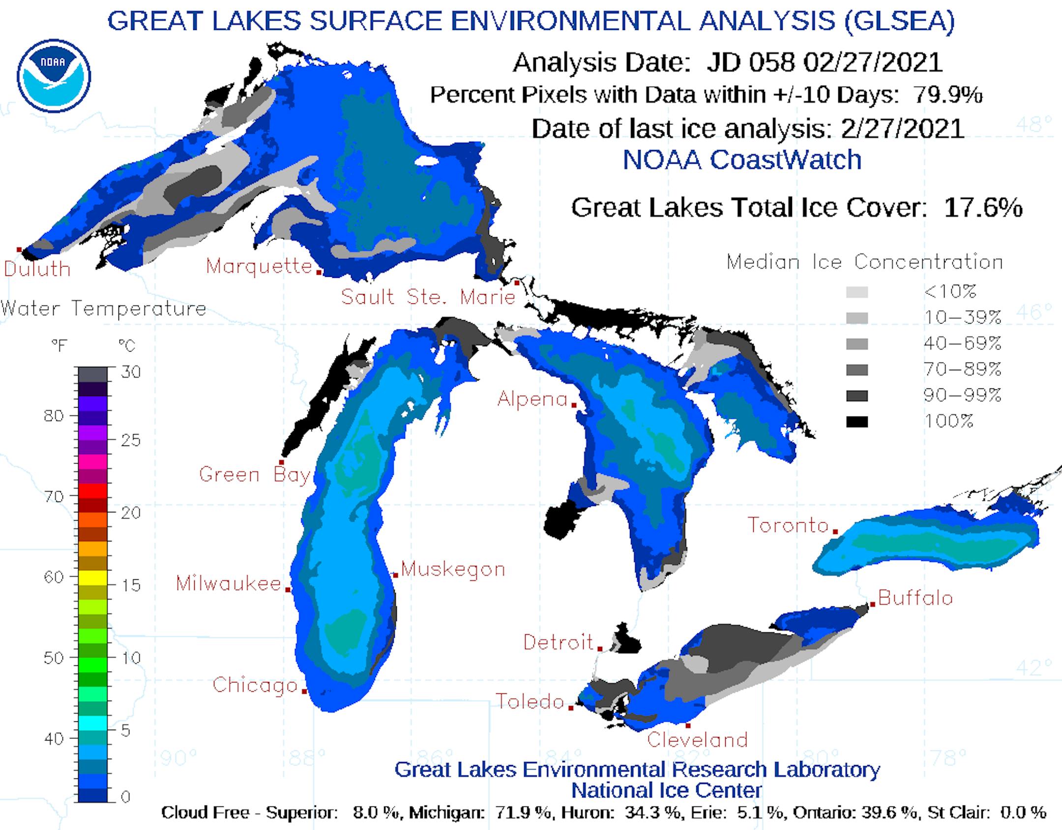
Great Lakes Ice Coverage Update
Here's the Great Lakes Ice Coverage as of late February. Note that nearly 18% is covered in ice. At this time last year, only 10% was covered, while nearly 70% was covered in 2019.
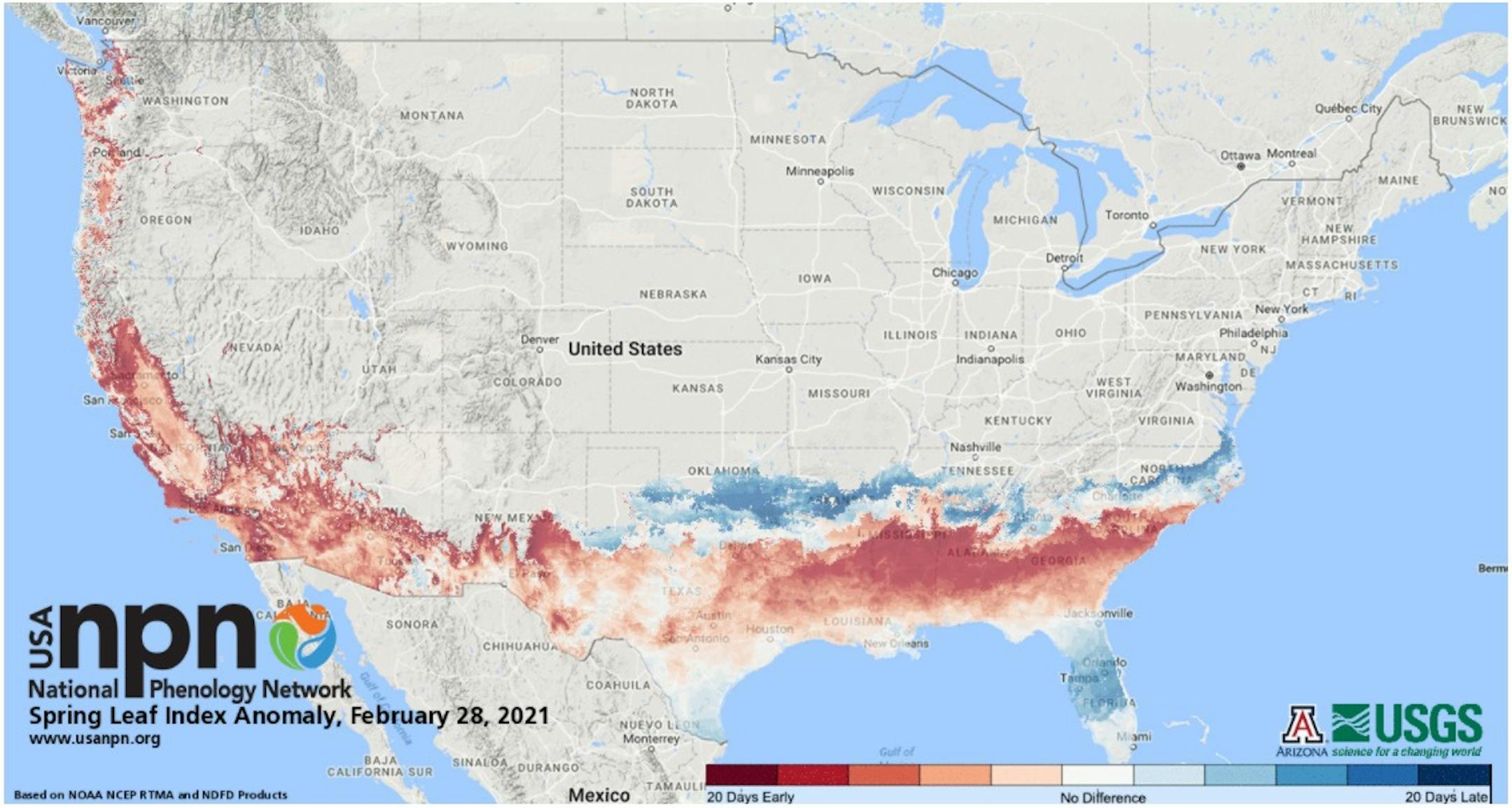
Status of Spring - Spring Leaf Index Anomaly
"How do you know when spring has begun? Is it the appearance of the first tiny leaves on the trees, or the first crocus plants peeping through the snow? The First Leaf and First Bloom Indices are synthetic measures of these early season events in plants, based on recent temperature conditions. These models allow us to track the progression of spring onset across the country. Spring leaf out has arrived in southern states. Spring arrived on time to one week late in Florida and southern Texas, was one-two weeks early in the middle and northern part of Southeast states, and has since slowed and is a few days late in Georgia and the Carolinas. Spring is days to weeks early in parts of the Southwest and West coast."
Tuesday Weather Outlook
Tuesday will be a much warmer day than it was on Monday with temps warming into the low/mid 40s by the afternoon. The only fly in the ointment will be the strong SSW winds that could gust up close to 30mph at times. The warm and windy will weather help to melt a bunch of snow out there during the day.
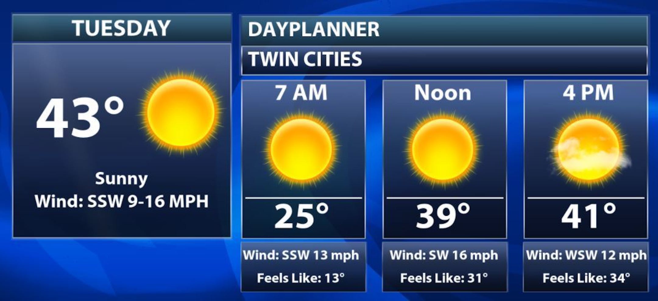
Tuesday Meteograms for Minneapolis
The meteograms for Minneapolis on Tuesday shows temps starting in the 20s early in the day, but will quickly warm through the 30s and top out in the low/mid 40s by the afternoon with lots of sunshine. Gusty SSW winds could reach 30mph at times in the Twin Cities.


