"Top Five Weather Events of 2020 in Minnesota"
"Here are the results of voting for the top five weather events of 2020 from the Minnesota State Climatology Office. Votes were cast from various weather enthusiasts including the National Weather Service, the University of Minnesota, State agencies and Facebook followers. Please visit us on Facebook (link is external) and post your own top five weather events for Minnesota."
"For the third year in a row, mid-April brought a major winter weather event to southern Minnesota. Although not as potent as the storms in 2018 and 2019, this one did produce accumulations of up to 10 inches, including 6.6 inches In the Twin Cities. In southern Minnesota, mid-April snows exceeding four inches generally only occur 5-10% of the time, or every 10-20 years on average. This marked the first time on record (back to the 1870s) that the Twin Cities had experienced such a storm in three consecutive Aprils."

Snowfall Analysis From Tuesday, December 29th
Tuesday's snowfall padded the December stats across the region. Note that the Twin Cities didn't get a ton with the system earlier this week, but there were pockets of heavier snow across parts of central and northern Minnesota, but the heaviest fell from Iowa into NW Illinois and into far southern Wisconsin. The official total at the MSP Airport was only 2.4"

Quiet Weather Next Several Days
Weather conditions close to home will be rather quiet over the next several days. However, there will be another surge of heavier precipitation that fall south of us from the Central US to the Great Lakes. Areas of heavy snow and ice will be as close to us as Iowa, Illinois and southern Wisconsin once again.

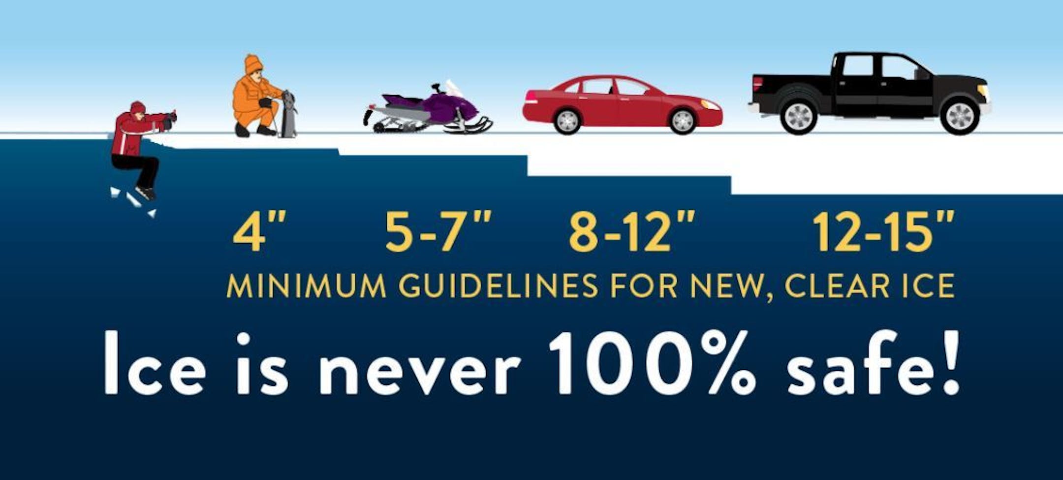
Ice Safety Guidelines
We're starting to see more folks venture out on frozen lakes and ponds, but keep in mind that that ice is never 100% safe!! You need at least 4" of ice to safely walk and close to a foot (12") to drive a small car on the ice. Stay safe out there!!