A cool and gusty spell, but more spring is ahead
25 mph gusts will keep us in light jackets into Saturday.
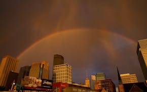
Rain tapers off, with cooler temps up next
Million-dollar rain replenished lakes, soil moisture.
Paul Douglas
Another soaking is headed for midweek
Rain comes after a postcard-perfect weekend.
Paul Douglas
Late-May warmth is premature, but it'll be spectacular
Afternoon high Saturday could hit 80 degrees, two to three weeks ahead of schedule.
Paul Douglas
Paul Douglas
Cool and gusty Thursday; weekend looks superb
Sunshine Saturday and Sunday with temps reaching the mid-70s.
Paul Douglas
Near 70 on Wednesday, with a warm weekend on tap
Cooler 50s will return later in April, but no slushy surprises in sight.
Paul Douglas
Paul Douglas
Storm may drop up to an inch of rain by Tuesday
Spring will come roaring back with a good shot at 70 next weekend (and a few potentially strong thunderstorms in a week).
Paul Douglas
Get outdoors Saturday before rain arrives Sunday
Over half an inch of liquid gold may fall.
Paul Douglas
Paul Douglas
Paul Douglas
The snow in your yard will soon yield to green
Sunny low to mid-40s Saturday, dry sky Easter Sunday.
Paul Douglas
Temps ahead will restore faith in a Minnesota spring
40s this holiday weekend will be close to average.
Paul Douglas
With the snowstorm behind us, an Easter thaw is ahead
Wednesday looks to be the coldest day in sight, with temps in the 20s.
Paul Douglas
Paul Douglas weather
Weather forecasts and musings from Star Tribune meteorologist Paul Douglas.
