Rainfall of historic proportions turned Minnesota into a vast wetland Thursday, and although skies were expected to clear Friday, the flood threat was mounting, especially on the Minnesota, Mississippi and Crow rivers.
Gov. Mark Dayton declared a state of emergency in 35 counties and announced that he, along with U.S. Sens. Al Franken and Amy Klobuchar and U.S. Rep. Tim Walz, would visit hard-hit communities in southern Minnesota on Friday. He also directed the state's National Guard to send 100 soldiers to fight flooding on the Rainy River and Rainy Lake in northern Minnesota's Koochiching County.
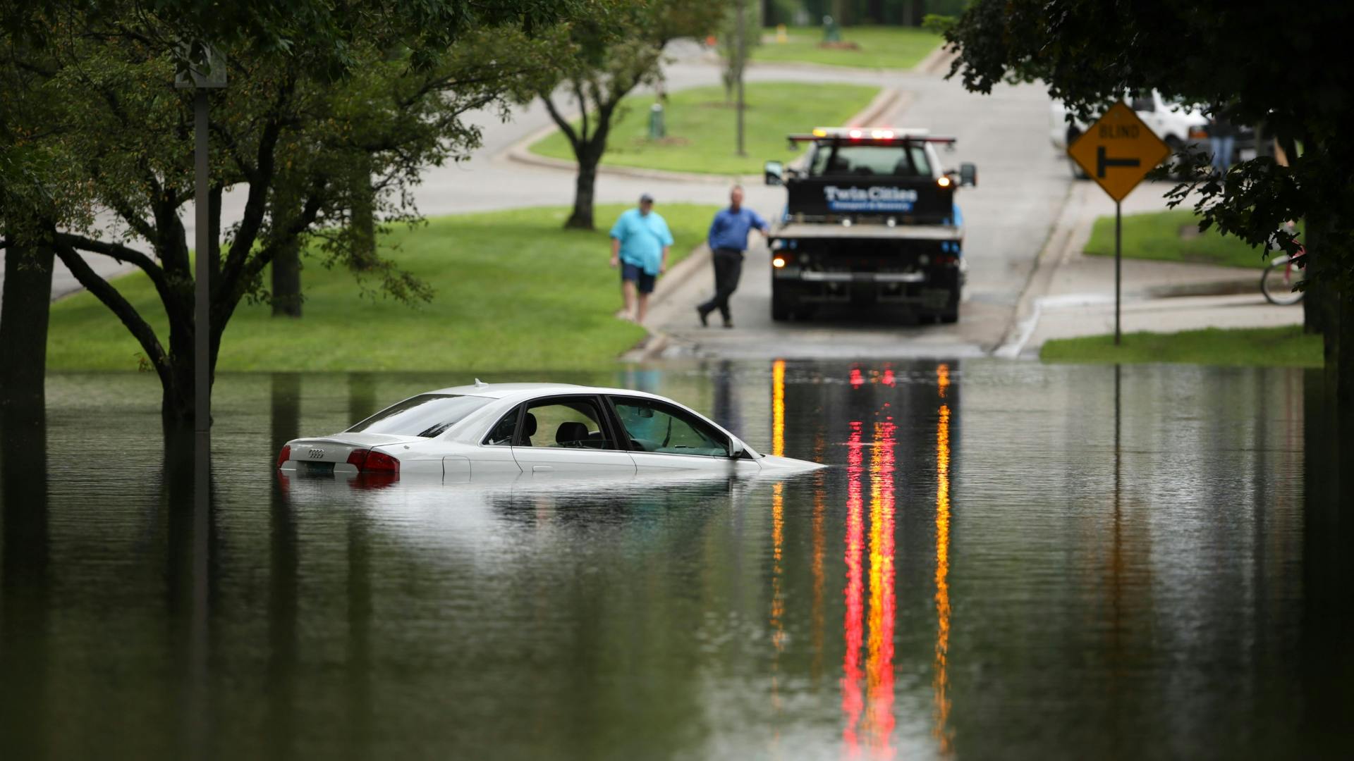
The Twin Cities metro area also was inundated. By Thursday night, 3 to 6 inches of rain had fallen across the metro, swelling streams, rivers and lakes; sending water and mud gushing into roads, parks and yards, and causing sewer system backups. Flash flood warnings were in effect in a broad swath across the metro area.
Twin Cities weather set all sorts of records Thursday — one for the wettest year thus far since 1871 and one of the wettest Junes on record. Water levels on Lake Minnetonka and Minnehaha Creek also set records.
The severe weather extended beyond rainfall. Police officers confirmed tornado sightings in Swift, Pope and Chippewa counties in western Minnesota, the National Weather Service reported. No major damage was reported Thursday evening.
The rain stopped Thursday night, and Friday should be dry, but that won't improve the flooding outlook. By the weekend, the runoff will have worked its way into rivers. The Weather Service warned that major flooding could be ahead on the Mississippi in St. Paul; the Crow River in Delano, Rockford and Mayer, and in parts of the Minnesota River Valley.
Rain has been falling throughout June, but Thursday's rainfall "broke the camel's back, so to speak," said Craig Schmidt, a Weather Service hydrologist.
Sewage backups
One of the messiest results came in the form of sewage backups into heavily used recreational waters, caused by rainwater pouring into local and regional wastewater collection systems. Sewage spilled into Maxwell and Carmen bays in Lake Minnetonka, the Mississippi River at Wabasha Street and Humboldt Avenue in St. Paul, and into Medicine Lake and Bassett Creek in Plymouth, the Metropolitan Council said.
"We're experiencing a rain event similar to June 1, but more widespread," Bryce Pickart, of the Met Council's environmental services division, said in a news release. "In parts of the region, we are running wastewater pumping stations and regional sewers beyond their designed maximum operating capacities."
Communities with especially high levels of stormwater flow included those around Lake Minnetonka — Orono, Mound, Excelsior, Wayzata, Minnetrista, Victoria, Chanhassen and Maple Plain. In addition, Chaska, Savage, Burnsville, South St. Paul, Forest Lake, St. Bonifacius, Hopkins, Plymouth, New Hope and North St. Paul were experiencing high flows late Thursday.
Thirty-five of the state's 87 counties were included in the governor's disaster declaration, which makes many state government resources available to local efforts underway to minimize flood damage or to clean up what has been waterlogged or washed away. The 35 counties are Beltrami, Blue Earth, Brown, Dodge, Faribault, Freeborn, Goodhue, Grant, Hubbard, Jackson, Lake of the Woods, Le Sueur, Lyon, Koochiching, McLeod, Morrison, Mower, Murray, Nicollet, Nobles, Olmsted, Otter Tail, Pipestone, Ramsey, Redwood, Renville, Rice, Rock, Roseau, St. Louis, Scott, Sibley, Steele, Todd and Waseca.
"We could use a break," said Jeff Marlowe, public works director in Renville County. More than a foot of rain has fallen on that southwestern county in a week.
Troubles in the metro area
The water level on Lake Minnetonka, recorded since 1906, reached an all-time high Thursday of 930.77 feet above sea level, breaking the record set only 16 days earlier. Minnehaha Creek also set a record, rising quickly in south Minneapolis and overflowing its banks in many spots along Minnehaha Parkway, much of which was closed Thursday.
As of late Thursday, Hennepin County had distributed 3,000 sandbags to cities; 8,000 more were on hand.
A mudslide below the University of Minnesota Medical Center on the Mississippi River's west bank narrowly missed two motorists on Minneapolis' West River Parkway and forced that part of the road to be closed about 7 p.m. Thursday. Minneapolis firefighters said that no one was injured and that the hospital buildings are on bedrock and shale and are safe.
The slide sent a 100-yard swath of the hill, including trees and brush, onto the road and into the river, said Deputy Fire Chief Todd White. The slide's force also sent pieces of the road into the river and left 6 to 8 feet of mud on the parkway, he said.
The road between Franklin Avenue and 4th Street probably will remain closed for a few days until the debris can be cleared, White said. "There's no passage through there on foot or bike or car," he said.
In Lakeville, a lightning strike was suspected of starting three homes on fire on a block shortly after 5 a.m., said Fire Chief Mike Meyer. Lightning also struck homes in three parts of St. Paul within 2 ½ hours, said Fire Marshal Steve Zaccard. No one was hurt in any of those incidents.
Staff writers Bill McAuliffe, Tim Harlow and Mary Lynn Smith contributed to this report. pwalsh@startribune.com 612-673-4482 jennifer.brooks@startribune.com 612-673-4008 kelly.smith@startribune.com 612-673-4141l

Trail section at one of Minnesota's most iconic spots closing for rehab

Will 'shotgun only' zone for deer in southern Minnesota be abolished?

Four Minnesotans catch salmonella in outbreak linked to basil sold at Trader Joe's