Ever since Mount St. Helens' cataclysmic eruption 34 years ago this month, scientists have been tracking its explosive energy to better understand how the volcano works. ¶ This summer, scientists — using techniques developed by the oil industry — will be the ones setting off explosions. ¶ Researchers are preparing to set off explosive charges buried in two dozen 80-foot-deep wells drilled around the mountain. They'll record the seismic energy of the explosions on thousands of portable seismometers placed by an army of volunteers traveling by car, on foot and on horseback.
Their goal is to see with greater clarity the details of how molten rock, or magma, makes its way to St. Helens' crater from the area where tectonic plates collide and the magma is created, some 60 miles beneath the surface.
"We've been looking at what's beneath the volcano through very fuzzy glasses," said Seth Moran of the U.S. Geological Survey's Cascade Volcano Observatory in Vancouver, Wash. "This still won't give us anything like 20/20 vision, but it should make things quite a bit clearer."
The explosive experiments, or "active imaging events," scheduled for this summer are one part of a battery of multidisciplinary imaging experiments collectively called iMUSH for "Imaging Magma Under St. Helens." Together, they constitute what researchers say is the one of the most complete and ambitious series of imaging experiments ever conducted on any volcano in the world. The $3 million project, funded mostly by the National Science Foundation, is headed by Kenneth Creager, a University of Washington professor of earth and space sciences.
The explosive research, which will use about $1 million of the total, is being conducted by a research team from Rice University, headed by earth science professor Alan Levander.
Along with UW, Rice and the USGS, participants include teams of researchers at Oregon State University in Corvallis, the Lamont-Doherty Earth Observatory at Columbia University in New York and Eidgenoessische Technische Hochschule of Zurich.
In addition to the explosive testing, specialists in other disciplines are preparing for experiments using enhanced receptors for naturally occurring seismic activity. They'll also examine the magnetic and electrical properties of rock deep beneath the volcano, which scientists say is a useful guide to identifying magma.
The goal is to "see" deep below St. Helens to the area where the Juan de Fuca tectonic plate from the Pacific is forced under the North America plate. This Cascade "subduction zone" also is the area that can produce magnitude-9 earthquakes when the plates slip or break.
Magma from this zone makes its way to the surface in Northwest volcanoes, but exactly how that happens remains a mystery despite more than three decades of research.
Scientists have a good sense of what's beneath the volcano down to a depth of about 6 miles, Moran said. There are many theories about what's going on in deeper reaches, but nobody has been able to prove one.
Does the magma pool in a reservoir at the crust? Does it make its way upward in a single, narrow pipelike conduit? Or does it collect in one or more underground ponds along the way?
Finding answers is important, scientists say, because it will enable them to better interpret the volcano's signals when magma is on the move. That knowledge, they say, will help them predict eruptions not only at St. Helens but also at other volcanoes in the Cascades and around the world — and possibly save many thousands of lives.
"It's long been looked at by individual disciplines," Moran said. "All of them have their own resolution issues and error issues, plus they're all measuring different kinds of things."
By combining the strengths of the various imaging methods, he said, individual weaknesses will be filtered out.
"By throwing multiple things at this, we'll have a better sense of the whole," he said.
Moran and other USGS analysts confirmed last month that St. Helens remains active. While an eruption is not impending, the analysis showed a new supply of magma is slowly repressurizing the magma chamber beneath the mountain.
Steve Malone, now a UW professor emeritus, but a seismicity superstar when St. Helens erupted 34 years ago, is an active participant in the iMush studies.
Scientists did not foresee St. Helens' unusual sideways blast on May 18, 1980, but thanks to Malone and others, they were able to roughly predict when the eruption would occur and thereby saved many lives.
Fifty-seven people died in the 1980 eruption, the deadliest volcanic eruption in U.S. history. It devastated 150 square miles of Washington and sent up an eruption cloud that reached the stratosphere.
Malone and his colleagues are meeting to design 70 enhanced seismic stations that will be installed up to 30 miles from the mountain for tests that will measure natural seismicity. "It's pretty much good to go, but there's still some paperwork left," he said. "We're hoping to start putting instruments out in June and by the end of June to get to all of the sites."
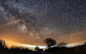
The Lyrid meteor shower peaks this weekend, but it may be hard to see it

Legislation that could force a TikTok ban revived as part of House foreign aid package
![Cattle at the Wysocki Dairy CAFO (concentrated animal feeding operation) in Armenia, Wisc. in late October. ] Aaron Lavinsky • aaron.lavinsky@s](https://arc.stimg.co/startribunemedia/GNUPD5JDUEDREIFU5RKJM2EV2Y.jpg?h=91&w=145&fit=crop&bg=999&crop=faces)
Iowa environmental groups ask EPA to step in and protect drinking water

Why you should donate clothing: It (probably) won't end up at the dump