If the sun is shining — which it probably will be — when you head to work Monday morning, bring your umbrella anyway. Maybe a pair of rain boots, too.
It's already been the third-wettest year on record, according to the National Weather Service, and according to meteorologist Michelle Margraf, most of central and southern Minnesota won't get a chance to dry out anytime soon. Daytime sunshine saved many Father's Day events Sunday, but the aftermath of Saturday's high winds and heavy rains kept homeowners and emergency workers busy much of the day.
About 110,000 Xcel customers were without power into Sunday. By 9 p.m., the utility said it had restored power to about 99 percent as the firm used emergency crews from throughout the Midwest to repair damaged lines.
Lightning strikes ignited several fires in the St. Cloud area late Saturday, including a 95-year-old school building that was razed Sunday morning when the fire damage made it impossible to save. District officials said they'll find another location for about 100 children who were scheduled to start summer school Tuesday at the Roosevelt Education Center.
In International Falls, volunteers filled about 50,000 sandbags to protect homes from high water in Rainy Lake and along the Rainy River. The Red Cross and Salvation Army were helping residents. The Koochiching County Sheriff's Office said Sunday that there had been damage to docks and boathouses, but it hadn't yet confirmed reports about damage to any homes.
Interstate 90 in southern Minnesota reopened Sunday after water as deep as 4 feet covered the highway, closing all four lanes of traffic from Luverne to the South Dakota border.
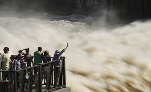
The sounds of chain saws were heard throughout Richfield, Edina, south Minneapolis and other locales Sunday as residents cleared downed trees that fell Saturday after straight-line winds of 60 to 70 miles per hour plowed through the metro area. Bicyclists and joggers caused wakes in the standing water that covered paths around Minnehaha Creek and metro-area lakes. Dozens of photos of the fast-flowing Minnehaha Falls were posted on Facebook as families headed outdoors for a brief respite from the rain.
Clear and dry weather is expected to continue through Monday afternoon, then more showers and thunderstorms will arrive, with up to 3 more inches of rain predicted on and off through the week. Computer models had the precipitation slipping into Saturday, the official first day of summer. Some of the storms Monday could be severe, Margraf said, as heavy, humid air settles in a wide swath across central and southern Minnesota.
Even she sounded a little weary of the rain Sunday.
"This is not the week we want to have rain," Margraf said. "We need to dry out and let the areas where we have water go down."
This year has seen the 14th-wettest meteorological spring — March through May — but through June 15, the third-wettest year, with 19.56 inches of precipitation. The record is 20.68 inches. That's 8.09 inches above normal, Margraf said.
The rainy week ahead can be blamed on the fact that Minnesota is sitting smack-dab in the middle of where a heat wave in the Central Plains is meeting colder air sitting to our north.
The hefty straight-line winds Saturday were caused by "a unique situation" of fast air currents high in the atmosphere bumping into showers and being pulled to the ground, Margraf said.
Pat Pheifer • 952-746-3284

Cigarettes at $15 per pack? Minneapolis might do it.
![St. Louis County Board approved a plan to distribute $24 million in CARES funding, including $6 million to be distributed to small businesses. ] ALEX](https://arc.stimg.co/startribunemedia/ED62G7Y2RWISNRUZQRT3ZTJVHU.jpg?h=91&w=145&fit=crop&bg=999&crop=faces)
Duluth man sentenced to 40 years for role in drive-by shooting that killed 19-year-old

