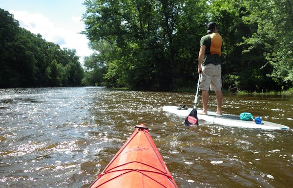
Minnesota's "Land of 10,000 Lakes" moniker evokes lasting memories of fishing, paddling and campfires at the edge of a shore. But being on the water isn't the only way to enjoy the outdoors.
Thousands of miles of hiking trails crisscross our fair state, with some seeing more foot traffic than others. From well-maintained, easy-to-access trails to narrow footpaths hidden deep in the wilderness, there's a trail to suit all tastes and skill levels.
On Aug. 21-23, the North Country Trail Association will host the Minnesota Hiking Celebration at Spirit Mountain in Duluth. In addition to seminars on hiking equipment and guided tours on the famous Superior Hiking Trail, the event will promote hiking on the lesser known North Country Trail and other under-the-radar routes.
"Our goal is to raise awareness of the North Country Trail," says Matthew Davis, regional trail coordinator for the North Country Trail Association in Minnesota and North Dakota. "We want to get more people to think about hiking as a great way to get out and enjoy the outdoors and disconnect from our fast-paced society. Enjoy a healthy activity," says Davis.
North Country Trail
Still in development, the planned 4,600-mile North Country trail will eventually meander from North Dakota to New York State, with twice the length of the Appalachian Trail.
Minnesota will be home to 775 miles of the North Country Trail, but only about 60 percent of the state's network is complete, with two contiguous sections. The 170-mile stretch from Chippewa National Forest to Tamarac National Wildlife Refuge offers a true wilderness experience. While hiking between primitive campsites, backpackers will travel through pine and hardwood forests, as well as rolling hills created by glacial moraines. The trail skirts the shores of many lakes with clear blue waters. The North Country Trail Association has recently published a guidebook to this 170-mile section, with detailed mile-by-mile descriptions of the route. The book is available online at www.northcountrytrail.org.
More Up North trails
Northern Minnesota boasts two more world-class wilderness trails. The Border Route and Kekekabic trails cut through different sections of the Boundary Waters Canoe Area Wilderness, offering up about 35 miles of BWCA experiences apiece. "We're fortunate to have these trails because they provide a unique experience," says Davis. "These trails have all the magic of the Boundary Waters experience except you are hiking instead of paddling."
Volunteer trail crews from the Minnesota Rovers built the 65-mile Border Route Trail between 1972 and 1980. Then they created a nonprofit called the Border Route Trail Association to manage long-term trail maintenance.
Like the North Country and Kekekabic trails, the Border Route Trail is best suited for experienced hikers. John Elliott, president of the Border Route Trail Association, invites hikers to develop skills like map and compass navigation so they can fully appreciate the trail. "The Border Route follows the Canadian border and Pigeon River. There are spectacular overlooks and the Rose Lake cliffs are incredible," advises Elliott.
Ed Solstad, trail maintenance coordinator for the Border Route Trail Association, suggests starting with shorter segments of the Border Route. "Start at the Swamp River trailhead on the eastern end of the BWCA. A short one-mile hike takes you to a wonderful overlook. The trail continues along a ridge that parallels the Pigeon River. A spur trail to Otter Lake leads to a parking area. It's a 3-mile hike back to the original trailhead." The Border Route Trail Association offers a detailed guidebook, available via www.borderroute trail.org.
The Kekekabic Trail is a challenging point-to-point footpath extending from the end of Fernberg Road east of Ely (near Snowbank Lake) all the way to the Gunflint Trail. Built as an access trail for firefighters in the 1930s, hikers must be prepared to climb steep ridges, but they're also sure to encounter natural wonders including waterfalls and beaver dams. More information is available at www.kek.org or pick up a trail guide at Midwest Mountaineering in Minneapolis.
Southern Minnesota trails
Part of the Minnesota Valley National Wildlife Refuge, the Louisville Swamp Unit offers 14 miles of trails cutting through diverse natural environments including prairie, wetlands and oak savanna. The remnants of stone buildings from the old Jabs Farm offer a glimpse of pioneer life. Pick up the trailhead of the 4.5-mile Mazomani Trail in the Louisville Swamp Unit's main parking lot in Shakopee.
An hour south of the Twin Cities, Nerstrand Big Woods State Park is a great place to sample the state's diverse plant life. Ten trail loops roam over rolling hills and through forests of sugar maple, white and bur oak, basswood, elm, green ash and ironwood trees. More than 50 varieties of wildflowers can be found in the prairie sections alone. A colony of rare Minnesota dwarf trout lilies are also found in the park.
Alert hikers occasionally catch glimpses of the white-tailed deer, fox and raccoon that live in the park. The Big Woods is also a popular destination for bird-watchers looking for barred owls, goldfinches, chickadees, bobolinks and white-breasted nuthatches. Seven species of woodpecker can also be found in the park.
Don't miss the waterfall at the bottom of the Hidden Falls Trail. As the trail descends from the parking lot, the sound of falling water captures your attention and pulls you closer to the source. The trail leads to Prairie Creek, which drops over a sheer vertical face of limestone bedrock. Watch in awe as erosion causes blocks of limestone to fall 20 feet into the shallow pond below.
Lou Dzierzak is a freelance writer and actively participates in outdoor pursuits. He is editor of Rootsrated.com, an online resource for Twin Cities outdoor destinations.
Verstappen takes pole for Chinese GP to extend F1 dominance. Hamilton 18th
Jordan Montgomery wins in debut, Diamondbacks get 22 hits in 17-1 win over Giants
Ingram, Valanciunas lift Zion-less Pelicans past Kings and into the playoffs
Justin Turner's homer, RBI single highlight Blue Jays' 5-1 win over the Padres
![Minnesota Twins pitcher Jhoan Duran (59) in the ninth inning Tuesday, August 15, 2023, Target Field in Minneapolis, Minn. ] CARLOS GONZALEZ • carlos](https://arc.stimg.co/startribunemedia/NWLT5CNXGTRZA6KVTMIPSOG3KI.jpg?h=91&w=145&fit=crop&bg=999&crop=faces)