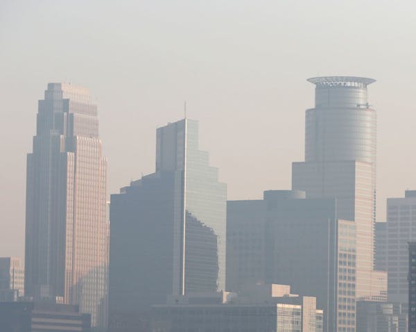
A smoky haze altered air-quality levels in the Twin Cities metro area and much of southeastern Minnesota on Saturday, ferried by winds from wildfires to the north.
Smoke from fires on Minnesota's Iron Range and those farther north in Canada triggered air-quality and health warnings, and the haze was thick enough to affect visibility in some areas of southern Minnesota on Saturday. The state Pollution Control Agency's air quality index wavered between "moderate" and "unhealthy for sensitive groups" in many areas, a situation that was expected to linger into Sunday. "Good" air-quality conditions are expected to return Monday.
The MPCA issued a health alert through 10 p.m. Saturday for southern Minnesota cities such as Rochester, Mankato, Owatonna, Faribault and Winona. Shifting winds were expected to move the smoke out by Sunday, the MPCA said.
But Saturday, "fine particle pollution is expected to remain at or above a level that is considered unhealthy for sensitive groups," the MPCA said in a news release. Those groups include people with cardiovascular ailments or participating in strenuous activity, the elderly and children.
In the Twin Cities, visibility was at its worst between 7 and 8 a.m. Saturday, with skies somewhat clearer by 10 a.m. To the southeast, the haze was even thicker in Hastings, Red Wing and other southeastern towns throughout the afternoon.
People spending time outdoors are advised to check the air quality and use good judgment when it comes to outdoor activities, said National Weather Service meteorologist Andy Lahr.
The fire in north-central Minnesota began in the Skibo area, a few miles southeast of Hoyt Lakes, around 3 p.m. Friday and quickly spread, growing from eight to 10 separate fires into four or five larger ones. The wildfires forced the evacuations of about 25 people from several residences, seasonal cabins and a senior living facility.
Residents later were allowed to return to their homes, but County Roads 565 and 569 remained closed Saturday. Crews worked overnight Friday to staunch the fires, which were enabled by dry, warm and breezy conditions over the last few days.
As of late Saturday night, the fire had spread 500 acres and containment was estimated at only 12 percent.
Next week is expected to bring lower temperatures and a chance of showers across the state, easing dry conditions somewhat, according to the National Weather Service.
Natalie Daher • 612-673-1775

911 transcript gives more detail of Sen. Mitchell's alleged burglary

Man shot by deputy in Montrose allegedly said during earlier clash he'd rather die than be arrested

Falcon Heights, St. Anthony move toward renewing police partnership severed after killing of Philando Castile

Minneapolis reaches $150k settlement with eyewitness of George Floyd's murder