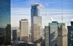
Warm, August-like temperatures will kick off the workweek and continue until the weekend, but meteorologists predict a cool and possibly rainy ending to the Labor Day holiday.
After a string of days this week with highs in the mid- to upper 80s, a colder front will limp across the Twin Cities by Sunday night, with the possibility of storms ending the summer's last hurrah.
"That cold front looks like it'll be the unofficial start to fall weather," said Chris Franks, meteorologist with the National Weather Service in Chanhassen.
The haze that has blanketed most of the state this summer continues as the fires in the Pacific Northwest and other areas burn.
Even so, air quality in the state will range from good-to-moderate levels throughout the week, according to the Minnesota Pollution Control Agency. On an air-quality scale that ranges from 0 to 200 (unhealthy), most of the state will be in the mid-50s.
With Labor Day falling later than normal, it will be "really tough for Minnesota to get back up near the 90s" after the holiday, Franks said. "The odds of getting back up to even the upper 80s are not good."
With gas prices hovering at $2.47 in the metro area, many will be hoping to hit the road and enjoy the last few warm days of summer.
But by mid-September, the weather will dry out and cool down as nights become longer, Franks said.
Karen Zamora

Minnesota TikTokers react to app's ban in the U.S.

Minnesota state senator's burglary arrest puts private family drama in the election year spotlight

Minnesota sales, cleanups and other events to celebrate Earth Day and Arbor Day
Minneapolis pushes to recruit more employers for youth internship program