A 5-mile stretch of Interstate 94 northwest of the Twin Cities was shut down for nearly three hours Tuesday because of treacherous conditions and numerous crashes as the metro area's first snow in nearly eight weeks swept through.
The end of the snow will usher extreme cold back in. Wednesday's high is forecast to be 6 degrees. Highs above freezing will bring melting later in the week, the National Weather Service said.
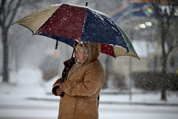
In the metro area, the snowfall kicked off at a moderate pace shortly after 7 a.m. and picked up in intensity as the morning went on.
The northern Twin Cities suburbs saw the heaviest snowfall, with 4 inches reported in Anoka and Blaine. Just north of Alexandria, a state-leading 6.5 inches fell, the Weather Service added.
So far this season, the Twin Cities has seen only about 2 feet of snow, well below normal for this time of year.
Between 6 and 10:45 a.m., the State Patrol responded to 111 crashes and 21 spinouts in the metro area, said spokeswoman Lt. Tiffani Nielson.
A crash-free drive was disrupted around 7:30 a.m., with wrecks on eastbound Interstate 94 at Wabasha Street in St. Paul, eastbound I-94 at Hwy. 169 in Brooklyn Park and northbound I-35W at 76th Street in Richfield.
The snow crept in from the west, where strong winds created conditions challenging enough that many school districts canceled school or delayed classes.
The Hennepin County Sheriff's Office warned motorists against driving on the ice. It issued a statement that Tuesday's snow blanket "may give the appearance that the ice is safe, when it is not." Ten vehicles and four people have broken through ice on lakes in the county this season.
Paul Walsh, Tim Harlow

Mosquitos are back and so are the workers trying to keep their numbers down
Officials ID teen who died after jumping into southwestern Minnesota lake to retrieve canoe paddle
Charges: Man fatally stabbed woman in neck outside downtown Duluth bar after closing time

Charges: Man posed as woman in video chats, lured men into sexually exploiting youngest of children